


Hidden Valley Park trail
Sandy, Utah
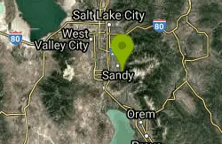
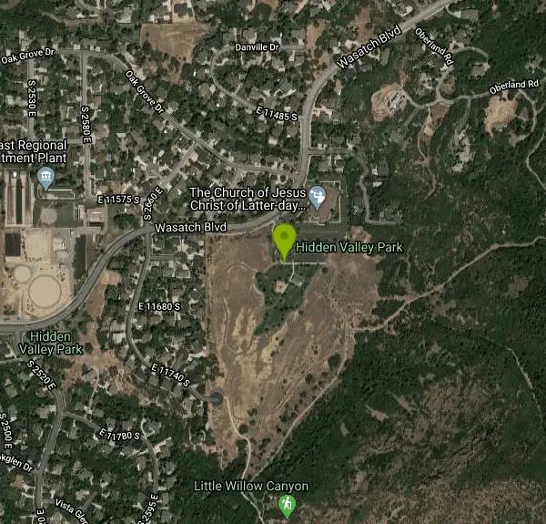
| Address: | Hidden Valley Park, 2860 Wasatch Blvd, Sandy, UT 84092, USA |
| GPS: |
40°32'26.2"N 111°48'49.1"W Maps | Directions |
| State: | Utah |
| Trail Length: | 1.80 miles |
| MTB Difficulty: | Intermediate |
| Trail Type: | Out & Back |
| Hike Difficulty: | Intermediate |
| Trails/Routes: | 0.4 mi |
Trails Rocks Wildflowers Fall Colors Pet Friendly Bicycles State Park
Hike and Mountain Bike
Hidden Valley Trail has different levels and gradual uphill fun and makes for a good adventure trail. It's a wide, shallow valley that is hidden from view; hence the name. The valley’s sandy floor is covered with grass and there are low cliffs on the north; while sandstone cliffs, covered by domes made of Navajo Sandstone, are in the southern rim of the valley. The trail gets hot during the summer, so make sure to have plenty of water and sunscreen. Within the trail, there are several loop options; all totaling one mile and Hidden Valley Park has a combination of landscaped and natural areas for scenery.
The trail sits on the south side of Spanish Valley just a few miles south of Moab. The trail starts on the south end of the parking area. The trail rises up the valley and after approx 1.2 miles, the trail elevation lowers. You then hike another 0.8 mile and climb a short hill to a turnaround point in the hike. In the south and west, you’ll find great views of Hidden Valley to the east. The park opens from dawn until 10pm and dogs are allowed on the trail but they must be kept on a leash; please clean up after pets.
More Information
Never modify trail features. Ride trails when they're dry enough that you won't leave ruts. Speak up when you see others on the trail and always yield to hikers, horses, and others coming uphill. Always ride on the established trail.
Read MoreBe courteous, informed, and prepared. Read trailhead guidelines, stay on the trail, and don't feed the wildlife.
Read More
- Plan Ahead and Prepare
- Travel & camp on durable surfaces
- Dispose of waste properly
- Leave what you find
- Minimize campfire impacts
- Respect wildlife
- Be considerate of other visitors
Directions
From Sandy, Utah
- Head west on E Sego Lily Dr toward S 1800 E/
Edgecliff Dr (0.8 mi) - Turn left onto 1300 EPass by Pizza Hut (on the right in 0.4 mi)(1.5 mi)
- Turn left onto E 11400 S (0.5 mi)
- Turn right onto S 1700 E (0.3 mi)
- Turn left onto E 11645 S/
Wasatch Blvd Continue to follow Wasatch BlvdDestination will be on the right(1.7 mi)
From Moab, drive 3 miles south on US 191 and turn right (west) on Angel Rock Road. Drive 2 blocks and turn right on Rimrock Road. Drive to the parking area and trailhead at the road’s end. Courtesy of visitutah.com
Other Mountain Bike Trails and Hiking Trails Nearby

Rocky Mouth Trail/Waterfalls
Sandy, Utah
0.6 miles NEAn easy 0.2-mile stroll from suburbia reaches a scenic waterfall at the canyon mouth, while climbers can push deeper for 60-ft and 70-ft rappels through a slot canyon.
Canyoneer, Hike, Rock Climb 0.2 mi
Orson Smith trail
Draper, Utah
1.3 miles SA short Draper foothills trail leading to a popular suspension bridge completed in 2015 at Bear Canyon — connecting to the Bonneville Shoreline Trail and open to hikers, bikers, and bird watchers.
Hike, Mountain Bike 0.8 mi
Bear Canyon Suspension Bridge
Draper, Utah
1.7 miles SWA 4.5-mile moderate hike in Draper connecting to a 185-foot suspension bridge over Bear Canyon, with sweeping Salt Lake Valley views and dozens of additional trails branching off nearby.
Hike, Mountain Bike 1.1-4.7 mi
Bells Canyon
Sandy, Utah
1.8 miles NA 4.5-mile moderate hike up to a canyon waterfall through gorgeous fall foliage, meadows, wildflowers, and a creekside trail — the last 1.2 miles involve serious climbing over large rocks.
Backpack, Hike, Mountain Bike, Snowshoe 0.5 mi
Draper City Park
Draper, Utah
2.4 miles SWA spacious Draper city park near the Porter Rockwell and Willow Creek trailheads, featuring two lighted pavilions, four baseball fields, playgrounds, and a famous central willow 'Tree of Life.'
Hike 0.6 mi
Bst To Equestrian Center Loop
Draper, Utah
3.0 miles SWA 10-mile intermediate singletrack loop in Draper connecting the Bonneville Shoreline Trail and Equestrian Center with 417 feet of elevation along varied terrain.
Hike, Mountain Bike 3.2 mi
Little Cottonwood Pipeline Trail
Sandy, Utah
3.0 miles NEA single-track trail starting at the mouth of Little Cottonwood Canyon that stays smooth for the first mile, then gets rocky and steep — ending across a creek from historic ruins after 3.5 miles.
Mountain Bike 1.6 mi
Corner Canyon Trail
Draper, Utah
3.0 miles SWA go-to mountain biking area in South Salt Lake mixing beginner training trails in Little Valley with big table tops and wall rides in Maple Hollow.
Backpack, Hike, Mountain Bike 1.2 mi
Ghost Falls Trail
Sandy, Utah
3.2 miles SA family-friendly hike in Corner Canyon that winds through sandy rocky slopes and dry creek beds to the Ghost Falls loop, with helpful trail signs at the confusing intersections.
Hike, Mountain Bike, Snowshoe 0.2-1.8 mi
Lone Peak
Draper, Utah
3.2 miles SOne of the Wasatch Front's taller peaks at over 11,000 feet, Lone Peak offers five different trailhead approaches, a 9-mile average round trip, rugged canyon terrain, and stunning Salt Lake valley views.
Hike, Mountain Bike, Rock Climb 1.7 mi
Jacob's Ladder Trail
Sandy, Utah
3.2 miles SJacob's Ladder is the steep, relentless local favorite for climbing into the Lone Peak Wilderness above Draper, Utah — and a legendary technical descent.
Hike, Mountain Bike 0.6 mi
Potato Hill Trail
Draper, Utah
4.1 miles SWA short, paved trail system in Draper that connects Potato Hill to the Bonneville Shoreline Trail — combine with Red Potato and Lexie and Ethan trails for a 3-mile loop with smooth climbing.
Hike, Mountain Bike 
Little Valley Trail
Draper, Utah
4.2 miles SWSuperbly constructed flow trails in a small Draper valley that are just as fun for adults as for kids — with connections to Corner Canyon for a longer ride.
Hike, Mountain Bike 0.7 mi
Great White Icicle
Sandy, Utah
4.3 miles NEAn ice climb in winter and a waterfall rappel in summer just outside Salt Lake City — the Great White Icicle in Little Cottonwood Canyon offers four shelves of ice and a bucket-list 4-to-5-hour ascent for all seasons.
Hike, Rock Climb 
Mercer Hollow Trail
Draper, Utah
4.3 miles SA fast, flowy descent on the southern flank of Corner Canyon Ridge, packed with berms, rock features, rollers, and a quick uphill that rewards you on the way back down.
Hike, Mountain Bike 0.8 mi
Red Rock Trail
Draper, Utah
4.4 miles SWA one-mile cliff-edge loop delivers sweeping Salt Lake Valley views and beginner-to-intermediate rock climbing on five walls with dental-themed route names.
Hike, Mountain Bike, Rock Climb 1.3 mi
Eagle Crest Trail
Draper, Utah
4.9 miles SA beginner-level 2.4-mile mountain bike trail along the north side of Traverse Mountain in Draper, with sweeping views of Salt Lake Valley, Mount Timpanogos, Lone Peak, and Box Elder Mountain.
Hike, Mountain Bike 1.7 mi
Schoolhouse Springs Trail
Alpine, Utah
4.9 miles SEA short, scenic trail at 5,300 feet in Alpine, Utah, featuring a lake and activities from horseback riding to hiking — best enjoyed between May and October.
Hike, Mountain Bike 
Ferguson Canyon
Cottonwood Heights, Utah
5.0 miles NA popular climbing destination tucked between Big and Little Cottonwood Canyons, where you can hike into a shaded canyon with a stream or push on to a rocky summit for sweeping views.
Hike, Mountain Bike, Rock Climb 
Lisa Falls
Sandy, Utah
5.1 miles NEA shaded granite climbing area in Little Cottonwood Canyon with polished friction faces, clean cracks, juggy overhangs, and a roaring waterfall that keeps the atmosphere cool and energizing.
Hike, Rock ClimbNearby Campsites

Spruces Campground
Salt Lake City, Utah
11.5 miles NEA fee campground in Big Cottonwood Canyon near Salt Lake City — check USDA.gov for current rates and seasonal availability.
Camp, Sled 1.6-14.1 mi
Mount Timpanogas
Provo, Utah
11.9 miles SEUtah's most-climbed mountain towers 7,000 feet above the Provo valley, stretching seven miles north to south with multiple peaks over 11,000 feet — a Wasatch landmark.
Camp, Hike, Horseback, Swim 
Mill Creek Canyon
Salt Lake City, Utah
12.2 miles NEAn out-and-back canyon trail with over 1,000 feet of elevation gain — the lower ski trail sees heavy traffic while the upper section above Elbow Fork stays quiet, with a reservable Yurt at the top December through April.
Camp, Cross-country Ski, Snowshoe 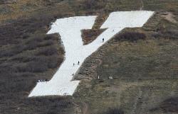
Y-Mountain Summit Trail
Provo, Utah
23.1 miles SEA 1.2-mile climb east of BYU leads to a massive block Y on the hillside and sweeping panoramas over Provo, Orem, Utah Valley, and Utah Lake below.
Camp, Hike 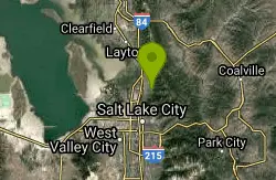
Holbrook Trailhead
Bountiful, Utah
23.6 miles NThe Holbrook Trailhead is a popular access point for the Bonneville Shoreline Trail and Holbrook Canyon above Bountiful, Utah, on the western face of the Wasatch. Perched on the bench right at the...
Airsoft, Backpack, Camp, Paintball, Snowshoe 4.7 mi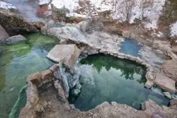
Fifth Water Hot Springs
Provo, Utah
39.8 miles SEA scenic 2.5-mile riverside hike to the famous Diamond Fork rock pools and waterfall, with soaks up to 108°.
Backpack, Camp, Hike, Hot Springs, Mountain Bike, Swim 5.6 mi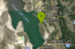
Antelope Island Lakeside Trail
Syracuse, Utah
40.3 miles NWAn easy 2-hour loop on Antelope Island around the Great Salt Lake, with rock formations, views of the Sierra Nevadas, and the GSL — kid-friendly and good for bug fans.
Camp, Hike, Horseback 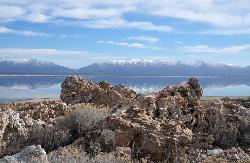
Antelope Island State Park
Syracuse, Utah
40.4 miles NWTwenty miles of trails cross Utah's Great Salt Lake island alongside free-roaming bison, antelope, and bobcats — best visited in early spring or late fall to beat the bugs.
Backpack, Camp, Hike, Horseback, Mountain Bike


