


110 Things to do near Happy Jack, AZ 86024
first prev 1 2 3 4 5 6 next lastShowing results within 50 miles Distance miles of Happy Jack, AZ 86024, USA City, Zip, or Address
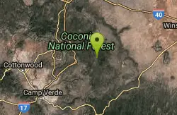
Arizona Trail: Gooseberry Springs to Blueridge
Happy Jack, Arizona
5.7 miles NA singletrack-and-dirt-road route along the Arizona Trail corridor, winding south through open terrain with AZ Trail markers guiding the way to Highway 87 at Blue Ridge Campground.
Mountain Bike 1.0 mi
Maxwell Trail No. 37
Happy Jack, Arizona
12.6 miles SMaxwell Trail drops from the Mogollon Rim down into West Clear Creek, ending at shaded swimming holes, small caves, and great fishing — water shoes required.
Hike, Swim 0.6-2.9 mi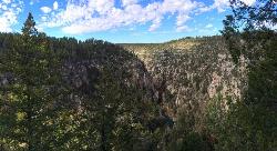
Tramway Trail No. 32
Happy Jack, Arizona
12.8 miles SA steep, rock-scrambling descent through the Mogollon Rim to West Clear Creek, with deep fishing and swimming holes waiting at the bottom — not for beginners.
Hike, Rock Climb, Swim 7.1 mi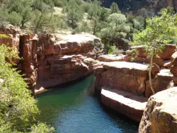
The Crack at Wet Beaver Creek
Rimrock, Arizona
18.1 miles WCrystal-clear water and cliffs high enough to jump from, about 3.5 miles down Bell Trail along Wet Beaver Creek — a rewarding desert hike to a stunning red-rock swimming hole.
Dive, Hike, Horseback, Swim 

Beaver Creek Campground
Camp Verde, Arizona
18.1 miles WBeaver Creek is a refreshing creekside oasis in the high desert of central Arizona, where the cool, clear waters of Wet Beaver Creek wind beneath big cottonwoods and sycamores in the Coconino...
Camp, Canoe, Kayak, Swim 
Beaver Creek Dispersed Camping
Rimrock, Arizona
19.0 miles WThis free dispersed camping area sits on the cliffs above Wet Beaver Creek in the Coconino National Forest of central Arizona, in the red-rock and juniper country near Rimrock and Camp Verde, not far...
Camp 0.8-1.8 mi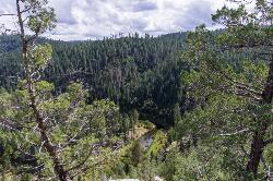
Kinder Crossing Trail #19
Happy Jack, Arizona
19.0 miles SEA short but steep 0.75-mile hike dropping 500 feet to beautiful East Clear Creek — high-clearance vehicle required on FR 95T, no motorized vehicles past the trailhead, closed in winter snow.
Hike, Swim 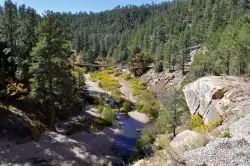
East Clear Creek
Happy Jack, Arizona
19.3 miles SEA Wild and Scenic river winding through the Mogollon Rim with canyon views, cliff-scaling canyoneers, trout fishing, and deep swimming holes for a full adventure day.
Canyoneer, Hike, Swim 4.2 mi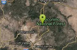
Munds Wagon Trail
Sedona, Arizona
19.3 miles NWA gnarly, loose-rock mountain bike climb near Sedona with 1,700 feet of elevation gain over six miles, delivering increasingly jaw-dropping views the higher you ride.
Hike, Mountain Bike 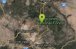
Cow Pies
Sedona, Arizona
19.5 miles NWSweet slickrock with awesome views, Cow Pies functions as a climb from Munds Wagon Trail up to the Hangover trail — a short but scenic connector.
Mountain Bike 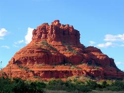
Schnebly Hill Vista Overlook
Sedona, Arizona
19.6 miles NWA sweeping red rock formation divided into four geological members — from reptile-fossil-bearing sandstone to limestone and dolomite — telling 500-foot stories of Sedona's ancient past.
Hike 
Schnebly Hill Trail
Sedona, Arizona
19.7 miles NWAn upper-mountain mountain bike trail in Sedona that dead-ends at the wilderness boundary and flows naturally into the Munds Wagon trail heading down.
Mountain Bike 
Cathedral Rock Trail
Sedona, Arizona
20.4 miles WAccess via a tunnel under Highway 179, this Sedona trail delivers fast rolling flow with some good-sized drops on the downhill sections.
Mountain Bike 
Bell Rock Area Trails
Sedona, Arizona
20.4 miles WThe Bell Rock Area Trails in Sedona offer the easiest riding in town — a great place for beginners seeking big views with manageable terrain.
Mountain Bike 
Bell Rock Trailway
Sedona, Arizona
20.4 miles WA smooth, wide 3.5-mile trailway through Oak Creek trees and slickrock that connects to Big Park Loop, Courthouse Rock, Llama, Templeton, and Little Horse trails in Sedona.
Mountain Bike 
Made In The Shade
Sedona, Arizona
20.4 miles WA singletrack connector linking the Templeton Trail to the Village of Oak Creek in Sedona, with moderate climbs, red rock views, and a super descent to finish.
Mountain Bike 
Slim Shady
Sedona, Arizona
20.5 miles WA 2.4-mile one-way backbone trail connecting Yavapai Point to Made in the Shade, Hiline, and more — a key link in Sedona's trail network for mountain bikers.
Mountain Bike 3.4 mi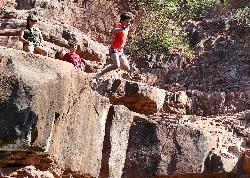
Grasshopper Point
Sedona, Arizona
21.0 miles NWCrimson red rock walls frame a teal swimming hole in Oak Creek Canyon — with multiple cliff jumping spots, picnic tables, restrooms, and access via Allen's Bend and the Huckaby Trail.
Dive, Hike, Swim 
Yavapai Point Trails
Sedona, Arizona
21.0 miles WTightly wound singletrack near the trailhead gives way to longer trails like Slim Shady further out — a versatile trail system near Sedona's Yavapai Point.
Mountain Bike 
Hiline
Sedona, Arizona
21.0 miles WAn expert-level mountain bike trail in Sedona best ridden from the Village of Oak Creek side — narrow and ledgy on the climb, with steep and loose sections on the descent.
Mountain Bike


