


Yavapai Point Trails
Sedona, Arizona
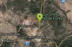
| Address: | ~Yavapai Point, Sedona, AZ 86351, USA |
| GPS: |
34°48'26.7"N 111°46'9.8"W Maps | Directions |
| State: | Arizona |
| Trail Length: | 10.00 miles |
| MTB Difficulty: | Intermediate |
| Trail Type: | Network |
| MTB Trail Type: | Singletrack |
Mountain Bike
The Yavapai Point Trails feature some tightly-wound singeltrack trails near the trailhead, with longer trails like Slim Shady located further out. Courtesy of Singletracks.com
More Information
Yavapai Point Trails Mountain Bike Trail in Sedona, Arizona - Directions, Maps, Photos, and Reviews
Yavapai Point Trails is a singletrack mountain bike trail in Sedona, Arizona. View maps, videos, photos, and reviews of Yavapai Point Trails bike trail in Sedona.
http://www.singletracks.com/bike-trails/yavapai-point-trails/Never modify trail features. Ride trails when they're dry enough that you won't leave ruts. Speak up when you see others on the trail and always yield to hikers, horses, and others coming uphill. Always ride on the established trail.
Read More
- Plan Ahead and Prepare
- Travel & camp on durable surfaces
- Dispose of waste properly
- Leave what you find
- Minimize campfire impacts
- Respect wildlife
- Be considerate of other visitors
Directions
From Sedona, Arizona
- Head south on N State Rte 89A toward Forest Rd (0.3 mi)
- At the traffic circle, take the 3rd exit onto AZ-179 S (0.4 mi)
- At the traffic circle, take the 1st exit and stay on AZ-179 S (0.5 mi)
- At the traffic circle, continue straight to stay on AZ-179 S (0.6 mi)
- At the traffic circle, continue straight to stay on AZ-179 S (1.4 mi)
- At the traffic circle, continue straight to stay on AZ-179 S (0.5 mi)
- At the traffic circle, take the 2nd exit and stay on AZ-179 S (1.5 mi)
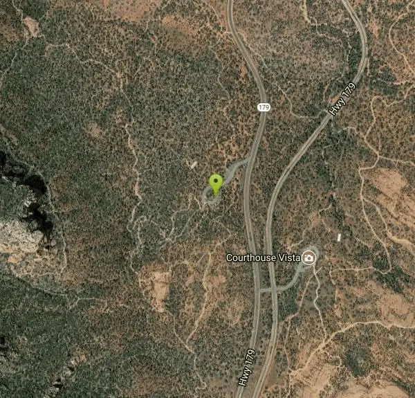
- Turn right onto Yavapai Point (417 ft)
- Keep left to stay on Yavapai Point (151 ft)
Other Mountain Bike Trails Nearby
Hiline
Sedona, Arizona
0.0 miles SWAn expert-level mountain bike trail in Sedona best ridden from the Village of Oak Creek side — narrow and ledgy on the climb, with steep and loose sections on the descent.
Mountain Bike 
Made In The Shade
Sedona, Arizona
1.2 miles SA singletrack connector linking the Templeton Trail to the Village of Oak Creek in Sedona, with moderate climbs, red rock views, and a super descent to finish.
Mountain Bike 
Bell Rock Trailway
Sedona, Arizona
1.2 miles SA smooth, wide 3.5-mile trailway through Oak Creek trees and slickrock that connects to Big Park Loop, Courthouse Rock, Llama, Templeton, and Little Horse trails in Sedona.
Mountain Bike 
Bell Rock Area Trails
Sedona, Arizona
1.2 miles SThe Bell Rock Area Trails in Sedona offer the easiest riding in town — a great place for beginners seeking big views with manageable terrain.
Mountain Bike 
Templeton
Sedona, Arizona
1.2 miles NA twisting Sedona singletrack through two tunnels under Highway 179 and along Cathedral Rock's slickrock contours, with river stretches and technical switchbacks to cap it off.
Mountain Bike 
Slim Shady
Sedona, Arizona
1.5 miles SA 2.4-mile one-way backbone trail connecting Yavapai Point to Made in the Shade, Hiline, and more — a key link in Sedona's trail network for mountain bikers.
Mountain Bike 
Pig Tail
Sedona, Arizona
1.8 miles NA short, one-way downhill blast packed with jumps, drops, berms, and rocks — Pig Tail in Sedona is pure descent fun from start to finish.
Mountain Bike 
Cathedral Rock Trail
Sedona, Arizona
1.8 miles SAccess via a tunnel under Highway 179, this Sedona trail delivers fast rolling flow with some good-sized drops on the downhill sections.
Mountain Bike 
Broken Arrow Trail System
Sedona, Arizona
2.2 miles NA system of classic Sedona rides — Broken Arrow, Hog Heaven, Hog Wash, Pig Tail and more — ranging from relatively easy to technical double-black-diamond exposure.
Mountain Bike 
Baldwin Loop
Sedona, Arizona
2.4 miles NWA 2.25-mile Sedona loop with steps, ledges, and technical moves — best ridden clockwise to tackle descents naturally, and easily combined with Templeton Trail for a longer lollipop.
Mountain Bike 
Broken Arrow Trail / Chicken Point
Sedona, Arizona
2.5 miles NTechnical climbs, drop-offs, stairs, narrow cliff singletrack, and awesome slickrock views at the top — Broken Arrow is not for beginners.
Mountain Bike 
Ram's Head Trail
Sedona, Arizona
2.9 miles NWA family- and beginner-friendly figure-eight mountain bike route in Sedona linking Ram's Head Trail and Ridge Trail with a sandy wash crossing and a few optional walk-your-bike moments.
Mountain Bike 
Airport Mesa Trail Network
Sedona, Arizona
3.6 miles NWA network of trails south of Hwy 89A and north of Oak Creek in Sedona, with several possible routes through the Airport Mesa area for mountain bikers to explore.
Mountain Bike 
Ridge Trail
Sedona, Arizona
3.7 miles NWA lower-profile Sedona ride through Red Rock country connecting Ridge Trail to Secret Slick Rock, Oak Creek, and Cathedral Rock — includes a $2 park crossing fee or a ford of the creek.
Mountain Bike 
Soldier Wash Trails
Sedona, Arizona
4.0 miles NEleven miles of flowing, renegade-origin singletrack in Sedona that locals once kept secret — now part of the USFS Soldier Wash Trails system with great signage on the ground.
Mountain Bike 
Courthouse Butte Loop
Sedona, Arizona
4.0 miles NA 4-mile clockwise loop circling Courthouse Butte and Bell Rock in Sedona — wide cairn-marked trails, a Wilderness section, and spectacular red rock scenery.
Mountain Bike 
Hangover
Sedona, Arizona
4.2 miles NHangover Trail in Sedona is one of the most technical mountain bike trails in the area — serious exposure, steep rock rolls, and tight singletrack for experienced riders only.
Mountain Bike 3.0 mi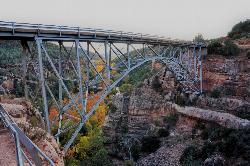
Huckaby Trail
Sedona, Arizona
4.3 miles NA 3-mile Sedona trail through Arizona Sycamores and striking Red Rock formations — crossing Oak Creek at the bottom where you can take a dip, with a boulder passage and optional mountain bike cruise on the other side.
Canoe, Hike, Mountain Bike 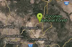
Herkenham Trail
Sedona, Arizona
4.3 miles NWA tight, flowing mile of classic Sedona singletrack through a canyon — loose gravel, small drops, cactus, and great views that connect to a web of trails in the surrounding valleys.
Mountain Bike 
Chuck Wagon
Sedona, Arizona
4.5 miles NWBuilt in spring 2012, this modern Sedona trail winds through diverse landscapes, flows nicely in both directions, and links to Mescal and Long Canyon for longer loops.
Mountain BikeNearby Campsites
Chavez Crossing
Sedona, Arizona
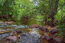
2.5 miles NA campground on Oak Creek in Sedona's red-rock canyon, perfectly placed for cool water play, sunsets over Munds Mountain, and access to nearby swimming holes.
Camp, Hike, Swim 
Beaver Creek Dispersed Camping
Rimrock, Arizona
9.5 miles SThis free dispersed camping area sits on the cliffs above Wet Beaver Creek in the Coconino National Forest of central Arizona, in the red-rock and juniper country near Rimrock and Camp Verde, not far...
Camp 
Beaver Creek Campground
Camp Verde, Arizona
10.0 miles SBeaver Creek is a refreshing creekside oasis in the high desert of central Arizona, where the cool, clear waters of Wet Beaver Creek wind beneath big cottonwoods and sycamores in the Coconino...
Camp, Canoe, Kayak, Swim 0.1-0.7 mi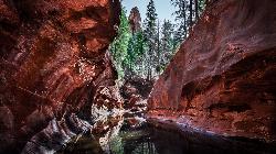
Cave Springs
Sedona, Arizona
13.1 miles NAn 84-site campground on Oak Creek in Sedona's canyon, with picnic tables and natural tree shade, close to Slide Rock, swimming holes, and the Coconino National Forest.
Camp, Hike, Swim 0.4 mi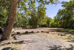
Clear Creek Campground
Camp Verde, Arizona
20.2 miles SA grassy creekside campground shaded by tall cottonwoods on West Clear Creek — ideal for hiking, swimming, fishing for smallmouth bass and sunfish, and wildlife watching in a desert canyon oasis.
Camp, Hike, Swim 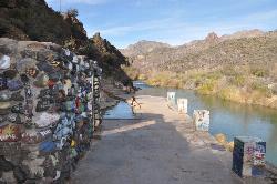
Verde Hot Springs
Camp Verde, Arizona
32.0 miles SNatural hot spring pools beside the Verde River — the remnants of an old resort — reached by wading upstream from a dispersed camping area with no amenities near Sedona.
Camp, Hike, Hot Springs 0.1-7.8 mi
Wolf Creek Falls
Prescott, Arizona
46.6 miles SWSix miles of trails, two campgrounds, and a 90-foot waterfall that roars in spring storms and glitters as a frozen cascade in winter — Wolf Creek Falls is dramatic in every season.
Camp, Hike, Swim


