


239 Things to do near Teton, Idaho
first prev 1 2 3 4 5 6 7 8 9 10 next lastShowing results within 50 miles Distance miles of Teton, ID, USA City, Zip, or Address

The Arcane
Ririe, Idaho
21.0 miles SERock Climb near Ririe, Idaho
Rock Climb
Blacktail Day Use Area
Ririe, Idaho
21.4 miles SOn the North end of Ririe Reservoir there is a great little park with cliff jumping and even rock climbing. There is a trail from the south end of the parking lot down along the cliffs. There are...
Dive, Rock Climb, Swim
North Mahogany Trail #220
Tetonia, Idaho
22.0 miles SEhe N. Mahogany Trail is open to Motorbikes, Mountain bikes, Horses, and Hikers. Motorbikes and Horseback riders are the most common visitors, but the trail is becoming increasingly...
Mountain Bike
Burns Canyon
Ririe, Idaho
22.1 miles SEHike and Mountain Bike near Ririe, Idaho
Hike, Mountain Bike 0.6-5.5 mi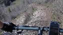
Old Ranger
Ririe, Idaho
22.1 miles SEOn the South end of the Big Hole mountains just above the Snake River is a grueling yet diverse section of single-track on Forest Service Trail 287 called Old Ranger. Because of the...
Mountain Bike
Ashton Hill
Ashton, Idaho
22.3 miles NEFairly thick forest. Considerable underbrush. Lots of places in the area to play.
Airsoft, Paintball
Sand Creek Frenzy
Ashton, Idaho
22.3 miles NThere are some woods back there and it is secluded. There are many places you can play just watch out for campers.
Paintball
Horseshoe Canyon
Tetonia, Idaho
22.3 miles SEHorseshoe Canyon is one of the closest trail systems to the town of Driggs, Idaho. This network doesn't have a ton of climbing or descending, but the smooth, swooping singletrack with a...
Mountain Bike
Horseshoe Trails
Driggs, Idaho
22.4 miles SEMountain Bike near Driggs, Idaho
Mountain Bike
Bovine
Driggs, Idaho
22.4 miles SEBovine trail is part of a larger system. You can use it to access more trails or make it your end destination from other trailheads. It is a steep climb but returns the favor with a fast downhill....
Mountain Bike

Channel Lock
Driggs, Idaho
22.7 miles SETrail is a little over 1 mile uphill. Recommended route up to access the larger Horseshoe canyon trail system. Makes a nice downhill with twists. Gets its name from the deep ruts made from cows....
Mountain Bike
Sharks Belly
Driggs, Idaho
22.8 miles SETrail system can start from Channel lock or Bovine. Channel Lock is an easier climb than Bovine. This description and mileage starts at the Channel Lock trail, forest service boundary marker. Take...
Mountain Bike
Southbound
Driggs, Idaho
22.8 miles SETrail starts by going up the Channel lock trail. At the top of Channel Lock go right onto the Southbound trail. Trail will loop back to Channel lock which you take back to your car. Trail is...
Mountain Bike
Blacks Canyon Trail
Ririe, Idaho
23.4 miles SEThe Blacks Canyon trail begins at Black Can Road and ends at Junction Fleming Canyon Trail. The trail is open for the following uses: Motorcycle Trail Riding, Off Highway Vehicles (OHV)...
Mountain Bike
South Fork Rim Trail
Ririe, Idaho
23.4 miles SEMotorcycle trail. source: fs.usda.gov Courtesy of Singletracks.com
Mountain Bike 3.2-47.0 mi
Yellowstone Branch Line Trail
Ashton, Idaho
24.3 miles NEYellowstone branch line trail runs from Warm River to the Montana border totaling 39 miles. There are a few places to jump on and off the trail as well as a few smaller trails that branch off of this...
Backpack, Cross-country Ski, Hike, Horseback, Mountain Bike 2.1-2.3 mi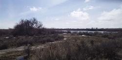
Market Lake Wildlife Management Area
Roberts, Idaho
24.4 miles WMallards, Canada geese, canvasbacks, cinnamon and green-winged teal, northern shovelers and ruddy ducks are common waterfowl species nesting and raising broods on the WMA. Several thousand...
Hike, Horseback
Warm River Campground
Ashton, Idaho
24.4 miles NEWarm River Campground is located nine miles northeast of Ashton, Idaho, along the slow-moving Warm River at an elevation of 5,200 feet. Willows line the riverbanks and pine trees offer partial...
Camp
Falls River, Lower Run
Ashton, Idaho
24.8 miles NEFall River rises on the Madison and Pitchstone plateaus in the southwest corner of Yellowstone National Park, Wyoming and flows approximately 64 miles (103 km) to its confluence with the Henrys Fork...
Whitewater
Big Bend Ridge Trail
Ashton, Idaho
24.8 miles NTrail is open to OHVs. source: fs.usda.gov
Mountain Bike


