


Webber Creek
Dubois, Idaho
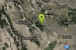
| Address: | Webber Creek Trailhead, Forest Road 196, Dubois, ID, United States |
| GPS: |
44°21'48.8"N 112°41'17.9"W Maps | Directions |
| State: | Idaho |
Backpack, Camp, Hike, Horseback, Hot Springs, and Mountain Bike
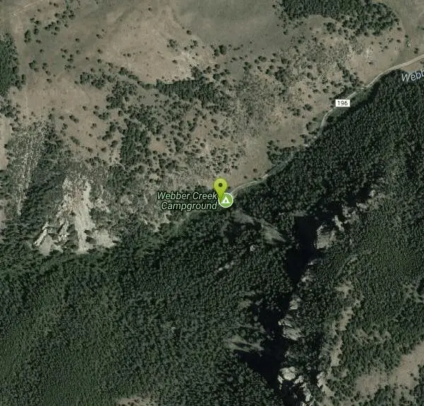
7000-foot elevation. A dispersed area with a trailhead, the only amenity is a toilet. Picnicking. The Webber Creek Trail departs from here, and heads west toward Scott Peak. Fishing in the creek. Horse riding, mountain biking, and hiking the trails.
More Information
Sample hike from Trails of Eastern Idaho, by Margaret Fuller and Jerry Painter 52. WEBBER LAKES Roun
Sample hike from Trails of Eastern Idaho, by Margaret Fuller and Jerry Painter 52.
https://www.trailguidebooks.com/images/Trails%20of%20Eastern%20Idaho-Webber%20Lakes.pdfsite – Public Lands Interpretive Association
The Public Lands Interpretive Association inspires and educates the public about the natural and cultural heritage resources of America’s public lands. Your purchases support projects on public lands. Your dollars will directly enhance your experience and help preserve these special places for future generations.
https://publiclands.org/pages/siteWebber Creek
Webber Creek is a singletrack mountain bike trail in Dubois, Idaho. View maps, videos, photos, and reviews of Webber Creek bike trail in Dubois.
http://www.singletracks.com/bike-trails/webber-creek/Never modify trail features. Ride trails when they're dry enough that you won't leave ruts. Speak up when you see others on the trail and always yield to hikers, horses, and others coming uphill. Always ride on the established trail.
Read MoreBe courteous, informed, and prepared. Read trailhead guidelines, stay on the trail, and don't feed the wildlife.
Read More
Be careful. Pay attention to posted signs and always test the waters before you get in. Some hot springs can get up to boiling temperatures. Be sure to drink plenty of water to combat the dehydrating effect of the spring.
Be respectful of other soakers and the hot spring. Don't hog the pool. Camp at least 200 yards away and keep fires in designated areas. Keep your pets out of the water and never pee in thermal feature. Glass bottles should never go near a hot spring.

- Plan Ahead and Prepare
- Travel & camp on durable surfaces
- Dispose of waste properly
- Leave what you find
- Minimize campfire impacts
- Respect wildlife
- Be considerate of other visitors
Directions
From Dubois, Idaho
- Head west on A-2 Clark County Rd/W Main St toward Oakley Ave (0.5 mi)
- Continue onto ID-22 W (5.9 mi)
- Turn right onto Medicine Rd (3.0 mi)
- Continue onto Medicine Lodge Rd (367 ft)
- Slight left onto Small Rd (1.1 mi)
- Turn right onto Doschades Cow Camp Rd (2.7 mi)
- Turn left (0.6 mi)
- Slight right (1.2 mi)
- Turn left onto Medicine Lodge Rd (1.4 mi)
- Continue straight (0.2 mi)
- Continue onto Medicine Lodge Rd (12.4 mi)
- Turn left onto Webber Creek Rd (3.0 mi)
- Slight right onto Forest Rd 196 (1.9 mi)
From Dubois, go 28 miles northwest on ID 22 and Forest Road 196.
Other Mountain Bike Trails, Hiking Trails, Horseback Trails, Hot Springs, and Backpacking Trails Nearby

Birch Creek Charcoal Kilns
Leadore, Idaho
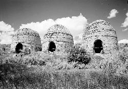
24.6 miles WSixteen remarkably intact 20-foot beehive brick kilns stand in remote Idaho as relics of an 1880s silver-mining operation that employed 200 workers for barely three years.
Hike 1.1-4.1 mi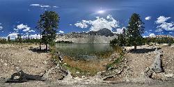
Meadow Lake
Leadore, Idaho
31.4 miles WA remote alpine lake in the Sawtooth Wilderness, tucked in the Sawtooth Mountains with no maintained trails and accessible only with a wilderness permit — $10–$20 per night to camp nearby.
Camp, Canoe, Hike 4.8 mi
Aldous Lake and Hancock Lake
Kilgore, Idaho
42.9 miles ETwin alpine lakes — Aldous and Hancock — on a scenic 1.5-to-2.5-mile hike near Kilgore, with beautiful mountain scenery and heavier weekend crowds.
Backpack, Camp, Hike, Horseback, Swim 
Pine Butte / The Caldera
St. Anthony, Idaho
43.4 miles EAn old volcano in the Idaho desert that feels like stepping into a mountain forest — pine-covered hillsides, a meadow ringed by aspen and boulders, and a quarter-mile easy trail to the caldera floor.
Camp, Hike, Horseback 0.6 mi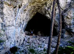
Hidden Mouth Cave
Moore, Idaho
46.6 miles SWA surprisingly large lava cave with three chambers and a secret back exit — reached by quad or a quarter-mile steep hike above Moore, Idaho.
Cave, Hike 2.1-2.3 mi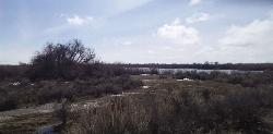
Market Lake Wildlife Management Area
Roberts, Idaho
49.0 miles SEA wildlife management area teeming with waterfowl — ibis colonies, ducks, geese, herons, eagles, hawks, and owls — plus mule deer, white-tailed deer, and a small moose population near Roberts, Idaho.
Hike, HorsebackNearby Campsites
Birch Creek
Leadore, Idaho
18.7 miles SWA campground along Birch Creek with 25 developed sites, picnic tables, fire rings, and restrooms — plus great fishing for brook, rainbow, and brown trout in the creek and nearby Caribou-Targhee access.
Camp 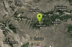
Stoddard Creek
Spencer, Idaho
23.6 miles EA campground just 1 mile off I-15 and 17 miles north of Dubois, surrounded by trails and wildlife in scenic high desert — an easy-access base for exploring northern Idaho's backcountry.
Camp 1.1-4.1 mi
Meadow Lake
Leadore, Idaho
31.4 miles WA remote alpine lake in the Sawtooth Wilderness, tucked in the Sawtooth Mountains with no maintained trails and accessible only with a wilderness permit — $10–$20 per night to camp nearby.
Camp, Canoe, Hike 4.8 mi
Aldous Lake and Hancock Lake
Kilgore, Idaho
42.9 miles ETwin alpine lakes — Aldous and Hancock — on a scenic 1.5-to-2.5-mile hike near Kilgore, with beautiful mountain scenery and heavier weekend crowds.
Backpack, Camp, Hike, Horseback, Swim
Pine Butte / The Caldera
St. Anthony, Idaho
43.4 miles EAn old volcano in the Idaho desert that feels like stepping into a mountain forest — pine-covered hillsides, a meadow ringed by aspen and boulders, and a quarter-mile easy trail to the caldera floor.
Camp, Hike, Horseback


