


Big Hole
Featherville
Swim
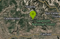
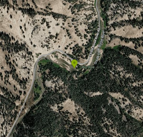
Big Hole is a day-use site on the South Fork of the Boise River in the Fairfield Ranger District of the Sawtooth National Forest, in the mountains of south-central Idaho. The Forest Service manages it as a small roadside stop whose main draw is a deep pool in the river, and its own listing names swimming, river fishing and picnicking as the uses of the site. The pool sits where the river swings through a tight bend below a forested canyon slope, roughly 15 miles by air east of Featherville and about 6 miles downstream (west) of the Big Smoky Guard Station area.
Access is by Forest Road 227, the gravel South Fork Boise River road that links Featherville with the Big Smoky area. From Featherville, follow the road upriver past the campgrounds strung along the South Fork; Big Hole is on the river side of the road, with the vault toilet on the opposite side. Parking is limited to a few roadside spots and a short pull-in, and the Forest Service asks visitors not to block the road or the restroom. Several stretches of this road washed out in floods, and the Forest Service and Camas County rebuilt segments out of the floodplain in a relocation project (now listed as completed), followed by flood repair work west of the Skeleton Creek bridge in 2024. The current Sawtooth alerts page lists no closure for Road 227, but this is remote country, so check with the Fairfield Ranger District before a long drive, especially early or late in the year.
The swim area is a natural river pool, not a designated beach. Expect a rocky river bottom and depth that changes quickly across the pool. The South Fork here is fed by snowmelt from the surrounding high country, so the water stays cold well into summer and runs high and fast during spring runoff, typically May and June. Swimming conditions are usually best from midsummer onward, once the flow drops and the pool calms down. There are no lifeguards, no posted swim season and no rescue services close by.
There is no fee to use Big Hole, according to the Forest Service listing. It is a day-use-only site with no posted opening hours; overnight camping is not allowed here, and horses and pack animals are not permitted. Facilities are minimal: one vault toilet across the road, no drinking water and no picnic tables. Bring your own water. The Fairfield Ranger District office (102 First Street East, Fairfield, phone 208-764-3202) handles questions about the site and road conditions.
The main hazards are the river itself and the road. Do not jump into the pool without checking depth first, because the gravel bars shift after high water, and keep children close when the current is still strong. Watch for traffic when crossing Road 227 to reach the toilet. Wildfire season can bring restrictions or area closures to this part of the forest, so check the Sawtooth National Forest alerts page before you go.
Big Hole works well as a stop on a longer trip along the South Fork corridor. Forest Service campgrounds such as Chaparral and Bird Creek sit along the same river with fee sites for overnight stays, and the stretch is popular for fishing and tubing. Upstream, the Big Smoky Guard Station area gives access to Big Smoky Creek and more campgrounds, while the small community of Featherville, downriver to the west, is the closest place for basic services.
More Information
Sawtooth National Forest | Alerts | Forest Service
Special orders are legal documents drafted to address management concerns. Special orders are signed by Regional Foresters or Forest Supervisors and vary in ...
https://www.fs.usda.gov/r04/sawtooth/alertsSawtooth National Forest | Big Hole | Forest Service
Big Hole is a day use site on the South Fork of the Boise River located 6 miles west (down river) from the Big Smoky Gaurd Station area on Road No.227. Popular for its swimming hole, the area provides access to fishing, parking and a restroom.
https://www.fs.usda.gov/r04/sawtooth/recreation/big-holeSawtooth National Forest | Chaparral Campground | Forest Service
Chaparral Campground is a non-reservation campground composed of 7 single sites and 3 double sites located on the South Fork of the Boise River. Campground amenities include 3 vault toilet restrooms, picnic tables and fire rings. Hiking, tubing, and fishing are popular activities.
https://www.fs.usda.gov/r04/sawtooth/recreation/chaparral-campgroundSawtooth National Forest | Fairfield Ranger District | Forest Service
(Ranger District) For assistance outside of these hours, please call 208-764-3202 Office Hours:8:30 a.m.- noon and 1-4 p.m. Mondays and Fridays
https://www.fs.usda.gov/r04/sawtooth/offices/fairfield-ranger-districtSawtooth National Forest | Fairfield Ranger District | Forest Service
The Fairfield Ranger District encompasses 420,720 acres of National Forest System lands. Over 680 miles of streams and more than 20 high mountain lakes call the district home. There are many mountains on the District over 9,000 ft. in elevation and four peaks – Baker Peak, Big Peak, Two Point Mountain, and Smoky Dome – are over 10,000 ft. high. The South Fork of the Boise River, Little Smoky Creek and Big Smoky Creek are the major river drainages. The District offers seemingly endless opportunities for the backpacker, hiker, horseback rider, mountain biker and off-road vehicle user. There are 440 miles of inventoried trails on the Fairfield Ranger District, many of which top out in mountain lakes or cirque basins. Snowmobiling, downhill skiing, and snowboarding are some of the more popular winter activities on the District. There are about 50 miles of groomed snowmobile trails available north of Fairfield. Nordic skiing opportunities may be found in the backcountry through helicopter and cat ski guided trips into more remote areas. Visitors will find numerous hot springs on the District, accessible in the summer, including Worswick, Skillern, Willow Creek, Pries, and Baumgartner. Fairfield boasts 12 campgrounds. Baumgartner Campground is fully accessible to visitors using wheelchairs and includes paved camping sites. The campground also boasts a hot pool for soaking, a children's play area, and a 1/4-mile interpretive trail.
https://www.fs.usda.gov/r04/sawtooth/recreation/fairfield-ranger-district-0Sawtooth National Forest | Project Summary (#49740) | Forest Service
Camas County and the Sawtooth National Forest propose to relocate segments of the South Fork Boise River Road (Forest Road 227) out of the floodplain around existing washouts in at least four locations in order to reconnect the road between Big Smoky and Featherville.
https://www.fs.usda.gov/r04/sawtooth/projects/49740Sawtooth National Forest | Project Summary (#64548) | Forest Service
Four projects in the South Fork Boise Area to protect roads and recreational access following flooding.
https://www.fs.usda.gov/r04/sawtooth/projects/64548Sawtooth National Forest | Water Activities | Forest Service
Water activities on the Sawtooth National Forest include whitewater rafting, float and jet boating, hot spring bathing, and swimming.
https://www.fs.usda.gov/r04/sawtooth/recreation/opportunities/water-activities
- Plan Ahead and Prepare
- Travel & camp on durable surfaces
- Dispose of waste properly
- Leave what you find
- Minimize campfire impacts
- Respect wildlife
- Be considerate of other visitors
Directions
From Featherville
- Head northeast on N Pine-Featherville Rd/
Wood Creek Rd (0.2 mi) - Keep right to continue on E Baumgartner Rd/
S Boise River Rd/ S Fork Boise River Rd Continue to follow S Fork Boise River RdDestination will be on the right(17.9 mi)
Other Swimming Holes Nearby
Nearby Campsites

Preis Hot Spring
Fairfield, Idaho
6.3 miles EA small sunken wooden box beside Forest Road 227 north of Fairfield that fits two people in clear, roughly 102 degree water. Pair it with Worswick Hot Springs a couple of miles away.
Camp, Hot Springs 3.4 mi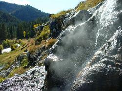
Skillern Hot Springs
Fairfield, Idaho
8.1 miles NEA stunning six-mile trail along crystal-clear Big Smoky Creek to a hot spring — spectacular in fall, with two trail options and a sign marking the final three miles.
Camp, Hike, Hot Springs
Worswick Hot Springs
Fairfield, Idaho
8.1 miles EFree hillside hot spring pools on Worswick Creek in the Sawtooth National Forest, about 20 miles north of Fairfield. The lower pools run about 90 to 105 degrees, and the source water is hot enough to scald.
Camp, Hot Springs
Mormon Reservoir
Fairfield
22.8 miles SIrrigation reservoir on McKinney Creek about five miles south of Fairfield, with a free Idaho Fish and Game boat ramp, docks, toilets and primitive camping. It is stocked with rainbow trout, but the water drops hard by late summer and in dry years.
Camp, Canoe, Kayak
Galena Lodge
Ketchum, Idaho
24.6 miles NEA community-owned historic lodge 23 miles north of Sun Valley, open summer and winter as a hub for hikers, bikers, Nordic skiers, and snowshoers with rentals and great food.
Camp, Cross-country Ski, Snowshoe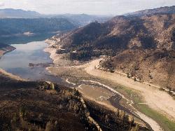
Anderson Ranch Reservoir
Pine
24.7 miles SWA 14-mile Reclamation reservoir on the South Fork Boise River northeast of Mountain Home, best known for kokanee fishing. This pin marks the free Fall Creek Boat Ramp on the west shore, with free Forest Service campgrounds a short drive away.
Camp, Canoe, Hike, Kayak, Swim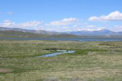
Little Camas Reservoir
Mountain Home
27.5 miles SWIrrigation reservoir on the western Camas Prairie northeast of Mountain Home, with a free Forest Service boat ramp, primitive shoreline camping and trout fishing. Water levels swing hard, and there is no trout stocking in 2026.
Camp, Canoe, Kayak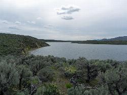
Magic Reservoir
Bellevue
31.7 miles SEMagic Reservoir is a big irrigation lake on the Big Wood River surrounded by BLM sagebrush land, with free ramps and primitive camps. It is known for trout, perch and ice fishing, but water levels swing hard with irrigation demand.
Camp, Canoe, Kayak
Loftus Hot Spring
Mountain Home, Idaho
33.7 miles WLoftus Hot Spring is a free Boise National Forest soak on the Middle Fork Boise River, with a hot waterfall between ~110F and ~104F pools.
Camp, Hot Springs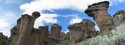
Little City of Rocks
Gooding, Idaho
35.3 miles SA volcanic hoodoo landscape of natural arches, towers, and mushroom-cap formations near Gooding, Idaho — best visited in spring when desert wildflowers bloom and the main loop trail is scenic.
Camp, Hike
Badger Creek Campground
Boise City-Nampa, ID, Idaho
38.1 miles WA small 5-site riverside campground at 3,200-foot elevation on the Middle Fork of the Boise River, with fishing for rainbow, cutthroat, and whitefish and access to the William Pogue National Recreational Trail nearby.
Camp
McKinney Butte Lava Tubes
Gooding, Idaho
40.1 miles STwo forking lava tubes near Bliss — one open to anyone, the other gated (BLM permit required) — that survived the Bonneville Flood and a 1993 landslide.
Camp, Cave
Bonneville Hot Springs
Lowman, Idaho
43.0 miles NWA series of soaking pools fed by a warm waterfall, plus a natural hot spring and a private iron-tub soak shack — all a quarter mile from Bonneville Campground beside Warm Springs Creek near Lowman.
Camp, Hike, Hot Springs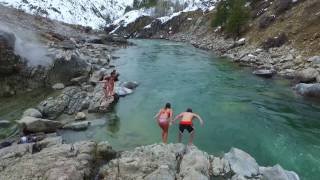
Kirkham Hot Springs Campground
Lowman, Idaho
44.2 miles NWMultiple hot waterfalls flowing into shallow rock pools right along a highway 21 pullout near the Boise National Forest — popular in both summer and winter seasons.
Camp, Hot Springs
Park Creek Campground
Lowman, Idaho
47.9 miles NWA small, tranquil campground in an old-growth forest along Park Creek in the Baker Lake basin, close to Baker Lake and the larger Swift Creek Campground.
Camp
Pine Flat Hot Springs
Garden Valley, Idaho
48.7 miles NWAn aqua-blue hot spring pool at the base of a small waterfall on the South Fork Payette River — just a quarter mile from Pine Flat Campground in the Boise National Forest.
Camp, Canoe, Hike, Hot Springs, Kayak, Whitewater


