


Casa Grande Mountain
Casa Grande, Arizona
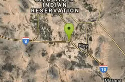
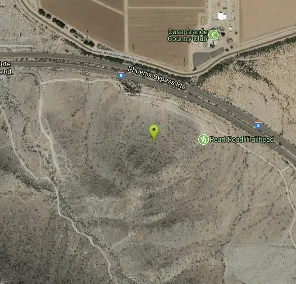
| Address: | ~Phoenix Bypass Rte, Casa Grande, AZ 85193, USA |
| GPS: |
32°49'56.2"N 111°42'48.8"W Maps | Directions |
| State: | Arizona |
| Trail Length: | 20.00 miles |
| MTB Difficulty: | Intermediate |
| Trail Type: | Loop |
| MTB Trail Type: | Singletrack |
Mountain Bike
There are easy trails by the starting point but they are not the main trail. It climbs the mountain side and heads south along the range. Jumping Cholla is a common plant here and the terrain is very sharp rock, padding suggested. No shade. The main loop is 13 miles but it has upper and lower parallel trails, the upper usually being more tech.New trails are being built so the mileage and routes will increase. Courtesy of Singletracks.com
More Information
Casa Grande Mountain
Casa Grande Mountain is a singletrack mountain bike trail in Casa Grande, Arizona. View maps, videos, photos, and reviews of Casa Grande Mountain bike trail in Casa Grande.
http://www.singletracks.com/bike-trails/casa-grande-mountain/Never modify trail features. Ride trails when they're dry enough that you won't leave ruts. Speak up when you see others on the trail and always yield to hikers, horses, and others coming uphill. Always ride on the established trail.
Read More
- Plan Ahead and Prepare
- Travel & camp on durable surfaces
- Dispose of waste properly
- Leave what you find
- Minimize campfire impacts
- Respect wildlife
- Be considerate of other visitors
Directions
From Casa Grande, Arizona
- Head west on Sawgrass Ct toward Cypress LnRestricted usage road(72 ft)
- Turn left onto Cypress LnRestricted usage road(197 ft)
- Turn right at the 1st cross street onto Aqusta CtRestricted usage road(131 ft)
- Turn left onto N Thornton Rd (0.1 mi)
- Turn left at the 1st cross street onto W Kortsen Rd (1.0 mi)
- Turn right onto N Pinal Ave (2.0 mi)
- Continue onto W 2nd St (0.7 mi)
- Continue onto N Casa Grande Ave (0.1 mi)
- At the traffic circle, take the 2nd exit onto Jimmie Kerr Blvd/E Main St (1.9 mi)
- Turn right onto S Peart Rd (1.5 mi)
- S Peart Rd turns left and becomes W Tate Rd (0.3 mi)
- Turn left (0.3 mi)
Other Mountain Bike Trails Nearby
San Tan
Queen Creek, Arizona
25.1 miles NAbout 4 miles of singletrack on the San Tan trail, reached via the Goldmine climb, with a shortcut option on Moonlight — fairly well marked with some sandy sections.
Mountain Bike 
South Mountain National Trail
Phoenix, Arizona
39.9 miles NWA scenic traverse of South Mountain Park from east to west, passing Hidden Valley, petroglyphs, abandoned mines, and multiple lookouts — with spectacular Phoenix valley views throughout.
Hike, Mountain Bike 
Desert Classic - Goat Trail
Phoenix, Arizona
39.9 miles NWHike and Mountain Bike near Phoenix, Arizona
Hike, Mountain Bike 1.5 mi
Desert Classic
Phoenix, Arizona
39.9 miles NWA classic 9-mile out-and-back (or 9-mile shuttle) on hardpacked sand, sandy washes, and small chunky rocks through South Mountain Park — the most accessible ride in the park.
Hike, Mountain Bike 
South Mountain Trails (Desert Classic Trail)
Phoenix, Arizona
39.9 miles NWHike and Mountain Bike near Phoenix, Arizona
Hike, Mountain Bike 2.5 mi
Hidden Valley from Buena Vista Trail
Phoenix, Arizona
40.1 miles NWSurprisingly quiet and natural for a trail right on Phoenix's southern border, Hidden Valley winds through granite boulders, saguaro cacti, and sandy washes with lizards and the occasional chuckwalla.
Hike, Mountain Bike 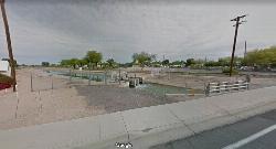
East Maricopa Floodway
Mesa, Arizona
40.3 miles NA flat, pebble-and-tar floodway connecting miles of easy cycling from Main Street and Higley Road all the way to Roosevelt Canal — a quiet, car-free route through Mesa.
Mountain Bike 1.8 mi
Javelina-Beverly Canyon Loop Trail
Phoenix, Arizona
40.6 miles NWA scenic, less-crowded mountain bike trail through beautiful hills and valleys that feels surprisingly remote, with fun singletrack options connecting to Bevery Canyon.
Hike, Horseback, Mountain Bike 1.9 mi
Javelina Trail
Phoenix, Arizona
40.6 miles NWA fast and fun descent on Javelina Trail at South Mountain — a great warm-up climb and crowd-free alternative to the busier Pima Canyon trail.
Hike, Horseback, Mountain Bike 0.8-1.1 mi
Kiwanis Trail to Telegraph Pass Lookout
Phoenix, Arizona
40.9 miles NWA short, beginner-friendly hike in South Mountain near Phoenix winding through a small canyon to Telegraph Pass — best enjoyed at sunrise or just before sunset for near-constant shade.
Hike, Mountain Bike 
Holy Hill And Gila Monster
Gold Canyon, Arizona
41.0 miles NEA fun Gold Canyon trail system combining the Holy Hill By-Pass single-track climb and the Gila Monster intermediate single-track, featuring bermed turns, a wooden track feature, and great desert riding.
Mountain Bike 2.3 mi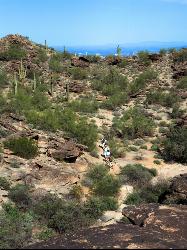
Hidden Valley Trail Via Mormon Trail
Phoenix, Arizona
41.2 miles NWA 2–4 mile hike through Phoenix's South Mountain featuring Fatman's Pass, a natural rock tunnel, petroglyphs, dry waterfalls, and sweeping desert views.
Hike, Mountain Bike 
Holbert-Hidden Valley-Mormon Trail Shuttle
Phoenix, Arizona
41.4 miles NWA 6.5-mile intermediate shuttle hike on South Mountain from ancient petroglyphs and a Hidden Valley rock playground to panoramic canyon and city views at Promontory Point.
Hike, Mountain Bike 
K-trail & Vortex
Gold Canyon, Arizona
42.0 miles NEA challenging intermediate mountain bike route combining the full K Trail and Vortex Trail south of the Gold Canyon trailhead, with several technical drops, washes, and the Rocky Dome summit.
Mountain Bike 
Lost Goldmine & Cougar Loop
Gold Canyon, Arizona
42.0 miles NEA short but technical desert mountain bike loop combining rocky hiking trail on the Lost Goldmine section with a fun, arroyo-dipping Cougar Trail descent.
Mountain Bike 
Cloudview
Gold Canyon, Arizona
42.0 miles NEAlmost 20 miles of intermediate and advanced mountain bike trails — from technical climbs along a cliff wall to fast, twisting singletrack and the challenging Vortex and Tech Trails.
Mountain Bike 
Secret, Tech & K
Gold Canyon, Arizona
42.2 miles NEA twisting desert mountain bike route linking the Horse Trail, Old Horse Trail, Secret, Tech, and K loops through washes, jeep roads, and unmarked singletrack.
Mountain Bike 12.6 mi
National Trail
Phoenix, Arizona
42.5 miles NWNational Trail at South Mountain is Phoenix's premier mountain bike destination — home to the infamous Waterfall feature, petroglyphs, saguaro cactus, and increasingly technical terrain east of Buena Vista Lookout.
Hike, Mountain Bike 
Cat Peaks Via Ruidoso
Apache Junction, Arizona
43.1 miles NA beginner-to-intermediate mountain bike loop from Ruidoso through Cat Peaks Pass with dry wash crossings, rock barriers, and a fun descent down the back side near Apache Junction.
Mountain Bike 
Crismon Wash Trail
Mesa, Arizona
43.2 miles NA 1.8-mile wash trail in Mesa, Arizona accessible from the Crismon Road trailhead or the Blevins Trail — part of a network that supports several loop configurations through desert terrain.
Hike, Horseback, Mountain BikeNearby Campsites

Buckhorn Campground Nature Trail
Apache Junction, Arizona
44.6 miles NCamp and Hike near Apache Junction, Arizona
Camp, Hike 2.1 mi
Lower Salt River Nature Trail
Fort McDowell, Arizona
49.4 miles NA 2-mile beginner loop alongside the Salt River in Tonto National Forest, with worn markers that keep things adventurous — watch for wild horses and spring cactus blooms.
Camp, Hike


