


Chiva Falls
Mount Lemmon, Arizona

| Address: | Arizona Trail, Vail, AZ 85641, USA |
| GPS: |
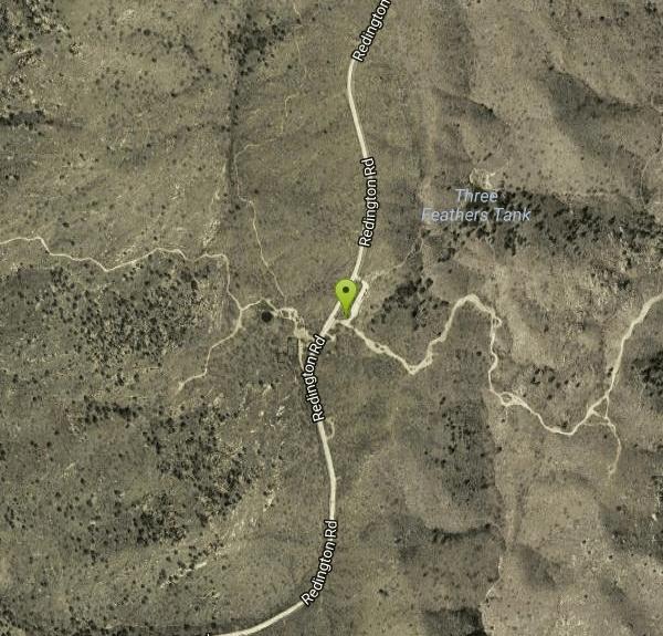
32°16'53.6"N 110°37'59.4"W Maps | Directions |
| State: | Arizona |
| Trail Length: | 8.00 miles |
| MTB Difficulty: | Intermediate |
| Trail Type: | Out & Back |
| Hike Difficulty: | Intermediate |
| Elevation Gain: | 2635 feet |
| Trails/Routes: | 4.4 mi |
Waterfalls Streams Rocks Bicycles Motorized Use
Hike, Mountain Bike, and Swim
Chiva Falls is a waterfall nestled within Coronado National Forest. The path to get there is quite rocky, proving a favorite for mountain biking and motorized vehicles, although hiking is also possible. At the falls, there is a pool to swim in, but be cautious before diving to make sure it's deep enough.
This is a popular route for motorized recreation, so the trails are now basically double-track and be aware of where you are among all the social trails and paths. Courtesy of sdmb.org
This is a trail that requires previous experience with off-roading or mountain biking, due to the difficult terrain. As with most of Arizona's desert waterfalls and pools, take care to avoid flash-flooding conditions. Even though the best time to view the falls is when they've been replenished with precipitation, a heavy rain or monsoon could prove dangerous on the trail.
More Information
Chiva Falls
I piled the kids into Big Jake and headed down to Tucson a few weeks ago for an extended weekend. On Sunday, we met up with Matt@exp-az and some of his local friends and headed out to Chiva Falls via Three Feathers. What an AWESOME trip! We met at the Circle K at Tanque Verde and Rebecca at the e…
https://offroadpassport.com/forums/topic/3203-chiva-falls/Chiva Falls and Frog Hollow Mountain Bike Trail, Tanque Verde, Arizona
This is a good ride in the summer after a monsoon rain Near Tanque Verde, Arizona.
https://www.mtbproject.com/trail/3776431/chiva-falls-and-frog-hollowChiva Falls Hiking Guide
Overview Chiva Falls is an outstanding waterfall in the shadow of the Rincon Mountains east of Tucson. Found in Joaquin Canyon, it only flows after heavy rain events, periods of consistent rainfall, or during snowmelt. Accessed from Redington Road, visitors must find their way to Chiva Falls by navigating a series of harrowing jeep trails. I mean it when I say this; there are some tough sections of road here that will destroy your vehicle if you are ill-equipped or unexperienced. As you might expect, many people opt for lifted 4x4 rigs, UTVs, and ATVs but others get there by
https://backobeyond.blog/chiva-falls-hiking-guide/Chiva Falls Mountain Bike Trail in Tucson, Arizona - Directions, Maps, Photos, and Reviews
Chiva Falls is a singletrack mountain bike trail in Tucson, Arizona. View maps, videos, photos, and reviews of Chiva Falls bike trail in Tucson.
http://www.singletracks.com/bike-trails/chiva-falls/Chiva Falls, Arizona | GPS Map, Photos & Reviews
Chiva Falls, or as the local residents call it, Chivo Falls, is one of the most favored challenging trails in the Tucson area. This trail has a couple of different four-wheeling challenges while traveling out to a 75-foot waterfall and the spectacular views of Mount Lemmon and the Rincon Mountain region. The waterfall that the trail is named for does not continuously run; therefore, planning around the weather is critical to have the complete experience. Fall and Spring offer the best chances for catching the water flowing over the falls. The area is incredibly scenic with pristine desert landscapes, with the destination point being the trail
https://www.trailsoffroad.com/US/arizona/trails/41-chiva-fallsVisit Tucson | Travel Guide to Arizona’s Desert City
Plan your trip to Tucson, AZ with guides to outdoor adventures, local culture, dining, and experiences in the heart of the Sonoran Desert.
https://www.visittucson.org/Never modify trail features. Ride trails when they're dry enough that you won't leave ruts. Speak up when you see others on the trail and always yield to hikers, horses, and others coming uphill. Always ride on the established trail.
Read MoreBe courteous, informed, and prepared. Read trailhead guidelines, stay on the trail, and don't feed the wildlife.
Read More
- Plan Ahead and Prepare
- Travel & camp on durable surfaces
- Dispose of waste properly
- Leave what you find
- Minimize campfire impacts
- Respect wildlife
- Be considerate of other visitors
Directions
From Mount Lemmon, Arizona
- Head south toward E Ski Run Rd/Summit Rd (0.1 mi)
- Turn left onto E Ski Run Rd/Summit Rd (0.3 mi)
- Slight left onto E Ski Run Rd (3.0 mi)
- Turn left onto N General Hitchcock Hwy (2.0 mi)
- Continue onto N Mt Lemmon Hwy (22.6 mi)
- Turn left onto N Mt Lemmon Short Rd (0.5 mi)
- Continue onto N Soldier Trail (3.5 mi)
- Turn left onto E Tanque Verde Rd (1.1 mi)
- Continue onto E Redington RdDestination will be on the right(7.5 mi)
Redington Road is rough, but there are places to park along the road, both a couple of miles from the trailhead, and further along the rocky, gravel road. Once the pavement stops, it will be rough, but will ease up.


Other Mountain Bike Trails, Swimming Holes, and Hiking Trails Nearby
Tanque Verde Falls
Tucson, Arizona
2.7 miles SWWaterfalls and pools in Tanque Verde Canyon reachable on a short hike — but this site has about 30 deaths since 1971 from flash flooding and cliff jumping. Check weather carefully and use extreme caution.
Hike, Swim 0.2-4.6 mi
Frog's Hollow
Vail, Arizona
3.8 miles NEMultiple small pools and shallow waterfalls in a frog-filled Arizona canyon, best in fall through spring after rain — hike via the Arizona or Indian Springs Trail.
Hike, Mountain Bike, Swim 1.2 mi
La Milagrosa Canyon
Tucson, Arizona
5.8 miles WA hidden canyon east of Tucson with rock-climbing walls and a seasonal waterfall pooling into swim basins — best after fall or winter rain, with boulder scrambling required.
Hike, Mountain Bike, Rock Climb, Swim 2.4 mi
Sycamore Reservoir
Tucson, Arizona
6.4 miles NWA small lake up in Bear Canyon on Mount Lemmon with a sandy shore and a dam that creates a small waterfall — best hiked in fall, winter, or spring, when the desert foliage is at its most striking.
Hike, Swim 
Cactus Forest Trail
Tucson, Arizona
7.6 miles SWA flat, multi-use 2.5-mile desert trail through old-growth saguaros and cholla in Saguaro National Park East — welcoming to hikers, horses, and bikes, with the Rincon Mountains as a stunning backdrop.
Hike, Mountain Bike 
Seven Cataracts
Tucson, Arizona
7.8 miles NWA set of waterfalls deep in Willow Canyon near Tucson, reached by off-trail canyoneering scrambles — visible from the Catalina Highway pulloff after rainfall.
Canyoneer, Hike, Swim 0.5-3.8 mi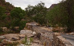
Hutch's Pool
Tucson, Arizona
11.2 miles WA famous desert pool in Sabino Canyon — 8 miles round trip from the trailhead, plus up to 8 more if you walk from the visitor center — with spectacular desert views the entire way.
Hike, Swim 1.3-3.5 mi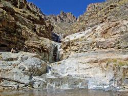
Seven Falls
Tucson, Arizona
11.3 miles WSeven Falls crosses a stream seven times through Bear Canyon before arriving at pools best visited in late winter when snowmelt keeps the water flowing strong.
Hike, Swim 3.6 mi
Lemmon Pools
Mount Lemmon, Arizona
12.4 miles NWA steep, rocky 8.5-mile trek through the Wilderness of Rocks to hidden pools tucked in the Santa Catalinas.
Hike, Swim 1.0-1.2 mi
Maiden Pools
Tucson, Arizona
13.7 miles WGranite pools carved smooth by the Ventana Stream, best filled in late winter and spring, with shading oak trees and big rocks for picnicking — 2.4 miles up Ventana Canyon Trail.
Hike, Rock Climb, Swim 1.4-1.8 mi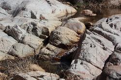
Romero Pools
Tucson, Arizona
18.9 miles NWA two-hour canyon hike through Romero Canyon leads to year-round stream-fed pools surrounded by Catalina State Park desert — best enjoyed September through May.
Hike, Swim 1.0 mi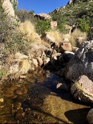
Montrose Pool
Tucson, Arizona
18.9 miles NWA seasonal catchment pool about a mile up the Romero Canyon Trail in Catalina State Park, filling after rainfall — best hiked October through May and dog-friendly to the pool.
Hike, Swim


