


Lemmon Pools
Mount Lemmon, Arizona

| Address: | Mt Lemmon, Arizona 85619, USA |
| GPS: |
32°25'41.3"N 110°45'20.1"W Maps | Directions |
| State: | Arizona |
| Trail Length: | 8.50 miles |
| Trail Type: | Out & Back |
| Hike Difficulty: | Advanced |
| Elevation Gain: | 1000 feet |
| Trails/Routes: | 3.6 mi |
Streams
Hike and Swim
High above the desert heat of Tucson, Lemmon Pools is a hidden reward tucked into the granite wonderland of Mount Lemmon — a series of clear swimming holes and small cascades along Lemmon Creek, deep in the Santa Catalina Mountains. Reaching them takes effort and a sense of adventure, which is exactly why those who make the trip often have the pools to themselves. At nearly 8,000 feet, the air up here is cool and pine-scented, a world away from the saguaro-studded desert floor.
The journey begins at the Marshall Gulch Trailhead, at the very end of the Catalina Highway just past the mountain village of Summerhaven. From there you'll climb to Marshall Saddle and pick up the Wilderness of Rocks Trail, winding southwest through one of southern Arizona's most magical landscapes — a maze of balanced boulders, granite spires, and sculpted stone that gives the area its name. Plan on roughly 8 to 10 miles round trip and about 2,500 feet of climbing, with a good half-day on your feet.
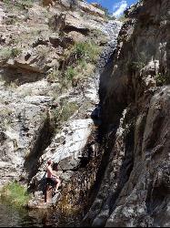
The pools themselves are the catch: there's no official trail down to them. At some point you'll leave the main path and pick your own way into Lemmon Canyon, scrambling over and around boulders to reach the water. It's steep, rocky, and route-finding is part of the game, so this stretch isn't for beginners — but with care and a little boulder-hopping, most fit, prepared hikers can manage it. Your payoff is a string of quiet pools and cascades cradled in granite, perfect for a cool dip after the work of getting there.
Timing matters. The pools run fullest and most inviting in spring and early summer, when snowmelt and seasonal rains keep Lemmon Creek flowing; by late summer the water can drop, though the July–August monsoon sometimes refills it (those storms can also bring fast-moving flash floods, so keep an eye on the sky). Roughly April through October is the prime window, when the high country is open and pleasant.
The reward is as much about the journey as the destination. The Wilderness of Rocks is one of the most enchanting landscapes in southern Arizona — a fairy-tale jumble of hoodoos, balanced boulders, and wind-sculpted granite, threaded with pines and seasonal creeks — and simply walking through it is worth the trip even if you never reach the water. Arriving at the pools themselves, after the off-trail scramble down into Lemmon Canyon, feels like discovering a secret: quiet granite basins and little cascades that almost no one else finds.
Come prepared for a real mountain outing: carry plenty of water and a way to filter more, wear sturdy shoes with good grip for the boulders, bring a map or GPS since you'll be navigating off-trail, and remember you're in the Pusch Ridge Wilderness of the Coronado National Forest — so leave no trace, pack out everything, and let the rocks and water stay wild for the next explorer. Few places blend the thrill of a true backcountry scramble with the payoff of a mountain swimming hole quite like Lemmon Pools.
More Information
Trailvoyant Blog: 16 Best Waterfalls (and the hikes to them) near Tucson, Arizona
Everything you need to know about hiking or backpacking to the most amazing wilderness points of interest and the trails you'll hike to get there.
https://blog.trailvoyant.com/2016/10/16-best-waterfalls-and-hikes-to-them.htmlUpper Lemmon Canyon Pools - Kingsnake's Home Den
Tucson Citizen - The Voice of Tucson
https://prestonm.com/upper-lemmon-canyon-pools/Be courteous, informed, and prepared. Read trailhead guidelines, stay on the trail, and don't feed the wildlife.
Read More
- Plan Ahead and Prepare
- Travel & camp on durable surfaces
- Dispose of waste properly
- Leave what you find
- Minimize campfire impacts
- Respect wildlife
- Be considerate of other visitors
Directions
From Mount Lemmon, Arizona
- Head south toward E Ski Run Rd/Summit Rd (0.1 mi)
- Turn left onto E Ski Run Rd/Summit Rd (0.3 mi)
- Slight left onto E Ski Run Rd (3.0 mi)
- Turn right onto N General Hitchcock Hwy (0.2 mi)
- Continue onto N Sabino Canyon Park (1.2 mi)
In order to park at the trailhead, a permit is required for Marshall Gulch.
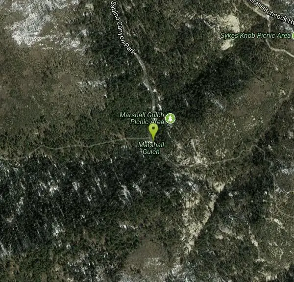
We start the hike at Marshall Gulch Trail Head then take Marshall Gulch to the saddle. Once at the saddle we head down Wilderness of Rock Trail. After approximately two miles we head off trail to the pools. There is a short scramble to get down to the pools, not too difficult. Once at the pools we take a break, go for a dip then head back. For the return route there is an option to take the Aspen trail and a short diversion to Bill Carter’s secret mountain vista (Very Nice) or return via Marshall Gulch trail. Courtesy of meetup.com


Other Swimming Holes and Hiking Trails Nearby
Seven Cataracts
Tucson, Arizona
4.9 miles SA set of waterfalls deep in Willow Canyon near Tucson, reached by off-trail canyoneering scrambles — visible from the Catalina Highway pulloff after rainfall.
Canyoneer, Hike, Swim 2.4 mi
Sycamore Reservoir
Tucson, Arizona
6.7 miles SA small lake up in Bear Canyon on Mount Lemmon with a sandy shore and a dam that creates a small waterfall — best hiked in fall, winter, or spring, when the desert foliage is at its most striking.
Hike, Swim 1.0-1.2 mi
Maiden Pools
Tucson, Arizona
8.4 miles SWGranite pools carved smooth by the Ventana Stream, best filled in late winter and spring, with shading oak trees and big rocks for picnicking — 2.4 miles up Ventana Canyon Trail.
Hike, Rock Climb, Swim 1.4-1.8 mi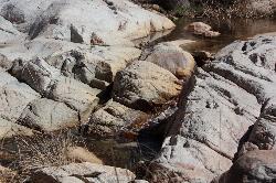
Romero Pools
Tucson, Arizona
8.9 miles WA two-hour canyon hike through Romero Canyon leads to year-round stream-fed pools surrounded by Catalina State Park desert — best enjoyed September through May.
Hike, Swim 1.0 mi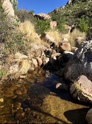
Montrose Pool
Tucson, Arizona
8.9 miles WA seasonal catchment pool about a mile up the Romero Canyon Trail in Catalina State Park, filling after rainfall — best hiked October through May and dog-friendly to the pool.
Hike, Swim 0.5-3.8 mi
Hutch's Pool
Tucson, Arizona
9.0 miles SWA famous desert pool in Sabino Canyon — 8 miles round trip from the trailhead, plus up to 8 more if you walk from the visitor center — with spectacular desert views the entire way.
Hike, Swim 1.2 mi
La Milagrosa Canyon
Tucson, Arizona
9.1 miles SA hidden canyon east of Tucson with rock-climbing walls and a seasonal waterfall pooling into swim basins — best after fall or winter rain, with boulder scrambling required.
Hike, Mountain Bike, Rock Climb, Swim 1.3-3.5 mi
Seven Falls
Tucson, Arizona
9.1 miles SWSeven Falls crosses a stream seven times through Bear Canyon before arriving at pools best visited in late winter when snowmelt keeps the water flowing strong.
Hike, Swim 4.4 mi
Chiva Falls
Mount Lemmon, Arizona
12.4 miles SEA desert waterfall tucked in Coronado National Forest, best reached by mountain bike or motorized vehicle on rocky double-track — with a pool at the bottom to cool off in (check depth before diving).
Hike, Mountain Bike, Swim 0.5 mi
Tanque Verde Falls
Tucson, Arizona
13.1 miles SEWaterfalls and pools in Tanque Verde Canyon reachable on a short hike — but this site has about 30 deaths since 1971 from flash flooding and cliff jumping. Check weather carefully and use extreme caution.
Hike, Swim 0.2-4.6 mi
Frog's Hollow
Vail, Arizona
13.5 miles SEMultiple small pools and shallow waterfalls in a frog-filled Arizona canyon, best in fall through spring after rain — hike via the Arizona or Indian Springs Trail.
Hike, Mountain Bike, Swim 
Cactus Forest Trail
Tucson, Arizona
15.9 miles SA flat, multi-use 2.5-mile desert trail through old-growth saguaros and cholla in Saguaro National Park East — welcoming to hikers, horses, and bikes, with the Rincon Mountains as a stunning backdrop.
Hike, Mountain Bike


