


Seven Cataracts
Tucson, Arizona
| Address: | Seven Cataracts, Arizona 85619, USA |
| GPS: |
32°21'43.3"N 110°43'35.3"W Maps | Directions |
| State: | Arizona |
Waterfalls Rocks
Canyoneer, Hike, and Swim
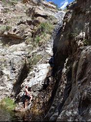
Seven Cataracts is one of Mount Lemmon's most beautiful seasonal secrets — a staircase of waterfalls cascading down Willow Canyon in the Santa Catalina Mountains above Tucson, Arizona. When winter snowmelt and summer monsoon rains get the water flowing, the falls tumble dramatically through the rugged canyon, a stunning splash of green and silver against the desert mountainside.
The easiest and safest way to enjoy Seven Cataracts is from the Seven Cataracts Vista, a marked pullout along the Catalina Highway (around milepost 9) as it climbs toward Mount Lemmon. From this overlook you can take in the whole cascade across the canyon — an effortless, family-friendly photo stop that's especially spectacular in the days after a good rain or snow. (Don't confuse it with Seven Falls in nearby Bear Canyon — this is a different spot.)
Reaching the pools at the base of the falls is another story entirely. There's no official trail into the canyon; getting down to the water means steep, technical canyoneering — scrambling, route-finding, and even rappelling over slick rock. This is for experienced, properly equipped canyoneers only. The terrain is steep and slippery, the rock is unforgiving, and narrow desert canyons like this carry a real flash-flood risk during storms — never venture in when rain is in the forecast.
Timing is everything, since the stream is seasonal: it can be roaring after a storm or snowmelt and bone-dry in between. Late winter through spring and the summer monsoon (roughly July through September) tend to offer the best flows. Check recent conditions before you go, and plan your visit for the days right after precipitation.
Whether you simply pull over for the view or take on the canyon as a seasoned canyoneer, Seven Cataracts showcases the wild, water-carved side of the Santa Catalinas — a reminder that even the desert mountains above Tucson hide their own hidden waterfalls.
More Information
Santa Catalina Mtns.
The Santa Catalinas, crowned by 9,157-foot Mt. Lemmon, rise in ragged ridges from the north edge of Tucson to cool forests atop the higher slopes. A paved road, the Catalina Highway/Sky Island Scenic Byway, winds high into the mountains past many vistas and recreation areas. Down below, a tram ride or easy walk takes you into Sabino Canyon, an oasis of greenery beneath rock walls dotted with saguaro cactus. Catalina State Park offers trails and vistas beneath the imposing western face of the Catalinas. Be aware that mountain lions live in the mountains and canyons! To reduce the danger of attack, hikers should pair up and keep children close at hand. Hikers can choose among trails totaling over 150 miles in length and ranging from easy strolls to extremely difficult climbs. Much of the hiking lies within the Pusch Ridge Wilderness, which protects most of the western part of the range. Hikers in the wilderness must heed special regulations to protect the desert bighorn sheep by not going more than 400 feet off trail from January 1 to April 30, not bringing in dogs (service animals are ok), and by limiting group sizes to 15 for day use or 6 camping. The Santa Catalina Mountains topo map shows the main trails, distances, and trailheads; it's sold at Forest Service offices and hiking stores. Volunteers and foresters of the Santa Catalina Ranger District office provide information on the Santa Catalinas at the Sabino Canyon Visitor Center (5700 N. Sabino Canyon Rd., Tucson, AZ 85750, 520/749-8700, www.fs.fed.us/r3/coronado, 8 a.m.-4:30 p.m. Mon.-Fri., 8:30 a.m.-4:30 p.m. Sat.-Sun.)
https://www.arizonahandbook.com/catalina.htmSonoran Connection: The Seven Cataracts- The Waterfalls
This is not the first time I have photographed these waterfalls but they are really beautiful each time. Hopefully you will enjoy seeing the...
http://sonoranconnection.blogspot.com/2010/03/seven-cataracts-waterfalls.htmlTrailvoyant Blog: 16 Best Waterfalls (and the hikes to them) near Tucson, Arizona
Everything you need to know about hiking or backpacking to the most amazing wilderness points of interest and the trails you'll hike to get there.
https://blog.trailvoyant.com/2016/10/16-best-waterfalls-and-hikes-to-them.htmlBe courteous, informed, and prepared. Read trailhead guidelines, stay on the trail, and don't feed the wildlife.
Read More
- Plan Ahead and Prepare
- Travel & camp on durable surfaces
- Dispose of waste properly
- Leave what you find
- Minimize campfire impacts
- Respect wildlife
- Be considerate of other visitors
Directions
From Tucson, Arizona
- Head west on E Broadway Blvd toward S Country Club Rd (39 ft)
- Turn right at the 1st cross street onto N Country Club Rd (1.0 mi)
- Turn right onto E Speedway Blvd (4.0 mi)
- Turn left onto N Wilmot Rd (0.5 mi)
- Continue onto E Tanque Verde Rd (1.7 mi)
- Keep left to stay on E Tanque Verde Rd (2.1 mi)
- Turn left onto E Catalina Hwy (4.5 mi)
- Continue onto E Mt Lemmon Hwy (9.2 mi)
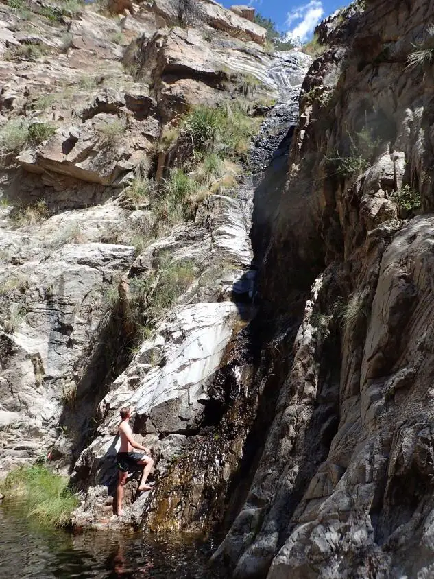
The most commonly used canyoneering route to Seven Cataracts begins at Windy Point Vista, not the Seven Cataracts Viewpoint. Both viewpoints are located to the side of Mt. Lemmon Highway.



Other Swimming Holes, Hiking Trails, and Canyons Nearby

Sycamore Reservoir
Tucson, Arizona
1.8 miles SA small lake up in Bear Canyon on Mount Lemmon with a sandy shore and a dam that creates a small waterfall — best hiked in fall, winter, or spring, when the desert foliage is at its most striking.
Hike, Swim 1.2 mi
La Milagrosa Canyon
Tucson, Arizona
4.4 miles SA hidden canyon east of Tucson with rock-climbing walls and a seasonal waterfall pooling into swim basins — best after fall or winter rain, with boulder scrambling required.
Hike, Mountain Bike, Rock Climb, Swim 3.6 mi
Lemmon Pools
Mount Lemmon, Arizona
4.9 miles NA steep, rocky 8.5-mile trek through the Wilderness of Rocks to hidden pools tucked in the Santa Catalinas.
Hike, Swim 0.5-3.8 mi
Hutch's Pool
Tucson, Arizona
6.6 miles SWA famous desert pool in Sabino Canyon — 8 miles round trip from the trailhead, plus up to 8 more if you walk from the visitor center — with spectacular desert views the entire way.
Hike, Swim 1.3-3.5 mi
Seven Falls
Tucson, Arizona
6.7 miles SWSeven Falls crosses a stream seven times through Bear Canyon before arriving at pools best visited in late winter when snowmelt keeps the water flowing strong.
Hike, Swim 1.0-1.2 mi
Maiden Pools
Tucson, Arizona
7.7 miles WGranite pools carved smooth by the Ventana Stream, best filled in late winter and spring, with shading oak trees and big rocks for picnicking — 2.4 miles up Ventana Canyon Trail.
Hike, Rock Climb, Swim 4.4 mi
Chiva Falls
Mount Lemmon, Arizona
7.8 miles SEA desert waterfall tucked in Coronado National Forest, best reached by mountain bike or motorized vehicle on rocky double-track — with a pool at the bottom to cool off in (check depth before diving).
Hike, Mountain Bike, Swim 0.5 mi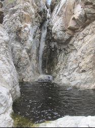
Tanque Verde Falls
Tucson, Arizona
8.3 miles SEWaterfalls and pools in Tanque Verde Canyon reachable on a short hike — but this site has about 30 deaths since 1971 from flash flooding and cliff jumping. Check weather carefully and use extreme caution.
Hike, Swim 0.2-4.6 mi
Frog's Hollow
Vail, Arizona
9.7 miles SEMultiple small pools and shallow waterfalls in a frog-filled Arizona canyon, best in fall through spring after rain — hike via the Arizona or Indian Springs Trail.
Hike, Mountain Bike, Swim 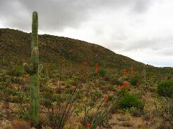
Cactus Forest Trail
Tucson, Arizona
11.2 miles SA flat, multi-use 2.5-mile desert trail through old-growth saguaros and cholla in Saguaro National Park East — welcoming to hikers, horses, and bikes, with the Rincon Mountains as a stunning backdrop.
Hike, Mountain Bike 1.4-1.8 mi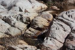
Romero Pools
Tucson, Arizona
11.4 miles NWA two-hour canyon hike through Romero Canyon leads to year-round stream-fed pools surrounded by Catalina State Park desert — best enjoyed September through May.
Hike, Swim 1.0 mi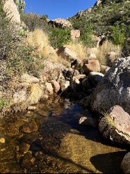
Montrose Pool
Tucson, Arizona
11.4 miles NWA seasonal catchment pool about a mile up the Romero Canyon Trail in Catalina State Park, filling after rainfall — best hiked October through May and dog-friendly to the pool.
Hike, Swim


