


La Milagrosa Canyon
Tucson, Arizona

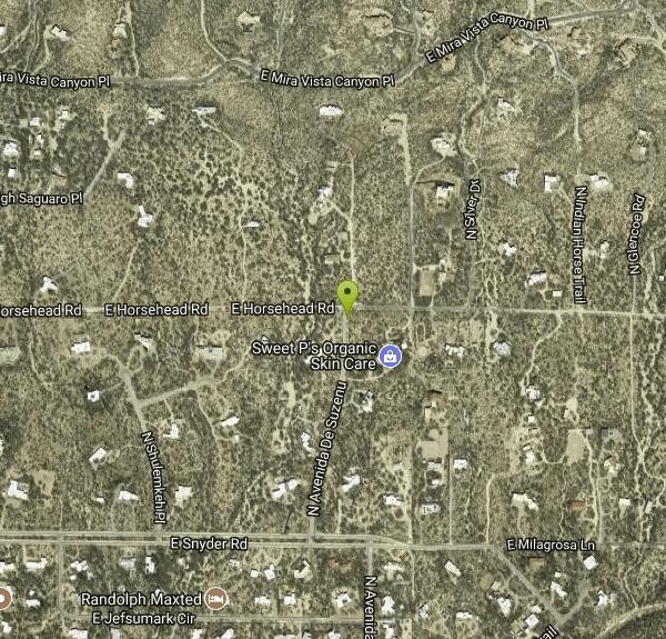
| Address: | 12985 E Horsehead Rd, Tucson, AZ 85749, USA |
| GPS: |
32°17'53.6"N 110°43'50.8"W Maps | Directions |
| State: | Arizona |
| Trail Length: | 2.90 miles |
| Trail Type: | Out & Back |
| Hike Difficulty: | Intermediate |
| Elevation Gain: | 345 feet |
| Trails/Routes: | 1.2 mi |
Waterfalls Rocks
Hike, Mountain Bike, Rock Climb, and Swim
La Milagrosa Canyon is a hidden gem just east of Tucson, Arizona and north of the Tanque Verde area. It features many rock-climbing walls, and even a seasonal waterfall with pools for swimming, best accessed by hiking. The waterfall may dry up depending on how long it's been since the last rainfall. Access to the pools will require scrambling over some boulders, especially if you're trying to reach one of the top two pools.
There is little to no sun on this hike, so be sure to take plenty of water and a hat. Like many such destinations in Arizona, this arena is best enjoyed in the fall, winter, or spring to avoid the summer heat. Though it is common to visit the canyon pools shortly after rainfall, take care to watch the local weather conditions to avoid a potential flash flood, which can be deadly.
More Information
Home - Bookmans Entertainment Exchange
BUY Buying used is good for your pocket and for the planet, so why buy new? SELL We buy all things entertainment from books to instruments! TRADE Trade credit spends like cash in all of our stores and never expires. HOW WE BUY Bookmans’ shelves...
https://bookmans.com/La Milagrosa and Agua Caliente Canyon Hiking Guide
Overview In Spanish, ‘la milagrosa’ translates to ‘the miraculous’ and is a fitting name for La Milagrosa Canyon. On the northeast side of Tucson, next to the unincorporated suburb of Tanque Verde, this hike begins at a low-profile trailhead outside of a gated community. The most common route taken is a 6-mile loop that crosses both La Milagrosa and Agua Caliente Canyon. To complete the loop, hikers must ascend two ridges that offer killer views of the surrounding area. Tip: For an off-trail experience, consider exiting the trail at the mouth of Agua Caliente Canyon and scrambling up canyon. At
https://backobeyond.blog/la-milagrosa-and-agua-caliente-canyon-hiking-guide/La Milagrosa Mountain Bike Trail, Tanque Verde, Arizona
It starts ugly, but rewards riders with a phenomenal finish. Near Tanque Verde, Arizona.
https://www.mtbproject.com/trail/306975/la-milagrosaRock Climbing in La Milagrosa Canyon, Southern Arizona
Find rock climbing routes, photos, and guides for every state, along with experiences and advice from fellow climbers.
https://www.mountainproject.com/area/105738043/la-milagrosa-canyonRock Climbing in Water World, Southern Arizona
Find rock climbing routes, photos, and guides for every state, along with experiences and advice from fellow climbers.
https://www.mountainproject.com/area/105918507/water-worldNever modify trail features. Ride trails when they're dry enough that you won't leave ruts. Speak up when you see others on the trail and always yield to hikers, horses, and others coming uphill. Always ride on the established trail.
Read MoreBe courteous, informed, and prepared. Read trailhead guidelines, stay on the trail, and don't feed the wildlife.
Read More
- Plan Ahead and Prepare
- Travel & camp on durable surfaces
- Dispose of waste properly
- Leave what you find
- Minimize campfire impacts
- Respect wildlife
- Be considerate of other visitors
Directions
From Tucson, Arizona
- Head west on E Broadway Blvd toward S Country Club Rd (39 ft)
- Turn right at the 1st cross street onto N Country Club Rd (1.0 mi)
- Turn right onto E Speedway Blvd (4.0 mi)
- Turn left onto N Wilmot Rd (0.5 mi)
- Continue onto E Tanque Verde Rd (1.7 mi)
- Keep left to stay on E Tanque Verde Rd (2.1 mi)
- Turn left onto E Catalina Hwy (3.7 mi)
- Turn right onto E Snyder Rd (1.3 mi)
- Turn left onto N Avenida De Suzenu (0.3 mi)
The nearest place to park is within town a little ways; there is not a formal lot, so you'll have to park on the street before starting out. You have to follow a dirt road for a while on foot before reaching the canyon.
From town, head north on the Catalina Highway as if going up Mt Lemmon. Before the base of the mountain, turn right (east) onto Snyder Road. Follow Snyder east to Suzenu Rd. and turn left. Drive to the end of Suzenu, and park off the road near the large gate. From the gate, hike east down a long, straight dirt road. After about ten minutes of hiking, pass through a chained gate and cross the bed of Molino Creek. Follow the road up a hill until you can see Agua Caliente Creek to the south. Courtesy of mountainproject.com


Other Rock Climbing Walls, Mountain Bike Trails, Swimming Holes, and Hiking Trails Nearby

Sycamore Reservoir
Tucson, Arizona
2.7 miles NA small lake up in Bear Canyon on Mount Lemmon with a sandy shore and a dam that creates a small waterfall — best hiked in fall, winter, or spring, when the desert foliage is at its most striking.
Hike, Swim 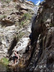
Seven Cataracts
Tucson, Arizona
4.4 miles NA set of waterfalls deep in Willow Canyon near Tucson, reached by off-trail canyoneering scrambles — visible from the Catalina Highway pulloff after rainfall.
Canyoneer, Hike, Swim 0.5 mi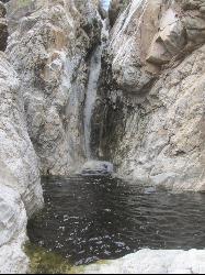
Tanque Verde Falls
Tucson, Arizona
4.9 miles SEWaterfalls and pools in Tanque Verde Canyon reachable on a short hike — but this site has about 30 deaths since 1971 from flash flooding and cliff jumping. Check weather carefully and use extreme caution.
Hike, Swim 0.5-3.8 mi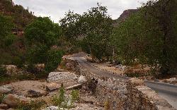
Hutch's Pool
Tucson, Arizona
5.4 miles WA famous desert pool in Sabino Canyon — 8 miles round trip from the trailhead, plus up to 8 more if you walk from the visitor center — with spectacular desert views the entire way.
Hike, Swim 1.3-3.5 mi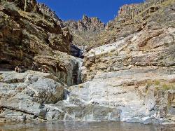
Seven Falls
Tucson, Arizona
5.5 miles WSeven Falls crosses a stream seven times through Bear Canyon before arriving at pools best visited in late winter when snowmelt keeps the water flowing strong.
Hike, Swim 4.4 mi
Chiva Falls
Mount Lemmon, Arizona
5.8 miles EA desert waterfall tucked in Coronado National Forest, best reached by mountain bike or motorized vehicle on rocky double-track — with a pool at the bottom to cool off in (check depth before diving).
Hike, Mountain Bike, Swim 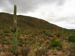
Cactus Forest Trail
Tucson, Arizona
6.8 miles SA flat, multi-use 2.5-mile desert trail through old-growth saguaros and cholla in Saguaro National Park East — welcoming to hikers, horses, and bikes, with the Rincon Mountains as a stunning backdrop.
Hike, Mountain Bike 1.0-1.2 mi
Maiden Pools
Tucson, Arizona
7.9 miles NWGranite pools carved smooth by the Ventana Stream, best filled in late winter and spring, with shading oak trees and big rocks for picnicking — 2.4 miles up Ventana Canyon Trail.
Hike, Rock Climb, Swim 3.6 mi
Lemmon Pools
Mount Lemmon, Arizona
9.1 miles NA steep, rocky 8.5-mile trek through the Wilderness of Rocks to hidden pools tucked in the Santa Catalinas.
Hike, Swim 0.2-4.6 mi
Frog's Hollow
Vail, Arizona
9.2 miles EMultiple small pools and shallow waterfalls in a frog-filled Arizona canyon, best in fall through spring after rain — hike via the Arizona or Indian Springs Trail.
Hike, Mountain Bike, Swim 1.4-1.8 mi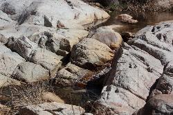
Romero Pools
Tucson, Arizona
13.6 miles NWA two-hour canyon hike through Romero Canyon leads to year-round stream-fed pools surrounded by Catalina State Park desert — best enjoyed September through May.
Hike, Swim 1.0 mi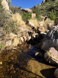
Montrose Pool
Tucson, Arizona
13.6 miles NWA seasonal catchment pool about a mile up the Romero Canyon Trail in Catalina State Park, filling after rainfall — best hiked October through May and dog-friendly to the pool.
Hike, Swim


