


Fisher Creek Road
Stanley, Idaho

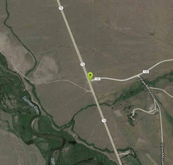
| Address: | ~ID-75, Stanley, ID 83278, USA |
| GPS: |
44°3'12.6"N 114°50'3.0"W Maps | Directions |
| State: | Idaho |
| Trail Length: | 8.00 miles |
| MTB Difficulty: | Beginner |
| Trail Type: | Out & Back |
| MTB Trail Type: | Fire Road |
Mountain Bike
This trail has one of the best descents in the area, and is coupled with some amazing views of the Sawtooth Mountains. There is a mix of both paved road and dirt track on this trail, and it can be ridden by most riders regardless of their level of experience. The trail starts off at the Williams Creek trail off of highway 75. There is an area where cars can be parked, and when the trail is done counter-clockwise, the last stretch will be a nice coast back to the parking lot.
From the parking lot, get back onto highway 75 and follow the road until reaching Fisher Creek road. This section of road riding is a great warm up for the rest of the trail. At this point, the trail will start to gain elevation, and the climb will begin. The climb is not too difficult for the first 2/3 of it, however about 8 miles into the trail the ascent becomes more difficult and might be walked by most riders. After this climb the trail will make a brief descent along the Fisher Creek trail as it approaches the intersection of Pig Tail and William Creek trail. Keep left and continue along William Creek trail, where the climb will once again continue.
This is the last climb of the trail and so after reaching this point, the trail is all downhill. At the top there are some fantastic views of the Sawtooth Mountains and the surrounding areas. Going down is one of the highlights of the trail because it is a very smooth ride. Many people are tempted to go down without touching their brakes though there are occasionally other bikers heading up the route in the opposite direction. At the end of this descent, there is a short but steep climb to get back to the level of the parking lot. From here it is a nice coast back to the car.
There was a fire that came through this trail several years ago. Because of this, it is not uncommon for there to be fallen trees along the trail. Be aware and watch out for any trail obstruction.
More Information
Fisher Creek Loop Mountain Bike Trail, Sun Valley, Idaho
An outstanding taste of the riding up near Stanley - but it's just a taste! Near Sun Valley, Idaho.
https://www.mtbproject.com/trail/5893349/fisher-creek-loopFisher Creek Road
Fisher Creek Road is a singletrack mountain bike trail in Stanley, Idaho. View maps, videos, photos, and reviews of Fisher Creek Road bike trail in Stanley.
http://www.singletracks.com/bike-trails/fisher-creek-road/Never modify trail features. Ride trails when they're dry enough that you won't leave ruts. Speak up when you see others on the trail and always yield to hikers, horses, and others coming uphill. Always ride on the established trail.
Read More
- Plan Ahead and Prepare
- Travel & camp on durable surfaces
- Dispose of waste properly
- Leave what you find
- Minimize campfire impacts
- Respect wildlife
- Be considerate of other visitors
Directions
From Stanley, Idaho
- Head west on Ace of Diamonds St toward Wall St (302 ft)
- Turn right at the 1st cross street onto Wall St (377 ft)
- Turn right onto Eva Falls Ave (0.3 mi)
- Turn right onto ID-75 SDestination will be on the left(13.1 mi)


Other Mountain Bike Trails Nearby
Williams Creek
Stanley, Idaho
2.2 miles NFlowy, fast, and full of great corners with awesome views — Williams Creek forms the backbone of the popular Fisher Creek Loop near Stanley, Idaho.
Mountain Bike 
Pigtail Trail
Stanley, Idaho
4.9 miles NEThe singletrack opener of the Fisher Creek Loop, Pigtail Trail offers a great descent to Williams Creek with excellent sidehilling.
Mountain Bike 
Fisher Creek Loop
Stanley, Idaho
8.8 miles ECounter-clockwise from Fisher Creek Road, this smooth rolling burnscape singletrack offers breakneck-speed descents, amazing views, and a well-maintained trail — a must-ride near Stanley.
Mountain Bike 
Fourth Of July Lake / Ants Basin / Robinson Bar
Stanley, Idaho
9.8 miles EAn epic Boulder-White Clouds mountain bike ride linking Fourth of July Lakes, Ants Basin, and Warm Springs Creek through spectacular scenery, creek crossings, and sweet technical singletrack.
Mountain Bike 
Germania Creek - Chamberlain Creek Loop
Stanley, Idaho
11.2 miles SEA spectacular, remote 16-mile loop through Chamberlain Basin with high mountain passes, creek crossings, open meadows, and views of Castle Peak from the summit.
Mountain Bike 
Galena Lodge Trail System
Ketchum, Idaho
15.4 miles SEA complex network of interconnected trails in Ketchum — home of the classic Galena Grinder cross-country race and great riding for all levels.
Mountain Bike 
Frenchman Creek
Ketchum, Idaho
16.6 miles SAn easy-to-moderate out-and-back ride through a wild, scenic mountain canyon past big meadows, avalanche chutes, and wildlife between Stanley and Ketchum.
Mountain Bike 
Spring Creek
Ketchum, Idaho
17.9 miles SEOne of the main singletrack trails at Galena Lodge near Ketchum — the lower section delivers excellent flow for mountain bikers looking for a smooth, fun ride in the Galena system.
Mountain Bike 
Frog Lake Loop
Clayton, Idaho
20.1 miles EA demanding singletrack loop up Little Boulder Creek and down Big Boulder — steep technical climbing gives way to 6 miles of bermed, bridged descending with fast sections and hidden sharp turns.
Mountain Bike 
East Fork Baker Creek Road
Ketchum, Idaho
25.3 miles SEA dead-end dirt road that climbs high into the mountains above Ketchum and serves as a gateway to numerous singletrack trails in the area.
Mountain Bike 
Osberg's Ridgeline Trail
Ketchum, Idaho
26.6 miles SAn epic ridgeline point-to-point shuttle ride near Ketchum with million-dollar views in every direction — plenty of climbing and descending along a gorgeous ridge to Adams Gulch.
Mountain Bike 
Oregon Gulch / Trail #183
Ketchum, Idaho
26.7 miles SEA long, remote mountain bike adventure through meadows, past a yurt, and into the steep downhill-only Upper Oregon Gulch — with loose rock, rooted terrain, and 50 feet of hike-a-bike near the top.
Mountain Bike 
Fox Peak / Trail #938
Ketchum, Idaho
28.1 miles SEA connector singletrack through a castle-rock fire recovery area and a beautiful aspen grove, linking Osberg Ridgeline to East Fork Road #168.
Mountain Bike 
Saddle / Trail #326
Ketchum, Idaho
28.2 miles SESaddle Trail (#326) is a smooth, shaded intermediate mountain-bike ride through aspen and pine near Ketchum, Idaho.
Mountain Bike 
Chocolate Gulch / Trail #312
Ketchum, Idaho
29.8 miles SEChocolate Gulch (Trail #312) is a mellow, scenic mountain-bike ride north of Ketchum with wildflowers and Boulder Mountain views.
Mountain Bike 
Greenhorn Gulch
Ketchum, Idaho
31.6 miles SEA scenic multi-use singletrack in Ketchum with good downhill flow, a moderate climb, and a grind up to the Imperial Gulch junction.
Mountain Bike 
Adams Gulch Loop
Ketchum, Idaho
32.8 miles SEA popular singletrack loop near Ketchum with a road option splitting it for easier riding, junctions to other trails, off-leash dogs outside the lot, and wildflowers going wild in July.
Mountain Bike 
White Clouds Trails
Sun Valley, Idaho
34.4 miles SEExcellent beginner-to-intermediate trails with some of the best panoramic views in the Sun Valley area — a welcoming option for families and those avoiding technical difficulty.
Mountain Bike 
Fox Creek Loop
Ketchum, Idaho
35.2 miles SEA fun singletrack loop near Ketchum with rocky sections, good climbs, and a fast steep descent after two switchbacks — experience recommended before tackling the downhill section.
Mountain Bike 
Bald Mountain Bike Park
Ketchum, Idaho
35.2 miles SEA lift-accessed summer mountain biking experience at Bald Mountain — 3,000 feet of uphill elevation included, followed by miles of advanced downhill trails back to the base.
Mountain BikeNearby Campsites
Galena Lodge
Ketchum, Idaho
15.4 miles SEA community-owned historic lodge 23 miles north of Sun Valley, open summer and winter as a hub for hikers, bikers, Nordic skiers, and snowshoers with rentals and great food.
Camp, Cross-country Ski, Snowshoe 
Bonneville Hot Springs
Lowman, Idaho
24.8 miles WA series of soaking pools fed by a warm waterfall, plus a natural hot spring and a private iron-tub soak shack — all a quarter mile from Bonneville Campground beside Warm Springs Creek near Lowman.
Camp, Hike, Hot Springs 3.4 mi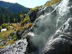
Skillern Hot Springs
Fairfield, Idaho
28.0 miles SA stunning six-mile trail along crystal-clear Big Smoky Creek to a hot spring — spectacular in fall, with two trail options and a sign marking the final three miles.
Camp, Hike, Hot Springs 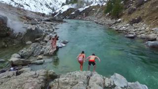
Kirkham Hot Springs Campground
Lowman, Idaho
35.2 miles WMultiple hot waterfalls flowing into shallow rock pools right along a highway 21 pullout near the Boise National Forest — popular in both summer and winter seasons.
Camp, Hot Springs 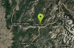
Park Creek Campground
Lowman, Idaho
37.4 miles WA small, tranquil campground in an old-growth forest along Park Creek in the Baker Lake basin, close to Baker Lake and the larger Swift Creek Campground.
Camp 
Pine Flat Hot Springs
Garden Valley, Idaho
42.3 miles WAn aqua-blue hot spring pool at the base of a small waterfall on the South Fork Payette River — just a quarter mile from Pine Flat Campground in the Boise National Forest.
Camp, Canoe, Hike, Hot Springs, Kayak, Whitewater 
Loftus Hot Spring
Mountain Home, Idaho
44.7 miles SWLoftus Hot Spring is a free Boise National Forest soak on the Middle Fork Boise River, with a hot waterfall between ~110F and ~104F pools.
Camp, Hot Springs


