


Greenhorn Gulch
Ketchum, Idaho

| Address: | ~976 Warm Springs Rd, Ketchum, ID 83340, USA |
| GPS: |
43°39'0.4"N 114°32'3.8"W Maps | Directions |
| State: | Idaho |
| Trail Length: | 5.00 miles |
| MTB Difficulty: | Intermediate |
| Trail Type: | Network |
| MTB Trail Type: | Singletrack |
Mountain Bike
Great trail in a network of multiuse trails. Good flow downhill, and moderate climbing going up. A grind up to Imperial Gulch intersection. Scenic. Courtesy of Singletracks.com
More Information
Greenhorn Gulch Mountain Bike Trail in Ketchum, Idaho - Directions, Maps, Photos, and Reviews
Greenhorn Gulch is a singletrack mountain bike trail in Ketchum, Idaho. View maps, videos, photos, and reviews of Greenhorn Gulch bike trail in Ketchum.
http://www.singletracks.com/bike-trails/greenhorn-gulch/Never modify trail features. Ride trails when they're dry enough that you won't leave ruts. Speak up when you see others on the trail and always yield to hikers, horses, and others coming uphill. Always ride on the established trail.
Read More
- Plan Ahead and Prepare
- Travel & camp on durable surfaces
- Dispose of waste properly
- Leave what you find
- Minimize campfire impacts
- Respect wildlife
- Be considerate of other visitors
Directions
From Ketchum, Idaho
- Head southwest on Sun Valley Rd toward N Main St (131 ft)
- Turn right at the 1st cross street onto N Main St (0.2 mi)
- Slight left onto Warm Springs RdDestination will be on the left(13.0 mi)


Other Mountain Bike Trails Nearby

Fox Peak / Trail #938
Ketchum, Idaho
5.1 miles NA connector singletrack through a castle-rock fire recovery area and a beautiful aspen grove, linking Osberg Ridgeline to East Fork Road #168.
Mountain Bike
Osberg's Ridgeline Trail
Ketchum, Idaho
6.6 miles NWAn epic ridgeline point-to-point shuttle ride near Ketchum with million-dollar views in every direction — plenty of climbing and descending along a gorgeous ridge to Adams Gulch.
Mountain Bike
East Fork Baker Creek Road
Ketchum, Idaho
6.6 miles NA dead-end dirt road that climbs high into the mountains above Ketchum and serves as a gateway to numerous singletrack trails in the area.
Mountain Bike
Oregon Gulch / Trail #183
Ketchum, Idaho
7.1 miles NA long, remote mountain bike adventure through meadows, past a yurt, and into the steep downhill-only Upper Oregon Gulch — with loose rock, rooted terrain, and 50 feet of hike-a-bike near the top.
Mountain Bike
Imperial Gulch Trail
Hailey, Idaho
7.1 miles SEA steady climb through wildflowers, aspen groves, and meadows near Hailey with stunning Pioneer Mountain views — best ridden counter-clockwise beginning with Greenhorn Gulch.
Mountain Bike
Adams Gulch Loop
Ketchum, Idaho
8.2 miles NEKetchum's busiest trail network, with easy loops on Shadyside and Sunnyside, the Griffin Butte intermediate loop and the one-way, bike-only Forbidden Fruit flow trail. The trailhead is less than two miles north of town.
Hike, Mountain Bike
Bald Mountain Bike Park
Ketchum, Idaho
8.4 miles EA lift-accessed summer mountain biking experience at Bald Mountain — 3,000 feet of uphill elevation included, followed by miles of advanced downhill trails back to the base.
Mountain Bike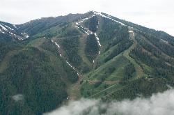
Bald Mountain Trail
Ketchum, Idaho
8.4 miles EThe main hiking and uphill-only biking route up Bald Mountain, climbing about 5.2 miles and 3,200 feet from River Run Plaza in Ketchum. Many hikers stop at the Roundhouse about 4 miles up.
Hike, Mountain Bike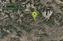
River Run
Ketchum, Idaho
8.6 miles EA great descending trail in the Bald Mountain area near Ketchum with plenty of switchbacks, wooded shade, and connections to Bald Mountain Trail and Warm Spring Trail — watch for hikers on the way down.
Mountain Bike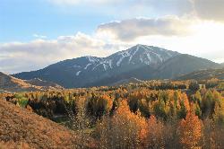
White Cloud Loop
Sun Valley, Idaho
9.4 miles EA 4.2-mile dirt loop around the White Clouds golf course in Sun Valley, maintained by Sun Valley Company and open to hikers, runners, riders and leashed dogs. It dries out early in spring and looks across at Bald Mountain and the Boulder Mountains.
Hike, Mountain Bike
Chocolate Gulch / Trail #312
Ketchum, Idaho
9.9 miles NEChocolate Gulch (Trail #312) is a mellow, scenic mountain-bike ride north of Ketchum with wildflowers and Boulder Mountain views.
Mountain Bike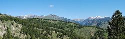
Fox Creek Loop
Ketchum, Idaho
9.9 miles NEA 6-mile singletrack loop north of Ketchum that climbs through the 2007 Castle Rock burn, drops through aspen and finishes along the Big Wood River. Bikes ride it one way, counter-clockwise.
Hike, Mountain Bike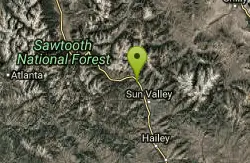
Saddle / Trail #326
Ketchum, Idaho
10.6 miles NESaddle Trail (#326) is a smooth, shaded intermediate mountain-bike ride through aspen and pine near Ketchum, Idaho.
Mountain Bike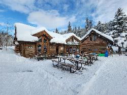
Harriman Trail
Ketchum
11.0 miles NEAn 18-mile gravel path from the Sawtooth National Recreation Area headquarters north of Ketchum to Galena Lodge. It is open to bikes, hikers and horses in summer and groomed by BCRD for Nordic skiing in winter.
Cross-country Ski, Cycle, Hike, Mountain Bike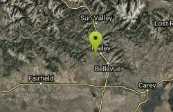
Lambs Gulch
Hailey, Idaho
13.0 miles SECLOSED. Closed due to wildfire as well as expressed concerns from the property owner. Four miles of buffed-out singletrack with bridges and berms — part of a large and growing trail system near Hailey, Idaho that rewards riders looking for flow.
Mountain Bike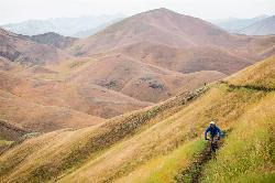
Two Dog
Hailey, Idaho
13.1 miles SEThe longest trail in the Croy Creek system, about 7.4 miles of non-motorized singletrack from Bullion Gulch Road over a sage saddle and down into the Croy Creek valley.
Hike, Mountain Bike
Hidden Valley
Hailey, Idaho
13.5 miles SEA connector trail in Bullion Gulch best ridden counterclockwise, passing through open sagebrush, an aspen grove, and about 13 bermed turns through rolling hills.
Mountain Bike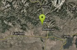
Bullion Connector Trail
Hailey, Idaho
14.0 miles SEA multi-use connector climbing through bermed turns and switchbacks to Bullion Gulch — fun in both directions and a great option when snow is still deep up high.
Mountain Bike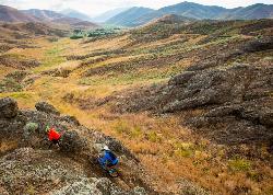
Croy Creek Trail System
Hailey, Idaho
14.0 miles SEAbout 18.5 miles of BLM and Blaine County singletrack in the sage foothills west of Hailey, rebuilt by IMBA after the 2013 Beaver Creek Fire and open early May to mid-November.
Atv/motorcycle, Hike, Mountain Bike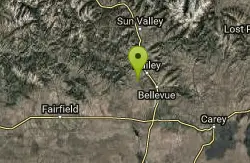
Bulldog
Hailey, Idaho
14.0 miles SEA cross-country singletrack in Hailey accessible via other trails — a satisfying climb leads to an amazing downhill run that rewards those who seek it out.
Mountain BikeNearby Campsites
Skillern Hot Springs
Fairfield, Idaho
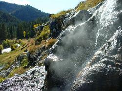
14.0 miles WA stunning six-mile trail along crystal-clear Big Smoky Creek to a hot spring — spectacular in fall, with two trail options and a sign marking the final three miles.
Camp, Hike, Hot Springs
Worswick Hot Springs
Fairfield, Idaho
14.5 miles SWFree hillside hot spring pools on Worswick Creek in the Sawtooth National Forest, about 20 miles north of Fairfield. The lower pools run about 90 to 105 degrees, and the source water is hot enough to scald.
Camp, Hot Springs
Preis Hot Spring
Fairfield, Idaho
15.7 miles WA small sunken wooden box beside Forest Road 227 north of Fairfield that fits two people in clear, roughly 102 degree water. Pair it with Worswick Hot Springs a couple of miles away.
Camp, Hot Springs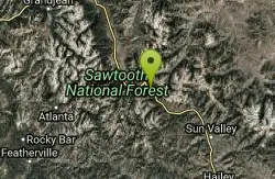
Galena Lodge
Ketchum, Idaho
16.5 miles NA community-owned historic lodge 23 miles north of Sun Valley, open summer and winter as a hub for hikers, bikers, Nordic skiers, and snowshoers with rentals and great food.
Camp, Cross-country Ski, Snowshoe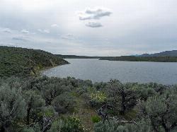
Magic Reservoir
Bellevue
22.4 miles SMagic Reservoir is a big irrigation lake on the Big Wood River surrounded by BLM sagebrush land, with free ramps and primitive camps. It is known for trout, perch and ice fishing, but water levels swing hard with irrigation demand.
Camp, Canoe, Kayak
Mormon Reservoir
Fairfield
28.9 miles SWIrrigation reservoir on McKinney Creek about five miles south of Fairfield, with a free Idaho Fish and Game boat ramp, docks, toilets and primitive camping. It is stocked with rainbow trout, but the water drops hard by late summer and in dry years.
Camp, Canoe, Kayak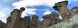
Little City of Rocks
Gooding, Idaho
37.4 miles SA volcanic hoodoo landscape of natural arches, towers, and mushroom-cap formations near Gooding, Idaho — best visited in spring when desert wildflowers bloom and the main loop trail is scenic.
Camp, Hike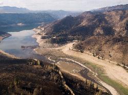
Anderson Ranch Reservoir
Pine
45.7 miles WA 14-mile Reclamation reservoir on the South Fork Boise River northeast of Mountain Home, best known for kokanee fishing. This pin marks the free Fall Creek Boat Ramp on the west shore, with free Forest Service campgrounds a short drive away.
Camp, Canoe, Hike, Kayak, Swim
McKinney Butte Lava Tubes
Gooding, Idaho
46.3 miles STwo forking lava tubes near Bliss — one open to anyone, the other gated (BLM permit required) — that survived the Bonneville Flood and a 1993 landslide.
Camp, Cave
Little Camas Reservoir
Mountain Home
47.8 miles SWIrrigation reservoir on the western Camas Prairie northeast of Mountain Home, with a free Forest Service boat ramp, primitive shoreline camping and trout fishing. Water levels swing hard, and there is no trout stocking in 2026.
Camp, Canoe, Kayak


