


Glacial Potholes
Shelburne Falls, Massachusetts
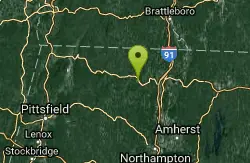
| GPS: |
42°36'8.9"N 72°44'19.4"W Maps | Directions |
| State: | Massachusetts |
Swim

- Plan Ahead and Prepare
- Travel & camp on durable surfaces
- Dispose of waste properly
- Leave what you find
- Minimize campfire impacts
- Respect wildlife
- Be considerate of other visitors
Directions
From Shelburne Falls, Massachusetts
- Head west toward Water St (62 ft)
- Turn left onto Water St (187 ft)
- Continue onto Deerfield Ave (417 ft)

Other Swimming Holes Nearby
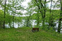
Ashfield Lake
Ashfield
5.9 miles SWTown beach at Belding Memorial Park on Ashfield Lake in Ashfield, Massachusetts, with a buoyed swim area, diving dock and summer lifeguards. Free and open to everyone, not just residents.
Canoe, Kayak, Swim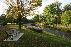
Green River Swimming and Recreation Area
Greenfield
6.2 miles EGreenfield's municipal swim area on the Green River, where a low dam backs the current into a cold, slow pool with a sand beach, a WPA era bathhouse and lawns full of shade trees.
Swim
Greenfield Area
Southwick, Massachusetts
6.8 miles NESwim near Southwick, Massachusetts
Swim
Cummington
Cummington, Massachusetts
12.9 miles SWA small, cool pond on the river with a wide sandy beach and a mostly gay social atmosphere — clothing is optional, and parking near Route 9 is limited.
Swim
Windsor State Forest
Cummington, Massachusetts
14.5 miles SWSwim near Cummington, Massachusetts
Swim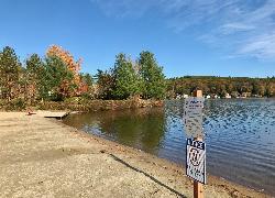
Lake Wyola State Park
Shutesbury
16.9 miles SEDCR's Carroll A. Holmes Recreation Area has a lifeguarded sand beach on the northwest shore of quiet Lake Wyola in Shutesbury, with a seasonal $8 (MA) or $30 (out-of-state) parking fee.
Canoe, Hike, Kayak, Swim
Puffers Pond
Amherst, Massachusetts
17.2 miles SESwim near Amherst, Massachusetts
Swim
Orange Dam
Northampton, Massachusetts
17.2 miles SSwim near Northampton, Massachusetts
Swim
Bellevue Falls
Adams, Massachusetts
19.7 miles WSwim near Adams, Massachusetts
Swim
Pisgah State Park
Hinsdale, New Hampshire
20.6 miles NEA clothing-optional swimming area at Kilburn Pond inside Pisgah State Park — separate from the park's Pisgah Reservoir, so be sure to head to the right body of water.
Swim
Glendale Falls
Chester, Massachusetts
20.9 miles SWSwim near Chester, Massachusetts
Swim
Mount Hope Park
Williamstown, Massachusetts
24.6 miles WSwim near Williamstown, Massachusetts
Swim
Margaret Lindley Park
Williamstown, Massachusetts
25.8 miles WSwim near Williamstown, Massachusetts
Swim
Royalston Falls
Royalston, Massachusetts
25.8 miles ESwim near Royalston, Massachusetts
Swim
Huntington Area
Granville, Massachusetts
25.8 miles SSwim near Granville, Massachusetts
Swim
Doane Falls
Royalston, Massachusetts
27.4 miles ESwim near Royalston, Massachusetts
Swim
Burbank Park Beach
Pittsfield
28.9 miles WPittsfield's free public swimming beach on Onota Lake, inside Burbank Park on Lakeway Drive, with a bath house, boat launch and lakeside path. Lifeguards are not hired every season, so check before you swim.
Canoe, Hike, Kayak, Swim
Upper Goose Pond
Lee, Massachusetts
31.1 miles SWSwim near Lee, Massachusetts
Swim
Lake Dennison Recreation Area
Winchendon
33.2 miles EA DCR-run state recreation area in Winchendon with a sandy beach on Lake Dennison, a wooded Army Corps lake. Summer parking is $8 for Massachusetts plates and $30 for others.
Camp, Canoe, Hike, Kayak, Swim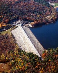
Surry Mountain Lake Beach
Surry
35.0 miles NEA free Army Corps of Engineers beach on Surry Mountain Lake, six miles north of Keene, with a long sandy swim area, no lifeguards, and weekly water testing that sometimes brings summer bacteria advisories.
Canoe, Hike, Kayak, Swim


