


7 Hiking Trails near Cowpasture River Area
first prev 1 next lastShowing Hiking Trails within 50 miles Distance miles of Cowpasture River Area near Millboro, Virginia City, Zip, or Address
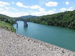
Coles Point Day Use Area
Hot Springs
16.3 miles WForest Service day use area on the south end of Lake Moomaw near Gathright Dam, with a small sand swim beach, boat ramps and picnic shelters. Open Memorial Day to Labor Day, $5 per vehicle.
Canoe, Hike, Kayak, SwimBullpasture Gorge
Williamsville, Virginia
22.7 miles NBullpasture Gorge is a wild and beautiful river canyon in the remote western highlands of Virginia, where the Bullpasture River carves a dramatic gorge through Highland County near Williamsville. A...
Canoe, Hike, Kayak, Whitewater
St. Mary's Falls
Raphine, Virginia
31.7 miles EBlue-green water and unique low rock formations set the scene at this cascading waterfall swimming hole in St. Mary's Wilderness — a 4.4-mile out-and-back hike through George Washington National Forest.
Hike, Swim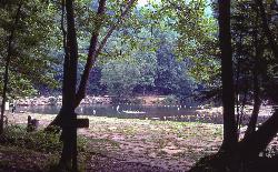
Blue Bend Recreation Area
White Sulphur Springs
32.0 miles WA free swimming hole on a wide bend of Anthony Creek at a 1930s CCC-built Forest Service recreation area in the Monongahela National Forest, about 12 miles north of White Sulphur Springs.
Camp, Hike, Swim

North River Gap
Mount Solon, Virginia
42.9 miles NEA free recreation area with an easy 2.4-mile river gorge hike through lush forest, a wading and swimming spot in the North River, and primitive campsites for $5 a night.
Camp, Hike, Swim
Pauls Creek
Nellysford, Virginia
44.3 miles EA quick 1.2-mile hike along Paul's Creek leads to a cascading waterfall and a natural water slide — stones smoothed by the water let visitors slide right into the swimming hole below.
Hike, Swim
Natural Chimneys
Mount Solon, Virginia
45.5 miles NETowering vertical limestone formations draped in trees and vines, with shallow river swimming holes, 2.5 miles of hiking and biking trails, and a well-equipped 135-site campground.
Camp, Hike, Mountain Bike, Swim


