


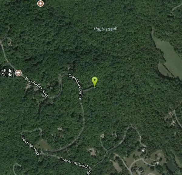
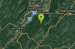
Pauls Creek
Nellysford, Virginia

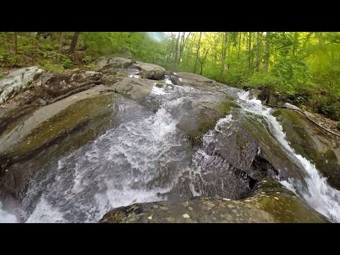
Hike and Swim
Paul's Creek Trail is a beautiful short hike to a unique little swimming hole. From the parking lot to the waterfall and back is a quick and easy 1.2 mile hike. This makes this a beautiful hike that is accessible to hikers of all levels.
Along the trail hikers will follow Paul's Creek until it transforms into a cascading waterfall. At the bottom of the waterfall the creek deepens into a functioning swimming hole, and the rocks form the natural waterslide Paul's Creek is famous for. The water has smoothed the stones at the bottom of the waterfall smooth enough to allow visitors to slide into the swimming hole below.
Paul's Creek is a uniquely beautiful and easily accessible location to experience nature. The beautiful waterfall makes a great location to visit year round for its beautiful views and exhilarating trails.
More Information
Paul’s Creek Trail: A Quiet Waterfall Hike (+ Natural Water Slides)
The easy forested hike on the Paul’s Creek Trail near Wintergreen Resort in Virginia leads to a cascading waterfall and natural water slides.
https://gohikevirginia.com/pauls-creek-trail/swimmingholes.org VIRGINIA Swimming Holes and Hot Springs rivers creek springs falls hiking camping
THE web site for beautiful, natural places for a cool dip or hot soak.
https://www.swimmingholes.org/va.htmlBe courteous, informed, and prepared. Read trailhead guidelines, stay on the trail, and don't feed the wildlife.
Read More- Plan Ahead and Prepare
- Travel & camp on durable surfaces
- Dispose of waste properly
- Leave what you find
- Minimize campfire impacts
- Respect wildlife
- Be considerate of other visitors
Directions
From Nellysford, Virginia
- Head northwest on State Rte 634 toward VA-151 N (121 ft)
- Turn right onto VA-151 NPass by Wells Fargo Bank (on the left)(1.6 mi)
- Turn left onto State Rte 613 (0.2 mi)
- Turn left onto Rodes Valley Dr (1.2 mi)
- Turn left onto Crawfords Climb (0.6 mi)
- Turn right onto Pauls Creek Ct (285 ft)


Other Swimming Holes and Hiking Trails Nearby
Campbell Creek
Tyro, Virginia
8.1 miles SWA 6-mile Appalachian Trail stretch with good elevation rewards remote explorers with a creek pool at the base of a waterfall — optional swimwear in this backcountry spot.
Swim
St. Mary's Falls
Raphine, Virginia
12.7 miles WBlue-green water and unique low rock formations set the scene at this cascading waterfall swimming hole in St. Mary's Wilderness — a 4.4-mile out-and-back hike through George Washington National Forest.
Hike, Swim
Mint Springs Valley Park
Crozet, Virginia
13.3 miles NETwo small lakes with sandy beaches, miles of forested hiking and mountain biking trails, a sand volleyball pit, and a playground — all in an eight-acre valley park near Crozet, Virginia.
Hike, Mountain Bike, Swim 15.7 mi
Sugar Hollow
Crozet, Virginia
16.3 miles NAn 11-mile loop starting and ending at Sugar Hollow Reservoir, passing Blue Hole and Rip Rap swimming holes — a hiker's way to combine challenge with a cool dip in Shenandoah.
Hike, Swim 6.1 mi
Rip Rap Hollow
Crozet, Virginia
18.6 miles NA 50-foot, mountain-fed swimming hole on a difficult 10-mile Shenandoah Valley loop that also passes Chimney Rock and a scenic waterfall — cold, clear, and worth the effort.
Hike, Swim
Big Marys Creek Slide
Vesuvius, Virginia
18.8 miles WA natural waterslide that launches you into a swimming hole below, with waterfalls and cool water in the Virginia hills — wear swimwear and foot protection, and check depth first.
Swim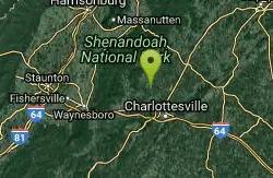
Charlottesville Area
Williamsville, Virginia
22.7 miles NETwo swimming spots north of Charlottesville, Virginia — a fee applies, so check details before heading out.
Swim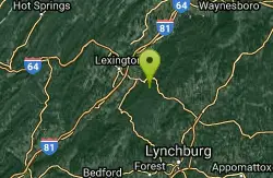
Panther Falls
Amherst, Virginia
27.4 miles SWSwim near Amherst, Virginia
Swim
Ben Salem Wayside
Lexington, Virginia
31.0 miles WSwim near Lexington, Virginia
Swim
Natural Chimneys
Mount Solon, Virginia
32.5 miles NTowering vertical limestone formations draped in trees and vines, with shallow river swimming holes, 2.5 miles of hiking and biking trails, and a well-equipped 135-site campground.
Camp, Hike, Mountain Bike, Swim
Stokesville Campground
Madison, Virginia
33.6 miles NWSwim near Madison, Virginia
Swim
North River Gap
Mount Solon, Virginia
34.3 miles NWA free recreation area with an easy 2.4-mile river gorge hike through lush forest, a wading and swimming spot in the North River, and primitive campsites for $5 a night.
Camp, Hike, Swim
Matts Creek Area
Clifton Forge, Virginia
36.5 miles SWSwimming holes near an Appalachian Trail shelter close to the James River — a 2.5-mile hike each way; holes may be shallow late in summer, suits possibly optional depending on solitude.
Swim
Fridley Gap
Keezletown, Virginia
40.7 miles NA small, chest-deep swimming hole at the halfway point of a beautiful George Washington National Forest loop — cold all year and only 0.5 miles from the trailhead.
Hike, Swim
Arnold Valley Pool
Natural Bridge Station, Virginia
41.6 miles SWArnold Valley Pool is a secluded Blue Ridge swimming hole near Natural Bridge Station, VA, with a 12-foot pool, natural slide, and rope swing.
SwimBullpasture Gorge
Williamsville, Virginia
44.2 miles NWBullpasture Gorge is a wild and beautiful river canyon in the remote western highlands of Virginia, where the Bullpasture River carves a dramatic gorge through Highland County near Williamsville. A...
Canoe, Hike, Kayak, Whitewater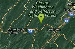
Cowpasture River Area
Millboro, Virginia
44.3 miles WSwim near Millboro, Virginia
Swim
Rapidan Rivers
Madison, Virginia
45.1 miles NESwimming holes beneath small waterfalls along the Rapidan River in Shenandoah, accessible on short hikes — protected waters known for trout and catfish fishing.
Swim 0.3 mi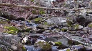
Big Rock Falls
Syria, Virginia
46.4 miles NEA moderately challenging 1.5-mile trail follows Mill Prong River to a beautiful cascading waterfall with a swimming hole that fills up nicely at higher water levels.
Hike, Swim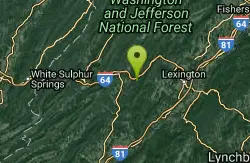
Longdale
Clifton Forge, Virginia
46.5 miles WSwim near Clifton Forge, Virginia
SwimNearby Campsites
Natural Chimneys
Mount Solon, Virginia
32.5 miles NTowering vertical limestone formations draped in trees and vines, with shallow river swimming holes, 2.5 miles of hiking and biking trails, and a well-equipped 135-site campground.
Camp, Hike, Mountain Bike, Swim
North River Gap
Mount Solon, Virginia
34.3 miles NWA free recreation area with an easy 2.4-mile river gorge hike through lush forest, a wading and swimming spot in the North River, and primitive campsites for $5 a night.
Camp, Hike, Swim


