


North River Gap
Mount Solon, Virginia

| Address: | North River Gap, Virginia 22843, USA |
| GPS: |
38°21'39.5"N 79°9'36.1"W Maps | Directions |
| State: | Virginia |
Fishing
Camp, Hike, and Swim
North River Gap is a recreation area between Todd Lake and Stokesville Campground. Though smaller, North River Gap is well worth exploring and enjoying its unique features.
One of North River Gap's best features is its access to North River Gorge Hike. North River Gorge Hike is a 2.4 mile easy out and back hike. This hike is family friendly and a great way to reconnect with nature. The forest surrounding the trail is lush, making this hike shady most of the day. North River Gorge Trail follows an old railroad, making the trail level and easy to follow. The trail has beautiful views of plant and wildlife along a trickling stream.
Another popular feature of North River Gap is the river itself. Not far from the North River Gap the river widens and becomes deep enough to swim. This area is totally free to access and families can enjoy wading in the cool water and find relief from the heat.
There are several campsites available throughout the area. These campsites are available for $5 a night. these campsites are primitive and have no access to any facilities. There are also several areas designated for camping that are free to the public. Campers should treat the area with respect and bring all their own supplies.
More Information
Free Camping Near You | Go Camping for Free!
Campsite Fee? * Required Free Pay ($12 or less) Pay (more than $12) Permit Required How much did it cost? Is this campsite on public or private land? Public Private What kind of public land? National Park Service Forest Service Bureau of Land Management Fish and Wildlife Service Bureau of Reclamation Corp of Engineers State Park State Forest County Park Rest Area Other What kind of private land? Privately Owned Campground Casino Truck Stop Retail Store Utility Company Other Please be more specific: Is this site officially approved? Yes No Summary of your review How would you rate this campsite? image/svg+xmlIntergalactic DataFreecampsites.net What kind of rig did you stay here with? - 89101112131415161718192021222324252627282930313233343536373839404142434445464748495051525354555657585960 ft Select A Rig (RV) Class A (RV) Class A + a Toad (RV) Class B (RV) Class C (RV) Fifth Wheel (RV) Trailer (RV) Truck Camper (RV) Skoolie (RV) Passenger Vehicle (RV) PopUp Trailer (Tent) Bicycle (Tent) Feet (Tent) Motorcycle (Tent) Passenger Vehicle Would you stay here again? Yes No Link to your blog post about this campsite guidelines Link to your video about this campsite guidelines What is the maximum allowed stay length? Dates this site is open? How many campsites at this location? 1-5 6-15 16-29 30 or more Maximum RV length? 15 feet 25 feet 35 feet 45 feet unlimited What sort of road to the campsite? Paved Gravel Dirt 4x4 How many miles to a paved road? Amenities: ADA accessible BBQ Grill Boat Ramp Drinking Water Dump Station Electricity Fire Ring Horse Corral Laundry Near Water Pay Phone Pets Welcome Picnic Tables Restrooms Playground Sewer Shooting Range Showers Trash Cans Activities: RV Parking Tent Camping OHV Biking Boating Fishing Hiking Horse Trails Hunting Swimming Rock Climbing Water Sports Wildlife Viewing Winter Sports Street Address: Website: Phone Number: Email: Add more Info /* editSite_type_specific() adds any type_specific fields defined here when editing an entry. */ function editSite_type_specific(id) { var activities = [];activities["RV Parking"] = 4096;activities["Tent Camping"] = 2048;activities["OHV"] = 1;activities["Biking"] = 2;activities["Boating"] = 4;activities["Fishing"] = 8;activities["Hiking"] = 16;activities["Horse Trails"] = 32;activities["Hunting"] = 64;activities["Swimming"] = 128;activities["Rock Climbing"] = 256;activities["Water Sports"] = 512;activities["Wildlife Viewing"] = 1024;activities["Winter Sports"] = 8192;var amenities = [];amenities["ADA accessible"] = 131072;amenities["BBQ Grill"] = 1;amenities["Boat Ramp"] = 2;amenities["Drinking Water"] = 4;amenities["Dump Station"] = 8;amenities["Electricity"] = 16;amenities["Fire Ring"] = 32;amenities["Horse Corral"] = 64;amenities["Laundry"] = 128;amenities["Near Water"] = 65536;amenities["Pay Phone"] = 256;amenities["Pets Welcome"] = 262144;amenities["Picnic Tables"] = 512;amenities["Restrooms"] = 1024;amenities["Playground"] = 2048;amenities["Sewer"] = 4096;amenities["Shooting Range"] = 8192;amenities["Showers"] = 32768;amenities["Trash Cans"] = 16384; $('[name=max_stay]').val(siteinfo.type_specific.max_stay); $('[name=paved_road]').val(siteinfo.type_specific.from_pavement); if (siteinfo.type_specific.fee != ') $('[name^=campsite_fee][value="' + siteinfo.type_specific.fee + '"]').prop('checked', 'true').triggerHandler('change'); if (siteinfo.type_specific.status != ') $('[name^=status][value="' + siteinfo.type_specific.status +'"]').prop('checked', true).triggerHandler('change'); if (siteinfo.type_specific.campsite_type != ') { $('[name^=campsite_type][value="' + siteinfo.type_specific.campsite_type + '"]').prop('checked', 'true').triggerHandler('change'); } if (siteinfo.type_specific.num_sites != ') if ($('[name^=num_sites][value="' + siteinfo.type_specific.num_sites + '"]').length) $('[name^=num_sites][value="' + siteinfo.type_specific.num_sites +'"]').prop('checked', 'true').triggerHandler('change'); if (siteinfo.type_specific.max_rv_size != ') if ($('[name^=max_rv_size][value="' + siteinfo.type_specific.max_rv_size + '"]').length) $('[name^=max_rv_size][value="' + siteinfo.type_specific.max_rv_size +'"]').prop('checked', 'true').triggerHandler('change'); if (siteinfo.type_specific.road_type != ') if ($('[name^=road_type][value="' + siteinfo.type_specific.road_type + '"]').length) $('[name^=road_type][value="' + siteinfo.type_specific.road_type +'"]').prop('checked', 'true').triggerHandler('change'); if (siteinfo.type_specific.campsite_type2 != ') if ($('[name^=campsite_type2][value="' + siteinfo.type_specific.campsite_type2 + '"]').length) $('[name^=campsite_type2][value="' + siteinfo.type_specific.campsite_type2 + '"]').prop('checked', 'true').triggerHandler('change'); else { if (siteinfo.type_specific.campsite_type == "Private") $('[name^=campsite_type2_private][value="Other"]').prop('checked', 'true').triggerHandler('change'); else if (siteinfo.type_specific.campsite_type == "Public") $('[name^=campsite_type2_public][value="Other"]').prop('checked', 'true').triggerHandler('change'); $('[name=campsite_type2_other]').val(siteinfo.type_specific.campsite_type2); } if (typeof(siteinfo.type_specific.amenities) != 'undefined') for (var i = 0; i < siteinfo.type_specific.amenities.length; i++) { $('.amenities[value="' + amenities[siteinfo.type_specific.amenities[i]] + '"]').prop('checked', 'true'); } if (typeof(siteinfo.type_specific.activities) != 'undefined') for (var i = 0; i < siteinfo.type_specific.activities.length; i++) $('.activities[value="' + activities[siteinfo.type_specific.activities[i]] + '"]').prop('checked', 'true'); } /* hideDetails() hides all of the extra submission widgets that don't need to be displayed. */ function hideDetails() { $('#campsite_type2_public').hide(); $('#campsite_type2_private').hide(); $('#paved_road_wrapper').hide(); $('#price').hide() $('#campsite_type2_other').hide(); } /* ui_cleanup_type_specific() sets the initial state for toggles and 2nd/3rd level fields in add a site / edit a site. */ function ui_cleanup_type_specific() { hideDetails(); $('.campsite_type').change(function(e) { if (this.value == "Public" && this.checked) { $('#campsite_type2_private').hide(); $('#campsite_type2_other').hide(); $('#campsite_type2_public').show(); } else if (this.value == "Private" && this.checked) { $('#campsite_type2_public').hide(); $('#campsite_type2_other').hide(); $('#campsite_type2_private').show(); } else { $('#campsite_type2_public').hide(); $('#campsite_type2_other').hide(); $('#campsite_type2_private').hide(); } }); $('.campsite_type2_private, .campsite_type2_public').change(function(e) { if (this.value == "Other" && this.checked) $('#campsite_type2_other').show(); else $('#campsite_type2_other').hide(); }); $('.road_type').change(function(e) { if (this.value != "Paved" && this.checked) $('#paved_road_wrapper').show() else $('#paved_road_wrapper').hide() }); $('.campsite_fee').change(function(e) { if (this.value != "Free" && this.checked) $('#price').show() else $('#price').hide() }); } // toggle get_rig inputs on reviews $('.review_rig').change(function(e) { if (this.value != "Yes" && this.checked) $('.get_rigtype').show() else $('.get_rigtype').hide() }); Warning! This information has not been error checked. You have enabled research data. This information may be (and often is) wildly innacurate. It is provided as a means to help locate new camp sites that have not yet been reported on the site. It also houses many listings that have changed status over the years. Every once in a while, we get to change them back.
https://freecampsites.net/#!819&query=sitedetailsNorth River Gorge Trail - Friends of Shenandoah Mountain
North River Gorge is known for its scenic beauty, its clean water, its wildflowers, and its unique hanging bridge. The trail follows an old railroad grade, making good hiking for families and...
https://www.friendsofshenandoahmountain.org/north-river-gorge-trail.htmlStoked on Stokesville, Virginia - Ninja Mountain Bike Skills
While Stokesville may sound like a fantasy land, it is, in fact, a real place. And you don’t know it yet, but by the end of your Ninja weekend, you are going to be STOKED on STOKESVILLE. As you make your way to the Village of Stokesville, you will find yourself driving through the rural […]
https://ridelikeaninja.com/2018/05/29/stoked-on-stokesville-va/Be courteous, informed, and prepared. Read trailhead guidelines, stay on the trail, and don't feed the wildlife.
Read More
- Plan Ahead and Prepare
- Travel & camp on durable surfaces
- Dispose of waste properly
- Leave what you find
- Minimize campfire impacts
- Respect wildlife
- Be considerate of other visitors
Directions
From Mount Solon, Virginia
- Head west on State Rte 747 toward VA-731 (0.2 mi)
- Turn left to stay on State Rte 747 (3.2 mi)
- Continue onto State Rte 730 (1.0 mi)
- Turn left onto State Rte 730/
State Rte 763 (0.3 mi) - Continue onto State Rte 718 (0.6 mi)


Other Swimming Holes and Hiking Trails Nearby

Stokesville Campground
Madison, Virginia
0.7 miles SESwim near Madison, Virginia
Swim
Natural Chimneys
Mount Solon, Virginia
4.1 miles ETowering vertical limestone formations draped in trees and vines, with shallow river swimming holes, 2.5 miles of hiking and biking trails, and a well-equipped 135-site campground.
Camp, Hike, Mountain Bike, Swim 6.1 mi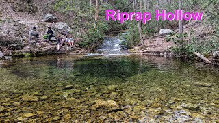
Rip Rap Hollow
Crozet, Virginia
24.9 miles SEA 50-foot, mountain-fed swimming hole on a difficult 10-mile Shenandoah Valley loop that also passes Chimney Rock and a scenic waterfall — cold, clear, and worth the effort.
Hike, SwimBullpasture Gorge
Williamsville, Virginia
25.5 miles SWBullpasture Gorge is a wild and beautiful river canyon in the remote western highlands of Virginia, where the Bullpasture River carves a dramatic gorge through Highland County near Williamsville. A...
Canoe, Hike, Kayak, Whitewater
Fridley Gap
Keezletown, Virginia
26.1 miles EA small, chest-deep swimming hole at the halfway point of a beautiful George Washington National Forest loop — cold all year and only 0.5 miles from the trailhead.
Hike, Swim 15.7 mi
Sugar Hollow
Crozet, Virginia
26.9 miles SEAn 11-mile loop starting and ending at Sugar Hollow Reservoir, passing Blue Hole and Rip Rap swimming holes — a hiker's way to combine challenge with a cool dip in Shenandoah.
Hike, Swim
Blue Hole Bergton
Bergton, Virginia
29.8 miles NEA scenic day-use picnic area on a river in Rockingham County — flooding and erosion have made it shallower over time, best now for wading and enjoying the forest and rock surroundings.
Swim
St. Mary's Falls
Raphine, Virginia
29.9 miles SBlue-green water and unique low rock formations set the scene at this cascading waterfall swimming hole in St. Mary's Wilderness — a 4.4-mile out-and-back hike through George Washington National Forest.
Hike, Swim
Mint Springs Valley Park
Crozet, Virginia
30.3 miles SETwo small lakes with sandy beaches, miles of forested hiking and mountain biking trails, a sand volleyball pit, and a playground — all in an eight-acre valley park near Crozet, Virginia.
Hike, Mountain Bike, Swim
Big Marys Creek Slide
Vesuvius, Virginia
33.9 miles SA natural waterslide that launches you into a swimming hole below, with waterfalls and cool water in the Virginia hills — wear swimwear and foot protection, and check depth first.
Swim
Pauls Creek
Nellysford, Virginia
34.3 miles SEA quick 1.2-mile hike along Paul's Creek leads to a cascading waterfall and a natural water slide — stones smoothed by the water let visitors slide right into the swimming hole below.
Hike, Swim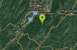
Campbell Creek
Tyro, Virginia
34.7 miles SA 6-mile Appalachian Trail stretch with good elevation rewards remote explorers with a creek pool at the base of a waterfall — optional swimwear in this backcountry spot.
Swim
Seneca Falls
Seneca Rocks, West Virginia
34.9 miles NA moderately difficult 3.5-mile forested hike to Seneca Falls — a cascade encircling a clear pool with a sloping rocky beach where you can swim right beneath the falls.
Hike, Swim
Cave Hole
Seneca Rocks, West Virginia
34.9 miles NA free, fee-free swimming hole on the North Fork South Branch Potomac River near Seneca Rocks, with blue-green water, a rocky beach, cliff reflections, and shaded alcoves — no diving.
Swim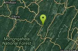
Seneca Area
Shady Spring, West Virginia
34.9 miles NSwim near Shady Spring, West Virginia
Swim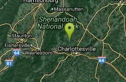
Charlottesville Area
Williamsville, Virginia
36.2 miles SETwo swimming spots north of Charlottesville, Virginia — a fee applies, so check details before heading out.
Swim
Upper Falls of Seneca Creek
Whitmer, West Virginia
36.3 miles NWA 30-foot cascade tumbles into a deep green pool at the end of a 5-mile moderately challenging hike through beautiful creek and forest scenery in West Virginia.
Swim
Big Bend
Cabins, West Virginia
36.9 miles NA sandy-beached swimming hole on the Potomac River with deep enough water for splashing and a circular current perfect for tubing — plus a campground with showers and fire pits.
Swim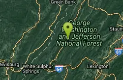
Jefferson Pools
Warm Springs, Virginia
39.9 miles SWNatural hot springs bubble up at 96–98°F through the rock floor of centuries-old wooden bathhouses, with segregated men's and women's pools and optional bathing suits.
Swim 0.3 mi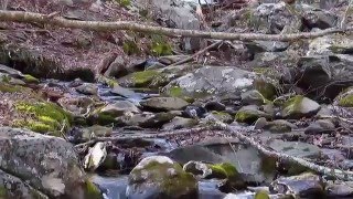
Big Rock Falls
Syria, Virginia
40.9 miles EA moderately challenging 1.5-mile trail follows Mill Prong River to a beautiful cascading waterfall with a swimming hole that fills up nicely at higher water levels.
Hike, SwimNearby Campsites
Natural Chimneys
Mount Solon, Virginia
4.1 miles ETowering vertical limestone formations draped in trees and vines, with shallow river swimming holes, 2.5 miles of hiking and biking trails, and a well-equipped 135-site campground.
Camp, Hike, Mountain Bike, Swim
Red Creek
Davis, West Virginia
45.2 miles NA remote West Virginia canyon hides multiple waterfalls, natural water slides, and deep swimming pools along a 6.3-mile out-and-back through dramatic rock formations.
Camp, Hike, Kayak, Swim


