


137 Hiking Trails near Desert Trails Bike Park
first prev 1 2 3 4 5 6 7 next lastShowing Hiking Trails within 50 miles Distance miles of Desert Trails Bike Park, 2801, 3057 N Recker Rd, Mesa, AZ 85215, United States City, Zip, or Address
Union Peak Loop
Phoenix, Arizona
29.5 miles NWHike near Phoenix, Arizona
Hike
Glendale Canal
Glendale, Arizona
29.9 miles WHike, Horseback, and Mountain Bike near Glendale, Arizona
Hike, Horseback, Mountain Bike 5.8 mi

Go John Trail
Cave Creek, Arizona
30.4 miles NWThe Go John Trail is a 5.8 mile loop trail outside of Cave Creek, Arizona, that is moderately trafficked, used by both hikers and mountain bikers. It is an excellent opportunity to view the desert...
Hike, Horseback, Mountain Bike
Clay Mine Trail
Cave Creek, Arizona
30.7 miles NWClay Mine Trail is a 1.6 mile out-and-back, beginner friendly trail in Cave Creek Regional Park. This is a trail that is very close to the Visitor Center. It's not too difficult but there...
Hike
Bobcat Trail - Sonoran Preserve
Phoenix, Arizona
31.0 miles NWBobcat Trail is a short, easy trail, often used for connecting to other bigger trails in the Sonoran Desert Preserve. This is a 2 mile out-and back trail. There isn't much of a parking...
Hike
Deem Hills East Trail
Phoenix, Arizona
31.3 miles NWDeem Hills is one of the newer parks in Phoenix to open (2010) and as such a lot of people still don't know it's there. This means that it has much more of a secluded feel then some of...
Hike
Palisade to Basalt to Circumference Trail Loop
Phoenix, Arizona
31.3 miles NWHike near Phoenix, Arizona
Hike
Deem Hills Inner Loop
Phoenix, Arizona
31.3 miles NWHike and Mountain Bike near Phoenix, Arizona
Hike, Mountain Bike 5.4 mi
Denton Trail #69
Tonto Basin, Arizona
31.3 miles NEFrom FR 421, the trail climbs steadily up the east face of the mountain. Some sections are quite steep. The trail eventually tops out at 5,760 feet elevation and then descends to Big Pine Flat for...
Hike, Mountain Bike
Tower Road - Sonoran Preserve
Phoenix, Arizona
31.6 miles NWShort and steep (.6 mile each way) out and back asphalt road to the radio tower.
Hike
Sidewinder-Ocotillo-West Loop
Phoenix, Arizona
31.6 miles NWThis loop starts at Carefree Hwy and 7th Ave, be aware there is limited parking at the trailhead. The Ocotillo part of the trail is relatively flat and the Sidewinder part has some good...
Hike, Horseback, Mountain Bike
Thunderbird H-2 Trail
Glendale, Arizona
31.6 miles NWThe trail is great for hiking and normally takes 1-3 hours. This is a nice, steady, non-strenuous, climb to the summit for anyone who is somewhat active. The type of incline where you...
Hike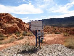
Arrowhead Point Trail
Glendale, Arizona
31.6 miles NWArrowhead Trail is a 2.4 mile hiking and mountain biking trail within Thunderbird Conservation Park. This trail is manageable enough for beginners, but offers enough challenge for more experienced...
Hike, Mountain Bike
Thunderbird H-1 H-2 H-3 Loop Trail
Glendale, Arizona
31.6 miles NWHike and Mountain Bike near Glendale, Arizona
Hike, Mountain Bike
H-1 to H-4 Trails Loop
Glendale, Arizona
32.0 miles NWThunderbird Park in Glendale, AZ consists of 5 H-Trails, named so because of the Hedgpeth Hills through which they wind. H-1: One-Way - 5.0 miles H-1a: Loop trail - 2.5 miles - 400...
Hike, Mountain Bike
Deem Hills Circumference Trail with Summit
Phoenix, Arizona
32.1 miles NWDeem Hills is one of the newer parks in Phoenix to open (2010) and as such a lot of people still don't know it's there. This means that it has much more of a secluded feel then some of...
Hike
Deem Hills Circumference Trail
Phoenix, Arizona
32.2 miles NWDeem Hills s a 10.5 mile loop trail located near Phoenix, Arizona. The trail is rated as moderate and primarily used for mountain biking.
Hike, Horseback, Mountain Bike 0.8-2.2 mi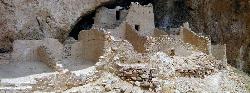
Tonto National Monument
Roosevelt, Arizona
35.9 miles EHike near Roosevelt, Arizona
Hike 3.9 mi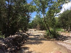
Cave Creek Swimming Hole
Cave Creek, Arizona
36.0 miles NHidden along Cave Creek Trail #4 is a swimming hole deep enough to refresh from the summer heat. It takes almost four miles of hiking in Arizona desert to reach the swimming hole, but the water is...
Hike, Swim 8.3 mi
Estrella Mountains Competitive Track
Tolleson, Arizona
36.1 miles WThe third competitive track in the Maricopa County Regional Park system, located in Estrella Mountain Regional Park, was completed in February 2000. The track consists of two loops totaling 13 miles....
Hike, Horseback, Mountain Bike


