


21 Hiking Trails near Granite Mountain Hotshots Memorial
first prev 1 2 next lastShowing Hiking Trails within 50 miles Distance miles of Granite Mountain Hotshots Memorial near Yarnell, Arizona City, Zip, or Address

Wolf Creek Falls
Prescott, Arizona
24.7 miles NESix miles of trails, two campgrounds, and a 90-foot waterfall that roars in spring storms and glitters as a frozen cascade in winter — Wolf Creek Falls is dramatic in every season.
Camp, Hike, Swim 

Discovery Trail
Peoria, Arizona
41.3 miles SEA paved 3.5-mile multi-use path in Vistancia winding past a Solar Garden, Cottonwood Park, and Riverwalk Park with fitness stations, playgrounds, ramadas, and BBQ grills nearby.
Hike 
West Wing Mountain Advanced Trail
Peoria, Arizona
44.4 miles SEHike near Peoria, Arizona
Hike 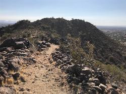
Sunrise Mountain Trail
Peoria, Arizona
44.6 miles SEThree sequential loop trails in suburban Peoria starting from Westwing Park — each loop harder than the last, with views of Glendale, Peoria, and Phoenix from the trail.
Hike, Mountain Bike 
Mule Deer Trail (Maricopa Trail)
Waddell, Arizona
45.4 miles SA quiet and relatively flat 3.5-mile desert trail on the Maricopa Trail with less than 300 feet of elevation gain — a peaceful meander past horse stables and the base of the White Tank Mountains.
Hike, Horseback, Mountain Bike 
Wildlife Trail
Waddell, Arizona
45.4 miles SA short trail that terminates at a small pond — a quick and easy outing for a peaceful desert stop near Waddell, Arizona.
Hike, Horseback 
Black Rock Loop Trail
Waddell, Arizona
45.6 miles SA 1.3-mile loop for all skill levels in the desert near Waddell, with a short accessible inner loop and a longer moderate loop that connects to the Waterfall Trail.
Hike 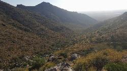
Goat Camp Trail
Buckeye, Arizona
46.5 miles SA 16-mile advanced out-and-back trail in White Tank Mountain Regional Park climbing 3,000+ feet through desert scenery — mesquite, wildflowers, cacti, and canyon views on the way to stunning city overlooks.
Hike, Mountain Bike 
South, Bajada, Mule Deer Loop Trail
Waddell, Arizona
46.8 miles SA 4.1-mile moderate desert loop near Waddell, Arizona with wildlife viewing opportunities — accessible from October through April, connecting South, Bajada, and Mule Deer trails.
Hike, Horseback, Mountain Bike 
Deem Hills Circumference Trail
Phoenix, Arizona
48.0 miles SEA 10.5-mile moderate mountain bike loop near Phoenix that's primarily used for riding — a straightforward circumference route around Deem Hills.
Hike, Horseback, Mountain Bike 
Deem Hills Circumference Trail with Summit
Phoenix, Arizona
48.0 miles SEA just-under-6-mile circumference trail looping two desert hills in Deem Hills Recreation Area, with a ridge summit option offering great overlooks and about 600 feet of total elevation gain.
Hike 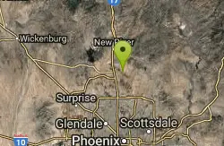
Sidewinder-Ocotillo-West Loop
Phoenix, Arizona
48.6 miles SEA Sonoran Desert loop near Phoenix combining the flat Ocotillo Trail with the more elevated, twisty Sidewinder section — bring at least 2 liters of water, there's no shade or water on trail.
Hike, Horseback, Mountain Bike 
Tower Road - Sonoran Preserve
Phoenix, Arizona
48.6 miles SEA short, steep 0.6-mile out-and-back on asphalt to the radio tower in the Sonoran Preserve — a quick, no-frills hill climb in Phoenix.
Hike 
Deem Hills Inner Loop
Phoenix, Arizona
48.7 miles SEHike and Mountain Bike near Phoenix, Arizona
Hike, Mountain Bike 
Palisade to Basalt to Circumference Trail Loop
Phoenix, Arizona
48.7 miles SEHike near Phoenix, Arizona
Hike 
Deem Hills East Trail
Phoenix, Arizona
48.7 miles SEA newer, less-crowded Phoenix park with a just-under-6-mile loop around two hills and more demanding terrain on the east side — well-cut desert trail with a Basalt shortcut option.
Hike 
H-1 to H-4 Trails Loop
Glendale, Arizona
48.9 miles SEOver 20 miles of H-Trails winding through the Hedgpeth Hills in Glendale, with routes ranging from 0.75 to 5 miles and elevation gains up to 550 feet — mix and match for a custom loop.
Hike, Mountain Bike 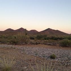
Bobcat Trail - Sonoran Preserve
Phoenix, Arizona
48.9 miles SEA 2-mile out-and-back connector trail in the Sonoran Desert Preserve with great desert scenery, distant mountain views, dry wash crossings, and well-signed GPS markers — ideal as a warmup to the Dixie Mountain Loop.
Hike 
Arrowhead Point Trail
Glendale, Arizona
49.0 miles SEA 2.4-mile rocky switchback trail climbs to a flag-topped summit with valley and peak views, then continues to a shaded ramada — classic Sonoran Desert hiking near Glendale.
Hike, Mountain Bike 
Thunderbird H-2 Trail
Glendale, Arizona
49.0 miles SEA steady, non-strenuous hike to the summit of Thunderbird with slightly rocky sections and an American flag planted at the top in a rock pile — 1 to 3 hours round trip.
Hike


