


Wolf Creek Falls
Prescott, Arizona

| GPS: |
34°27'24.4"N 112°28'4.6"W Maps | Directions |
| State: | Arizona |
| Trails/Routes: | 0.1-7.8 mi |
Camp, Hike, and Swim
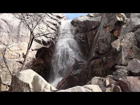
Wolf Creek Falls is Prescott's best-kept waterfall secret — a quarter-mile "waterfall alley" of cascades, chutes and natural rock dams hidden in the pines of the Prescott National Forest, high in the Bradshaw Mountains south of town. For most of the year Wolf Creek runs dry, its granite bed a quiet hiking corridor; but for a few weeks each spring, when snowmelt pours off the Bradshaw peaks — and again after a good summer monsoon storm — the creek comes alive and the falls run in a series of tumbling drops through a narrow granite gorge. Catching them flowing is a matter of timing, which is exactly what makes it feel like a find.
The falls are reached via the Wolf Creek Loop Trail #384, a roughly 5-mile loop rated moderate that climbs and winds through ponderosa forest with granite boulders and Bradshaw Mountain views. The upper falls sit only about a tenth of a mile from the trailhead and are easy to reach; the lower falls, around four-tenths of a mile in, require some rock scrambling and a bit of bushwhacking to get down to. Between them the "waterfall alley" strings together major drops, water chutes, small cascades and natural dams along the creek's polished granite. When the water is up, the pools between the falls are cold and inviting for a quick dip, but the granite is slick and the flow is snowmelt-cold, so footing and water shoes matter.
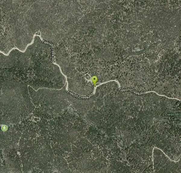
Getting there is part of the adventure. From downtown Prescott, Senator Highway runs south about five miles past the Sky Y YMCA camp; not long after the pavement turns to dirt, a signed right toward Pine Summit Camp and Upper and Lower Wolf Creek leads to the trailhead, passing Pine Summit Camp and the Lower Wolf Creek forest campground. The two Wolf Creek forest camps make it easy to turn a falls hike into an overnight in the Bradshaws. A high-clearance vehicle is a comfort on the dirt approach, and the road can be rough or muddy right after the same storms that get the falls flowing.
Trail #384 is open to multiple users — hikers share it with mountain bikers and horseback riders — so a little trail-etiquette awareness goes a long way. The falls run best during the spring snowmelt window, roughly March into April, and again during the July–September monsoon; outside those windows expect a dry but still-pleasant forest walk rather than a waterfall show. Flows here rise and fall fast with the weather — a dry bed can run hard within hours of a mountain storm, so it's wise to give the creek room during and right after heavy rain.
The trailhead sits at elevation in the cool Bradshaw pines, a welcome escape from the desert heat below. Bring plenty of water, sun protection for the exposed stretches, sturdy shoes for the scramble to the lower falls, and a plan for the dirt drive out. Time your visit to snowmelt or a fresh monsoon and Wolf Creek rewards the effort with one of the Prescott high country's most surprising displays of moving water.
More Information
Chill Out at Wolf Creek Falls Hike Prescott Arizona
Wolf Creek Falls hike is the place to relax by the cool refreshing water in Prescott National Forest - Perfect day trip from Prescott!
https://solotripsandtips.com/wolf-creek-falls-hike-prescott-arizona/swimmingholes.org Arizona Swimming Holes and Hot Springs rivers creek springs falls hiking camping o
THE web site for beautiful, natural places for a cool dip or hot soak.
https://www.swimmingholes.org/az.htmlWolf Creek Falls is Prescott’s best kept secret | Outdoors | eastvalleytribune.com
I love the swimming holes of Slide Rock and the roaring Havasu Falls. These not-so-secret escapes are gorgeous, must-see destinations.
https://www.eastvalleytribune.com/get_out/outdoors/wolf-creek-falls-is-prescott-s-best-kept-secret/article_323c9756-3a85-11e2-8386-0019bb2963f4.htmlBe courteous, informed, and prepared. Read trailhead guidelines, stay on the trail, and don't feed the wildlife.
Read More
- Plan Ahead and Prepare
- Travel & camp on durable surfaces
- Dispose of waste properly
- Leave what you find
- Minimize campfire impacts
- Respect wildlife
- Be considerate of other visitors
Directions
From Prescott, Arizona
- Head south on N State Rte 89A toward Forest Rd (0.3 mi)
- At the traffic circle, take the 3rd exit onto AZ-179 SGo through 1 traffic circle(0.9 mi)
- At the traffic circle, continue straight to stay on AZ-179 S (0.6 mi)
- At the traffic circle, continue straight to stay on AZ-179 S (1.4 mi)
- At the traffic circle, continue straight to stay on AZ-179 S (0.5 mi)
- At the traffic circle, continue straight to stay on AZ-179 S (3.0 mi)
- At the traffic circle, continue straight to stay on AZ-179 S (0.6 mi)
- At the traffic circle, continue straight to stay on AZ-179 S (0.2 mi)
- At the traffic circle, continue straight to stay on AZ-179 S (0.3 mi)
- At the traffic circle, continue straight to stay on AZ-179 S (7.0 mi)
- Turn right to merge onto I-17 S toward Phoenix (20.3 mi)
- Take exit 278 for State Hwy 169 toward Prescott (0.3 mi)
- Turn right onto AZ-169 S/
State Hwy 169 S (15.0 mi) - Turn right onto AZ-69 N/
E State Rte 69 Pass by Starbucks (on the left in 14.0 mi)(15.0 mi) - Slight left onto AZ-69 N (0.2 mi)
- Slight right onto E Gurley St (0.6 mi)
- Continue straight to stay on E Gurley St (417 ft)
- Turn left onto S Mt Vernon Ave (0.4 mi)
- S Mt Vernon Ave turns slightly left and becomes S Senator Hwy (6.8 mi)
- Turn right onto E Wolf Creek RdDestination will be on the right(1.6 mi)


Other Swimming Holes and Hiking Trails Nearby
Granite Mountain Hotshots Memorial
Yarnell, Arizona
24.8 miles SWA solemn 3/4-mile journey trail following the last steps of the 19 Granite Mountain Hotshots to their fatality site, with 19 gabions united by chains and a tribute wall for leaving mementos.
Hike 
Sycamore Canyon
Sedona, Arizona
37.0 miles NEA pleasant 3.5-mile round-trip canyon hike along a perennial stream to several swimming holes — bathing suits may be optional at the more distant pools in Sycamore Canyon.
Swim 0.2 mi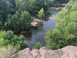
Mormons Crossing
Cornville, Arizona
38.1 miles NEShaded swimming holes, gentle rapids, and a rope swing along Oak Creek — an easy spot to cool off in Cornville.
Swim 0.4 mi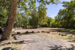
Clear Creek Campground
Camp Verde, Arizona
40.1 miles EA grassy creekside campground shaded by tall cottonwoods on West Clear Creek — ideal for hiking, swimming, fishing for smallmouth bass and sunfish, and wildlife watching in a desert canyon oasis.
Camp, Hike, Swim 8.4 mi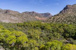
West Clear Creek Trail No. 17
Camp Verde, Arizona
43.7 miles EWest Clear Creek Trail winds down a shaded canyon to cool creek swimming, fishing, and dispersed camping — bring wading shoes, because wet feet are guaranteed.
Backpack, Hike, Swim 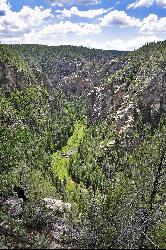
Bullpen Day Use Area
Camp Verde, Arizona
43.7 miles EA big red jumping rock on West Clear Creek, shaded picnic areas, and trails down a stunning canyon below the Mogollon Rim — a full afternoon of swimming and hiking.
Backpack, Dive, Hike, Swim 3.0 mi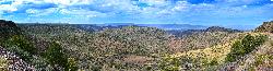
Blodgett Basin Trail No. 31
Camp Verde, Arizona
43.8 miles EA 3-mile riparian canyon trail through West Clear Creek Wilderness with 1,700 feet of elevation change, fishing, camping, and wading in a desert oasis — expect to get your feet wet.
Backpack, Hike, Swim 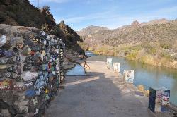
Verde Hot Springs
Camp Verde, Arizona
44.6 miles ENatural hot spring pools beside the Verde River — the remnants of an old resort — reached by wading upstream from a dispersed camping area with no amenities near Sedona.
Camp, Hike, Hot Springs 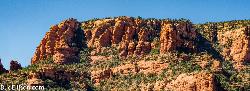
Red Rock State Park
Sedona, Arizona
45.3 miles NERed Rock's crimson sandstone layers tell 275 million years of geologic history — from ancient beachfronts to sand dunes to shallow seas — and inspired an art migration that fills the area with museums and galleries today.
Hike, Swim 
Beaver Creek Campground
Camp Verde, Arizona
45.4 miles EBeaver Creek is a refreshing creekside oasis in the high desert of central Arizona, where the cool, clear waters of Wet Beaver Creek wind beneath big cottonwoods and sycamores in the Coconino...
Camp, Canoe, Kayak, Swim 7.1 mi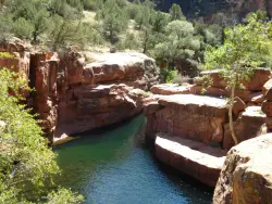
The Crack at Wet Beaver Creek
Rimrock, Arizona
45.4 miles ECrystal-clear water and cliffs high enough to jump from, about 3.5 miles down Bell Trail along Wet Beaver Creek — a rewarding desert hike to a stunning red-rock swimming hole.
Dive, Hike, Horseback, Swim 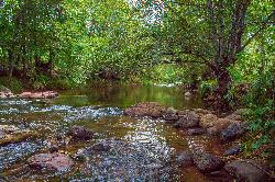
Chavez Crossing
Sedona, Arizona
47.4 miles NEA campground on Oak Creek in Sedona's red-rock canyon, perfectly placed for cool water play, sunsets over Munds Mountain, and access to nearby swimming holes.
Camp, Hike, Swim 3.9 mi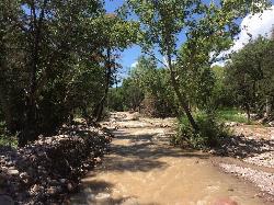
Cave Creek Swimming Hole
Cave Creek, Arizona
48.0 miles SEA refreshing desert swimming hole at the end of nearly four miles of Cave Creek Trail — worth the cactus-country hike for the cool pool waiting in the shade.
Hike, Swim 
Devil's Bridge
Sedona, Arizona
48.3 miles NEA 3.6-mile round-trip trail in Sedona to the breathtaking Devil's Bridge rock arch — rocky and sandy with a steep final mile, stunning red rock views, and very popular on weekends.
Hike 1.1 mi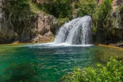
Fossil Creek Waterfall
Pine, Arizona
48.8 miles EOne of Arizona's two Wild and Scenic rivers, with a short hike from a dirt-road parking area to a deep pool at the base of the falls — watch for snakes on the trail.
Hike, Swim 
Brins Mesa Trail
Sedona, Arizona
49.1 miles NEAn open-mesa hike through red rock towers and formations in Coconino National Forest just outside Sedona — unobstructed desert views that intensify with summer heat, so bring plenty of water.
Hike 3.0 mi
Huckaby Trail
Sedona, Arizona
49.6 miles NEA 3-mile Sedona trail through Arizona Sycamores and striking Red Rock formations — crossing Oak Creek at the bottom where you can take a dip, with a boulder passage and optional mountain bike cruise on the other side.
Canoe, Hike, Mountain BikeNearby Campsites
Clear Creek Campground
Camp Verde, Arizona
40.1 miles EA grassy creekside campground shaded by tall cottonwoods on West Clear Creek — ideal for hiking, swimming, fishing for smallmouth bass and sunfish, and wildlife watching in a desert canyon oasis.
Camp, Hike, Swim 
Beaver Creek Dispersed Camping
Rimrock, Arizona
44.5 miles EThis free dispersed camping area sits on the cliffs above Wet Beaver Creek in the Coconino National Forest of central Arizona, in the red-rock and juniper country near Rimrock and Camp Verde, not far...
Camp
Verde Hot Springs
Camp Verde, Arizona
44.6 miles ENatural hot spring pools beside the Verde River — the remnants of an old resort — reached by wading upstream from a dispersed camping area with no amenities near Sedona.
Camp, Hike, Hot Springs
Beaver Creek Campground
Camp Verde, Arizona
45.4 miles EBeaver Creek is a refreshing creekside oasis in the high desert of central Arizona, where the cool, clear waters of Wet Beaver Creek wind beneath big cottonwoods and sycamores in the Coconino...
Camp, Canoe, Kayak, Swim
Chavez Crossing
Sedona, Arizona
47.4 miles NEA campground on Oak Creek in Sedona's red-rock canyon, perfectly placed for cool water play, sunsets over Munds Mountain, and access to nearby swimming holes.
Camp, Hike, Swim


