


16 Hiking Trails near Lower Calf Creek Falls
first prev 1 next lastShowing Hiking Trails within 50 miles Distance miles of UT-12, Boulder, UT 84716, USA City, Zip, or Address
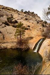
Upper Calf Creek Falls
Boulder, Utah
4.7 miles NUpper Calf Creek Falls is a stunning desert oasis hidden in the slickrock country of Grand Staircase-Escalante National Monument, between Escalante and Boulder, Utah. An 87-foot waterfall pours over...
Hike, Swim 12.1 mi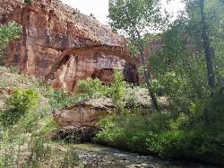
Escalante River
Escalante, Utah
9.1 miles WThe Escalante River is the wild green thread running through the heart of the Grand Staircase-Escalante National Monument, and hiking it is one of the signature experiences of southern Utah's...
Hike, Horseback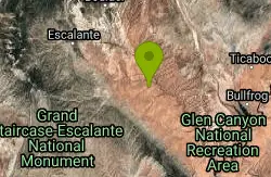
Neon Canyon and Golden Cathedral
Escalante, Utah
17.5 miles SEDeep in lower Neon Canyon, three pothole arches carved into the overhang form the Golden Cathedral — when the midday sun shines through, golden light columns illuminate the domed pour-off below.
Backpack, Canyoneer, Hike 3.7 mi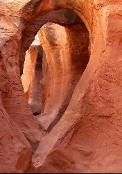
Peek-a-boo Gulch
Escalante, Utah
24.4 miles SEA fun slot canyon hike in Grand Staircase-Escalante with named rock formations you can see straight through — often hiked as a 3.5-mile loop with neighboring Spooky Gulch.
Hike 4.9 mi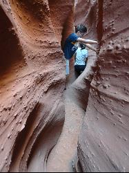
Spooky Gulch
Escalante, Utah
24.4 miles SEA short slot canyon hike near Escalante with sections so narrow they're genuinely 'spooky' — sandy trails, stagnant water pools, and flash flood awareness required.
Hike 20.4 mi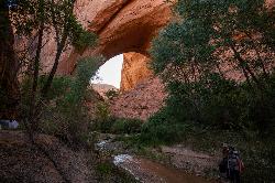
Coyote Gulch
Escalante, Utah
34.2 miles SEA remote 26-mile backpacker's slot canyon near Escalante with a flowing river, natural arches including Coyote Natural Arch and Jacob Hamblin Arch, and nights under the stars.
Backpack, Canyoneer, Hike 0.1-0.3 mi
Mossy Cave
Tropic, Utah
39.3 miles WAn easy mile-long trail past red rock hoodoos, a mossy cave with a summer waterfall and winter icicle curtain, and a charming stream to wade through in water shoes.
Hike 7.6 mi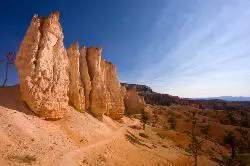
Fairyland Loop Trail
Bryce, Utah
41.3 miles WAn 8-mile loop descending 900 feet into Bryce Canyon's red and white hoodoos, connecting back along Rim Trail at Sunrise Point — with a 200-yard detour to the Tower Bridge rock formation.
Hike 0.5-5.4 mi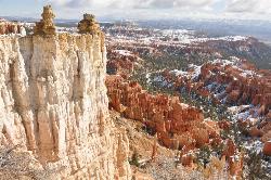
Rim Trail
Bryce, Utah
42.5 miles WA 5.5-mile Bryce Canyon rim hike connecting every major viewpoint above the Hoodoos, from Fairyland Point to Bryce Point — partially paved and wheelchair accessible at the midpoint.
Hike 2.3 mi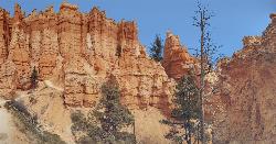
Queens Garden Trail
Bryce, Utah
42.5 miles WA descent through hoodoos and tunnels in Bryce Canyon's main amphitheater starting at Sunrise Point — well-kept dirt trail with benches, detour to a Queen Victoria rock formation, and a forest ecosystem below.
Hike 1.6 mi
Hat Shop
Bryce, Utah
42.7 miles WA moderately difficult 4-mile out-and-back hike to Bryce Canyon's Hat Shop — balancing gray boulders on slender red stilts, plus Pink Cliffs and far-off mountain views.
Hike 3.1 mi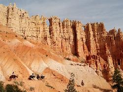
Peek-a-boo Loop
Bryce, Utah
42.7 miles WA strenuous 5-mile hike through quiet canyon trails with up-close hoodoo views, a shaded respite at the loop's bottom, and sweeping views of the Bryce Amphitheater.
Hike 1.8 mi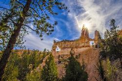
Tower Bridge
Bryce, Utah
42.7 miles WA moderately difficult 3-mile round trip from Sunrise Point past classic Bryce Canyon hoodoos to a dramatic rock formation resembling London Bridge — less crowded the further you go.
Hike 1.2 mi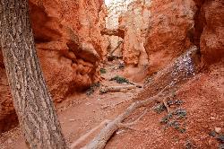
Navajo Trail
Bryce, Utah
42.8 miles WA short but winding 1.5-mile loop descending into Bryce Canyon's amphitheater, where towering hoodoos, Thor's Hammer, Twin Bridges, Wall Street, and 750-year-old Douglas Firs surround you.
Hike 4.1 mi

Swamp Canyon Overlook and Trail
Bryce, Utah
46.0 miles WA lesser-explored loop trail through Bryce Canyon's pink and red cliffs and forested Ponderosa Pines, descending and ascending 800 feet in a peaceful counter-clockwise circuit.
Hike
Mueller Park
Caineville, Utah
46.0 miles NThe Mueller Park trail in Mill Creek Canyon offers a great lower-altitude alpine mountain bike ride — 7-mile out-and-back to Big Rock or a 13-mile loop option.
Hike, Mountain Bike


