


92 Hiking Trails near Mallard Lake
first prev 1 2 3 4 5 next lastShowing Hiking Trails within 50 miles Distance miles of Lower Lodge Lp, Yellowstone National Park, WY 82190, USA City, Zip, or Address

Sepulcher Mountain Trail
Mammoth Hot Springs, Yellowstone National Park
36.1 miles NSepulcher Mountain Trail is an 11 mile loop trail from Mammoth Hot Springs to the peak of Sepulcher Mountain. This is a challenging hike with a 3,500 foot ascent to the 9,652 foot peak. The...
Hike 0.1-5.2 mi
Mammoth Hot Springs
Mammoth, Yellowstone National Park
36.1 miles NMammoth Hot Springs is a unique sight in Yellowstone National Park. The soft limestone in this area allowed the water to form colorful terraces. The extremely hot running water is clear and smooth,...
Camp, Hike 7.4 mi
Blacktail Deer Creek to Yellowstone River Trail
Mammoth Hot Springs, Yellowstone National Park
36.2 miles NBlacktail Deer Creek Trail is a 7 mile out and back trail that leads to the Yellowstone River. Hikers on this trail will enjoy seeing green open fields, boulder formations and waterfalls at the...
Hike 4.0 mi
Lava Creek Trail
Mammoth Hot Springs, Yellowstone National Park
36.3 miles NLava Creek Trail is a 4.2 mile hike where hikers can enjoy walking along the scenic Lava Creek. The trail passes Undine Falls and the Gardner River. Undine Falls is a beautiful 60 foot...
Hike
Mammoth/Gardiner Back Road
Mammoth Hot Springs, Yellowstone National Park
36.4 miles NThe only road open in Yellowstone National Park is Highway 89 at Gardiner, Montana to park Headquarters at Mammoth Hot Springs and from Mammoth Hot Springs to Silver Gate and Cooke City, Montana.
Hike, Mountain Bike
Tower Falls
Tower Junction, Yellowstone National Park
36.8 miles NETower Fall is a waterfall on Tower Creek in the northeastern region of Yellowstone National Park, in the U.S. state of Wyoming. Approximately 1,000 yards (910 m) upstream from the creek's...
Camp, Hike
Forces of the Northern Range
Mammoth, Yellowstone National Park
36.8 miles NThis short 1/2 mile boardwalk located on the Blacktail Deer Plateau between Mammoth Village and Tower Junction will open your eyes and educate you about forces of nature that have sculpted the land...
Hike 2.4 mi
Lost Lake Trail
Tower Junction, Yellowstone National Park
37.1 miles NELost Lake Trail is a 2.8 mile hike that can be completed in less than two hours. This is an easy hike with very little elevation change. Hikers can enjoy forests, meadows and a view of Lost Lake...
Hike 8.2 mi
Garnet Hill Trail
Tower Junction, Yellowstone National Park
37.4 miles NEGarnet Hill Trail is a 7.6 mile loop that follows an old, dirt stagecoach road. This trail passes through large meadows, dusty areas with sagebrush, forests and beside the Yellowstone River. This...
Hike 0.3 mi
Yellowstone River Picnic Area Trail
Tower Junction, Yellowstone National Park
37.8 miles NEThe Yellowstone River Picnic Area trail is 3.9 miles loop trail. It is called the Yellowstone Picnic Area trail because the beginning of the trail is in a picnic area.This hike features a...
Hike 7.3 mi
Agate Creek Trail
Tower Junction, Wyoming
37.9 miles NEAgate Creek Trail is a moderately difficult trail through some of Yellowstone's most beautiful and isolated landscapes. This 7.3 mile hike starts at the Yellowstone River Picnic Area. Parking is...
Hike 16.9 mi
Specimen Ridge Trail (2K4)
Buffalo Ford, Wyoming
37.9 miles NESpecimen Ridge Trail is a challenging hike that requires navigational and technical skills to complete. This 17 mile hike is remote, and though it is marked by carins and blazes, it is often...
Hike
Bitch Creek Trestle
Tetonia, Idaho
38.6 miles SWAs part of the Rails to Trails project, this old railroad bridge has been transformed into a very safe little viewing experience for the whole family. You can drive right up to the bridge where...
Hike
Hellroaring Creek Trail
Yellowstone National Park
38.9 miles NEIf the name didn't scare you enough, the Hellroaring creek trail begins with an arduous descent down to the the Yellowstone River Suspension Bridge.The suspension bridge is a beautiful...
Camp, Hike, Swim 7.9 mi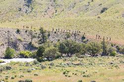
Rescue Creek Trail
Mammoth Hot Springs, Yellowstone National Park
39.2 miles NRescue Creek Trail is an 8 mile hike that crosses the Montana/Wyoming boarder. This double trail makes for a leisurely hike through beautiful hills and colorful yellow green grasslands. This trail,...
Hike 4.0 mi

Specimen Ridge Day Hike and Fossil Forrest Trail
Buffalo Ford, Wyoming
39.6 miles NESpecimen Ridge Day Hike is a strenuous almost 4 mile trail to Specimen Ridge. This trail is rugged with a high elevation, and is not recommended for hikers with respiratory or heart...
Hike 0.8 mi
Conant Creek Pegram Truss Railroad Bridge
Ashton, Idaho
40.3 miles SWAs part of the Rails to Trails project, this old railroad bridge has been transformed into a very safe little viewing experience for the whole family. You can drive right up to the bridge where there...
Hike 8.5 mi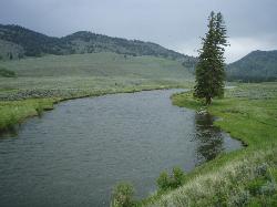
Slough Creek Trail
Tower Junction, Yellowstone National Park
41.9 miles NESlough Creek Trail is a 3.4 mile out and back trail that follows a historic wagon trail through several meadows. This trail is a fairly easy hike that has beautiful views of Slough Creek. The...
Hike 10.1 mi
Sky Rim Trail to Sheep Mountain
Big Sky, Montana
42.3 miles NSky Rim Trail to Sheep Mountain is a challenging hike with stunning and famous views. This 10 mile out-and-back trail starts at Dailey Creek Trailhead (WK1). The trail follows Dailey Creek over...
Backpack, Hike
Mt. Moran
Alta, Wyoming
43.1 miles SMount Moran (12,610 feet (3,840 m)) is a mountain in Grand Teton National Park of western Wyoming, USA. The mountain is named for Thomas Moran, an American western frontier landscape artist....
Hike


