


Specimen Ridge Day Hike and Fossil Forrest Trail
Buffalo Ford, Wyoming

| Address: | Specimen Ridge Day Hike / Fossil Forest Trailhead, Wyoming 82190, USA |
| GPS: |
44°54'42.2"N 110°19'40.4"W Maps |
| State: | Wyoming |
| Trails/Routes: | 4.0 mi |
Hike
Specimen Ridge Day Hike is a strenuous almost 4 mile trail to Specimen Ridge. This trail is rugged with a high elevation, and is not recommended for hikers with respiratory or heart problems.
The hike begins at a pullout on North East Entrance Road. From the pullout hikers will take a old service road through a dryer, flatter section of the valley, before reaching the forested area and heading up to Specimen Ridge. The path is not well marked, but it is the most obvious path and fairly easy to follow, and the view from the ridge is easily worth the strenuous hike.
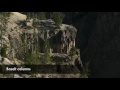
Hikers in this area can also enjoy hiking Fossil Forrest Trail. Fossil Forrest Trail is a separate trail on Specimen Ridge that takes hikers to an outcropping with fossilized trees. From Specimen Ridge hikers can look down and locate the outcropping in the 2 o'clock position.
Hikers should be careful not to leave trail for crossing wildlife trails, and should descend the way they came. Hikers should keep a safe distance from all wildlife and keep bear spray with them and readily accessible.
More Information
Specimen Ridge Day Hike / Fossil Forest Trailhead (U.S. National Park Service)
Specimen Ridge Day Hike / Fossil Forest Trailhead
https://www.nps.gov/places/000/specimen-ridge-day-hike-fossil-forest-trailhead.htmBe courteous, informed, and prepared. Read trailhead guidelines, stay on the trail, and don't feed the wildlife.
Read More
- Plan Ahead and Prepare
- Travel & camp on durable surfaces
- Dispose of waste properly
- Leave what you find
- Minimize campfire impacts
- Respect wildlife
- Be considerate of other visitors
Directions
Do not follow Google Directions.


Other Hiking Trails Nearby
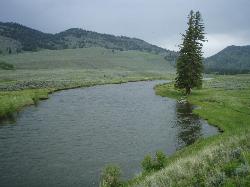
Slough Creek Trail
Tower Junction, Yellowstone National Park
2.4 miles NEAn easy 3.4-mile historic wagon trail follows Slough Creek through sweeping meadows in Yellowstone — a peaceful summer and fall walk with beautiful open views.
Hike 16.9 mi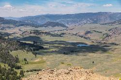
Specimen Ridge Trail (2K4)
Buffalo Ford, Wyoming
2.9 miles WA challenging 17-mile remote hike ascending 3,000 feet to Amethyst Mountain and descending into Lamar Valley — ending at a river ford that may require turning around if uncrossable.
Hike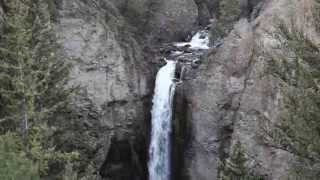
Tower Falls
Tower Junction, Yellowstone National Park
3.2 miles SWTower Fall plunges 132 feet off Tower Creek in Yellowstone, framed by dramatic rock pinnacles — located about 3 miles south of Roosevelt Junction.
Camp, Hike 0.3 mi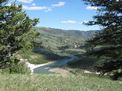
Yellowstone River Picnic Area Trail
Tower Junction, Yellowstone National Park
3.6 miles WA 3.9-mile loop trail from a Yellowstone picnic area along the canyon rim of the Yellowstone River — steam vents, wildlife sightings in meadows, and canyon erosion views throughout.
Hike 7.3 mi
Agate Creek Trail
Tower Junction, Wyoming
3.6 miles WA moderately difficult 7.3-mile hike along Yellowstone River with colorful cliff overlooks, the Narrows, and a primitive riverside campground at trail's end.
Hike 8.2 mi
Garnet Hill Trail
Tower Junction, Yellowstone National Park
4.2 miles WA 7.6-mile loop through Yellowstone meadows, sagebrush, and riverside forest with exceptional wildlife — wolves, bears, bison, moose, elk, and badgers all roam this area.
Hike 2.4 mi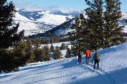
Lost Lake Trail
Tower Junction, Yellowstone National Park
4.5 miles WAn easy 2.8-mile loop behind Roosevelt Lodge, winding through forest, meadows, and along the shores of Lost Lake — open year-round and finishable in under two hours.
Hike
Hellroaring Creek Trail
Yellowstone National Park
5.9 miles NWA suspension bridge over the Yellowstone River leads to sandy creek-side beaches and a mild backcountry trail past Yellowstone's largest granite slab — great for all ages.
Camp, Hike, Swim 4.4 mi
Chittenden Road - Mount Washburn Trail
Canyon Village, Yellowstone National Park
9.4 miles SWA steady, well-packed 5.8-mile out-and-back on the former Chittenden service road to Mount Washburn's summit, with bighorn sheep, wildflowers, and sweeping Yellowstone views at the top.
Hike 16.3 mi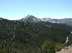
Mount Washburn Spur Trail
Canyon Village, Yellowstone National Park
9.5 miles SWAn 8-mile descent from the peak of Mount Washburn through bighorn sheep country, wildflower meadows, and forests to Canyon Village — with sweeping Grand Canyon of Yellowstone views from the top.
Hike 0.6-1.5 mi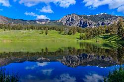
Trout Lake and Buck Lake
Tower Junction, Yellowstone National Park
10.1 miles EA steep half-mile through Douglas fir forest opens to beautiful views every direction — Mount Hornaday behind the lake, spring waterfalls from snowmelt, and cutthroat trout thick enough to give the lake its name.
Hike 3.4 mi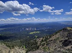
Dunraven Pass - Mount Washburn Trail
Canyon Village, Yellowstone National Park
10.7 miles SWA 6-mile Yellowstone hike via Dunraven Pass through quiet forests to the summit of Mount Washburn — a panoramic perch with bighorn sheep in summer and grizzlies near pine nuts in fall.
Hike
Forces of the Northern Range
Mammoth, Yellowstone National Park
12.1 miles WA half-mile boardwalk on Yellowstone's Blacktail Deer Plateau with mountain peak displays, a wildlife primer, and a view-packed introduction to the Northern Range's forces of nature.
Hike 7.4 mi
Blacktail Deer Creek to Yellowstone River Trail
Mammoth Hot Springs, Yellowstone National Park
13.4 miles WA 7-mile out-and-back trail dropping through green fields and boulder formations to waterfall views along the Yellowstone River, with a suspension bridge connecting onward trails.
Hike 7.6 mi
Observation Peak Trail
Canyon Village, Yellowstone National Park
13.5 miles SWA nearly 10-mile Yellowstone hike that eases through meadows and past beautiful Cascade Lake before a strenuous 1,400-foot climb to a spectacular panoramic peak.
Hike 2.4 mi
Cascade Lake Trail
Canyon Village, Yellowstone National Park
13.5 miles SWAn easy, well-marked 4.5-mile out-and-back hike through meadows and forest to Cascade Lake near Canyon Village, with wildflowers in summer and frequent wildlife sightings year-round.
Hike 9.0 mi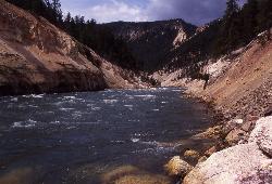
Seven Mile Hole Trail
Canyon Village, Yellowstone National Park
14.5 miles SWA challenging 10-mile hike along the Grand Canyon of Yellowstone rim, then a 1,000-foot descent into the canyon for up-close Yellowstone River views and active hot spring sightings.
Hike 0.8 mi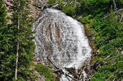
Wraith Falls Trail
Mammoth Hot Springs, Yellowstone National Park
14.6 miles WA less-than-a-mile family-friendly hike near Mammoth Hot Springs to the unique fan-shaped 79-foot Wraith Falls — open year-round and easy for all skill levels.
Hike 18.2 mi
Howard Eaton Trail
Canyon Village, Yellowstone National Park
14.9 miles SWA 10-mile Yellowstone trail passing Cascade Lake, Grebe Lake, and Wolf Lake through forests and meadows — fish any of the lakes with a valid permit, or hike the full 20-mile out-and-back.
Hike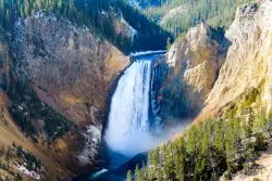
Lower Falls of the Yellowstone
Canyon Village, Yellowstone National Park
15.7 miles SWAt 308 feet, the tallest waterfall in Yellowstone National Park towers over the iconic yellow canyon walls — taller than Niagara Falls, with multiple viewpoints and trails accessible even in winter.
HikeNearby Campsites

Slough Creek Campground
Tower Junction, Yellowstone National Park
2.8 miles NA small, popular Yellowstone campground right on Slough Creek where wolf packs are frequently spotted — sites fill fast, so arrive early.
Camp
Tower Falls
Tower Junction, Yellowstone National Park
3.2 miles SWTower Fall plunges 132 feet off Tower Creek in Yellowstone, framed by dramatic rock pinnacles — located about 3 miles south of Roosevelt Junction.
Camp, Hike
Hellroaring Creek Trail
Yellowstone National Park
5.9 miles NWA suspension bridge over the Yellowstone River leads to sandy creek-side beaches and a mild backcountry trail past Yellowstone's largest granite slab — great for all ages.
Camp, Hike, Swim
Pebble Creek Campground
Northeast Entrance, Yellowstone National Park
10.5 miles EA quiet campground tucked in Yellowstone's far northeast corner near Trout Lake and world-class Lamar and Soda Butte trout rivers — arrive before 11 a.m. to secure a spot.
Camp
Canyon Campground
Canyon Junction, Yellowstone National Park
14.5 miles SWA popular Yellowstone campground of 300-plus sites just minutes from the Grand Canyon of the Yellowstone and the Upper and Lower Falls, with hiking trails and North Rim Drive access right from camp.
Camp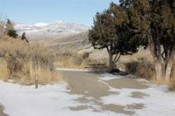
Mammoth Hot Springs Campground
Mammoth Hot Springs, Yellowstone National Park
18.4 miles WThe only year-round campground in Yellowstone, with 85 first-come sites at 5 miles from the North Entrance, walking distance to the famous Mammoth Hot Springs Terraces and nearby hiking and fishing.
Camp 0.1-5.3 mi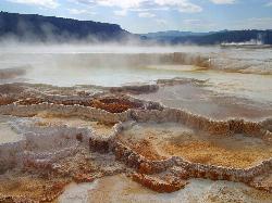
Mammoth Hot Springs
Mammoth, Yellowstone National Park
18.9 miles WColorful limestone terraces covered in glistening hot-spring water, a 1-mile boardwalk with 300 feet of elevation, elk in the parking lot, and an easy family-friendly loop — Yellowstone's showiest geology.
Camp, Hike
Indian Creek Campground Yellowstone
Mammoth Hot Springs, Yellowstone National Park
20.0 miles WIndian Creek Campground is a quiet, wooded, tent-friendly Yellowstone campground near Mammoth Hot Springs, big on wildlife and peace.
Camp 0.8-3.8 mi
Little Gibbon Falls
Norris, Yellowstone National Park
20.1 miles SWA family-friendly 4.5-mile Yellowstone loop reaches fishing and swimming spots along Gibbon Creek, with kid-safe trail, canoeing options, and bearspray-worthy backcountry feel.
Camp, Canoe, Hike
Norris Campground
Norris, Yellowstone National Park
21.7 miles SWCentrally located in Yellowstone NP, this campground puts you within a short drive of Grand Canyon of the Yellowstone, Hayden Valley, Old Faithful, and Yellowstone Lake.
Camp
Fishing Bridge RV Campground
Lake Village, Yellowstone National Park
24.1 miles SAn RV campground near the mouth of the Yellowstone River where visitors can watch White Pelicans, waterfowl, and trout from the historic Fishing Bridge — fishing from the bridge is no longer permitted.
Camp
Bridge Bay
Lake Village, Yellowstone National Park
26.7 miles SA scenic campground on the western shore of Yellowstone Lake at 7,800 feet — wooded upper loops, open meadows, and a nearby marina store, though far from the park's main dining hubs.
Camp
Madison Campground
Madison, Yellowstone National Park
32.3 miles SWA partly wooded riverside campground at 6,800 feet in Yellowstone, close to Old Faithful and the geyser basins, with great fishing on the Madison River and 270-plus individual sites.
Camp
Grant Village
Grant Village, Yellowstone National Park
37.6 miles SNamed for President Grant near Yellowstone Lake's West Thumb, this village has lakeside dining, a geyser basin next door, campfire ranger programs, and tree-lined campsites steps from the water.
Camp, Canoe, Kayak 25.6 mi
East Rosebud Lake
Roscoe, Montana
39.0 miles NEEast Rosebud Lake is the cliff-ringed gateway to the Beaten Path, one of the most beautiful backpacking routes in Montana's Beartooths.
Backpack, Camp, Canoe, Hike 14.8 mi
Biscuit Basin to Fairy Falls and Firehole Meadows
Old Faithful, Yellowstone National Park
41.8 miles SWA nearly 15-mile backcountry hike starting at Biscuit Basin passes turquoise pools, a 70-foot waterfall, Firehole Meadows, Imperial Geyser, and three stunning blue lakes with rust-red shores.
Backpack, Camp, Hike 6.9 mi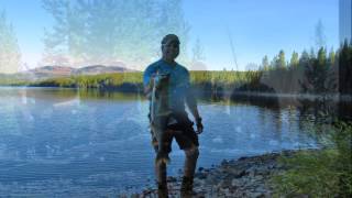
Heart Lake Trail
Grant Village, Yellowstone National Park
43.2 miles SAn 8-mile moderate hike to a remote backcountry lake with blue thermal pools, fumaroles, Rustic Geyser, and remarkable fishing for native cutthroat, mountain whitefish, and Arctic grayling.
Backpack, Camp, Hike, Hot Springs 0.1 mi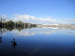
Lewis Lake Campground
Grant Village, Yellowstone National Park
46.0 miles SYellowstone's third-largest lake draws canoeists, kayakers, and serious anglers, with a quiet campground open mid-June through early November on a first-come basis.
Camp, Canoe, Kayak


