


57 Hiking Trails near Picket Post
first prev 1 2 3 next lastShowing Hiking Trails within 50 miles Distance miles of Picket Post near Superior, Arizona City, Zip, or Address
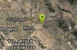
Siphon Draw Trailhead to Flatiron
Apache Junction, Arizona
21.8 miles NWA 5.5-mile advanced hike in Lost Dutchman State Park up to the Flatiron — slick sections, hands-and-feet scrambling, and one of the most exhilarating summits in the Superstitions.
Hike

Acacia Day Use Area Swim Beach, Canyon Lake
Apache Junction, Arizona
23.5 miles NWGentle sand-and-gravel swim beach at the Forest Service's Acacia Day Use Area on Canyon Lake, 14 miles up the Apache Trail from Apache Junction in Tonto National Forest.
Canoe, Hike, Kayak, Swim 0.4-1.1 mi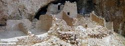
Tonto National Monument
Roosevelt, Arizona
26.0 miles NTonto National Monument preserves 700-year-old Salado cliff dwellings above Roosevelt Lake, reached by a short paved trail in the Arizona desert.
Hike
Crismon Wash Trail
Mesa, Arizona
28.2 miles NWA 1.8-mile wash trail in Mesa, Arizona accessible from the Crismon Road trailhead or the Blevins Trail — part of a network that supports several loop configurations through desert terrain.
Hike, Horseback, Mountain Bike 1.7 mi
Levee Trail
Mesa, Arizona
28.5 miles NWA smooth, flat double-track trail inside Usery Mountain Regional Park running parallel to a channel — an ideal cross-country ride, run, or connector for longer loops.
Hike, Horseback, Mountain Bike 1.5 mi
Moon Rock Loop
Apache Junction, Arizona
28.6 miles NWA fast, mostly-downhill 1.3-mile doubletrack loop with smooth pavement-like surface and flowy turns inside Usery Mountain Regional Park — accessible via the Blevins Trail.
Hike, Horseback, Mountain Bike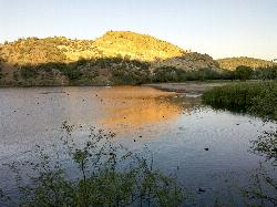
Butcher Jones Beach
Fort McDowell
28.6 miles NWA gently sloping Tonto National Forest beach on a motorboat-free cove of Saguaro Lake, with mesquite-shaded picnic tables and the Butcher Jones Trail. Tonto Pass required ($8 ahead, $12 on site).
Hike, Kayak, Swim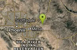
Buckhorn Campground Nature Trail
Apache Junction, Arizona
29.1 miles NWCamp and Hike near Apache Junction, Arizona
Camp, Hike
Riparian Preserve at Water Ranch Trail
Gilbert, Arizona
32.9 miles WAn urban loop trail system surrounding seven ponds stocked with fish and birds near Gilbert — a great spot for birding, wildlife watching, and easy walking.
Canoe, Hike
Desert Trails Bike Park
Mesa, Arizona
33.2 miles NWDesert Trails Park is a purpose-built mountain-bike and skills park on the northeast corner of McDowell and Recker roads in Mesa, Arizona. Opened in 2014 as one of the city's newest parks, its...
Hike, Mountain Bike 7.5 mi
Hawe's Loop
Mesa, Arizona
33.4 miles NWTwisting desert singletrack near Mesa with great flow, views of Red Mountain and the Salt River, and optional reverse laps for a serious endurance climb.
Hike, Mountain Bike 1.5 mi
The Saddle
Mesa, Arizona
33.5 miles NWAn intermediate mountain bike trail with views of the Salt River and Red Mountain, connecting to the greater Hawes trail network via scenic singletrack.
Hike, Mountain Bike 2.1 mi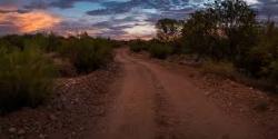
Lower Salt River Nature Trail
Fort McDowell, Arizona
33.7 miles NWA 2-mile beginner loop alongside the Salt River in Tonto National Forest, with worn markers that keep things adventurous — watch for wild horses and spring cactus blooms.
Camp, Hike 5.4 mi
Denton Trail #69
Tonto Basin, Arizona
37.1 miles NA strenuous trail climbing to 5,760 feet through Ponderosa pine with nice Tonto Basin vistas — rough, steep sections require caution and make this one for experienced riders.
Hike, Mountain Bike
Fountain Hills Park
Fountain Hills, Arizona
38.2 miles NWA 1.3-mile loop trail at Fountain Hills Park near Phoenix accessible year-round for all skill levels — a pleasant hike through a well-known community park.
Hike 1.4 mi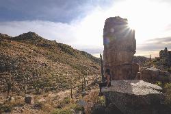
Ballantine Trail
Rio Verde, Arizona
38.6 miles NWMica-embedded boulders, deep granite gorges, and a naturally sculpted mini-Stonehenge passage make Ballantine Trail a rewarding strenuous desert adventure near Rio Verde.
Hike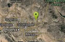
Fountain Park Trail
Fountain Hills, Arizona
38.6 miles NWA well-groomed ridge trail in Fountain Hills with Fountain Park views to the west and Four Peaks to the northeast — great for family hikes.
Hike, Mountain Bike
Sunrise Peak via Sunrise Trail
Scottsdale, Arizona
40.8 miles NWSunrise Peak is one of the most rewarding summit hikes in the McDowell Sonoran Preserve, the vast protected desert straddling the McDowell Mountains northeast of Scottsdale and north of Fountain...
Hike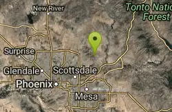
Sonoran Trail Fountain Hills
Fountain Hills, Arizona
42.3 miles NWHike near Fountain Hills, Arizona
Hike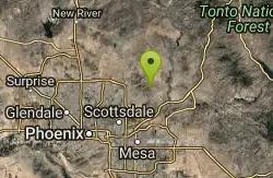
Dixie Mine
Fountain Hills, Arizona
42.3 miles NWA McDowell Mountain Regional Park trail near Fountain Hills accessible from multiple trailheads — reach the park at 16300 McDowell Mountain Park Dr, AZ 85255.
Hike


