


Acacia Day Use Area Swim Beach, Canyon Lake
Apache Junction, Arizona

| GPS: |
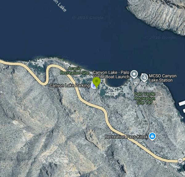
33°32'12.7"N 111°25'54.1"W Maps | Directions |
| State: | Arizona |
Canoe, Hike, Kayak, and Swim
Canyon Lake is the second of the four Salt River reservoirs stacked up the Apache Trail east of Phoenix, and Acacia is the Forest Service day-use site where most people swim. The site sits on a cove on the west shore, about 14 miles from Apache Junction on AZ 88, with 40 picnic sites under steel ramadas, tables and grills, vault toilets and a beach that slopes gently into the water. There is no potable water, so bring your own. The Palo Verde boat launch shares the entrance road, and the view across the lake is straight into the canyon walls that give the reservoir its name, red volcanic rock rising several hundred feet out of the water.
Access is on a Tonto National Forest daily pass: $8 from a vendor in the valley or $12 from the pay machine on site, or $80 for the annual Tonto pass. The fee is a federal recreation fee, not a private charge. Day use is open year-round, and in the desert that means the swimming season runs from April into October. Summer water temperatures climb into the 80s and the air is often over 105, so shade under a ramada matters. Boat wakes reach into the cove on weekends; the roped area in front of the beach is small and there is no lifeguard.
A closure worth knowing about: the Salt River Project and the Forest Service closed Canyon Lake to all access starting September 8, 2026, and began drawing the lake down on September 16 for a roughly 16-week dam safety inspection of Mormon Flat Dam. Acacia, Palo Verde and the marina are all shut during that window. Check the Tonto National Forest recreation page for the reopening date before driving up the trail.
Paddling is the other reason to come. Canyon Lake is ten miles long and narrow, and once you round the first bend upstream of Acacia the road noise is gone and the walls close in; kayakers day-trip to the side canyons or push all the way toward the base of Horse Mesa Dam. The lake was formed in 1925 by Mormon Flat Dam and is only 950 surface acres, small enough that the wind stays manageable in the morning. Hikers use the Boulder Canyon Trail, which leaves the Apache Trail across from the marina and climbs into the Superstition Wilderness with views back over the lake, and the drive itself, the historic Apache Trail stage road built to haul supplies for Roosevelt Dam, is a destination. The paved section ends at Tortilla Flat a few miles past the lake.
More Information
Be courteous, informed, and prepared. Read trailhead guidelines, stay on the trail, and don't feed the wildlife.
Read More
- Plan Ahead and Prepare
- Travel & camp on durable surfaces
- Dispose of waste properly
- Leave what you find
- Minimize campfire impacts
- Respect wildlife
- Be considerate of other visitors
Directions
From Apache Junction, Arizona
- Head west on W Apache Trail/
Historic U.S. 80 toward N Plaza Dr Pass by Burger King (on the right)(0.3 mi) - Turn right onto N Rennick Dr (0.5 mi)
- Turn right onto W Superstition Blvd (0.8 mi)
- At the traffic circle, take the 3rd exit onto AZ-88 E/
N Apache Trail (13.5 mi) - Turn leftRestricted usage road(112 ft)
- Turn leftPartial restricted usage roadDestination will be on the right(292 ft)
 Canyon Lake from the Canyon Lake Vista on the Apache Trail courtesy of Beyond My Ken↗ (CC BY-SA 4.0↗)

 Canyon Lake shoreline near the day-use areas courtesy of dconvertini↗ (CC BY-SA 2.0↗)

 Canyon walls above the west shore of Canyon Lake courtesy of dconvertini↗ (CC BY-SA 2.0↗)

 A cove on Canyon Lake courtesy of Alan Stark from Goodyear, AZ, United States↗ (CC BY-SA 2.0↗)

 Paddling on Canyon Lake courtesy of cogdogblog↗ (CC BY 2.0↗)
 Canyon Lake and the canyon walls courtesy of w:User:2candle↗ (CC BY-SA 3.0↗)

Other Swimming Holes, Hiking Trails, Canoeing Areas, and Kayaking Areas Nearby
Siphon Draw Trailhead to Flatiron
Apache Junction, Arizona
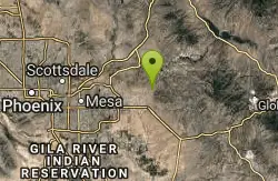
6.0 miles SWA 5.5-mile advanced hike in Lost Dutchman State Park up to the Flatiron — slick sections, hands-and-feet scrambling, and one of the most exhilarating summits in the Superstitions.
Hike 
Pebble Beach
Mesa, Arizona
8.2 miles WA popular Salt River spot near Mesa for tubing, swimming, and picnicking in the Cibola National Forest.
Swim 
Buckhorn Campground Nature Trail
Apache Junction, Arizona
11.7 miles WCamp and Hike near Apache Junction, Arizona
Camp, Hike 1.5 mi
Moon Rock Loop
Apache Junction, Arizona
11.7 miles SWA fast, mostly-downhill 1.3-mile doubletrack loop with smooth pavement-like surface and flowy turns inside Usery Mountain Regional Park — accessible via the Blevins Trail.
Hike, Horseback, Mountain Bike 1.7 mi
Levee Trail
Mesa, Arizona
11.9 miles SWA smooth, flat double-track trail inside Usery Mountain Regional Park running parallel to a channel — an ideal cross-country ride, run, or connector for longer loops.
Hike, Horseback, Mountain Bike 
Crismon Wash Trail
Mesa, Arizona
12.1 miles SWA 1.8-mile wash trail in Mesa, Arizona accessible from the Crismon Road trailhead or the Blevins Trail — part of a network that supports several loop configurations through desert terrain.
Hike, Horseback, Mountain Bike 2.1 mi
Lower Salt River Nature Trail
Fort McDowell, Arizona
13.2 miles WA 2-mile beginner loop alongside the Salt River in Tonto National Forest, with worn markers that keep things adventurous — watch for wild horses and spring cactus blooms.
Camp, Hike 1.5 mi
The Saddle
Mesa, Arizona
14.7 miles WAn intermediate mountain bike trail with views of the Salt River and Red Mountain, connecting to the greater Hawes trail network via scenic singletrack.
Hike, Mountain Bike 7.5 mi
Hawe's Loop
Mesa, Arizona
14.7 miles WTwisting desert singletrack near Mesa with great flow, views of Red Mountain and the Salt River, and optional reverse laps for a serious endurance climb.
Hike, Mountain Bike 1.4 mi
Ballantine Trail
Rio Verde, Arizona
16.1 miles NMica-embedded boulders, deep granite gorges, and a naturally sculpted mini-Stonehenge passage make Ballantine Trail a rewarding strenuous desert adventure near Rio Verde.
Hike 
Desert Trails Bike Park
Mesa, Arizona
16.2 miles WDesert Trails Park is a purpose-built mountain-bike and skills park on the northeast corner of McDowell and Recker roads in Mesa, Arizona. Opened in 2014 as one of the city's newest parks, its...
Hike, Mountain Bike 
Fountain Hills Park
Fountain Hills, Arizona
16.6 miles WA 1.3-mile loop trail at Fountain Hills Park near Phoenix accessible year-round for all skill levels — a pleasant hike through a well-known community park.
Hike 
Fountain Park Trail
Fountain Hills, Arizona
16.9 miles WA well-groomed ridge trail in Fountain Hills with Fountain Park views to the west and Four Peaks to the northeast — great for family hikes.
Hike, Mountain Bike 5.4 mi
Denton Trail #69
Tonto Basin, Arizona
18.9 miles NA strenuous trail climbing to 5,760 feet through Ponderosa pine with nice Tonto Basin vistas — rough, steep sections require caution and make this one for experienced riders.
Hike, Mountain Bike 0.4-1.1 mi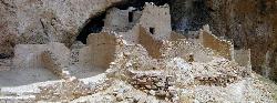
Tonto National Monument
Roosevelt, Arizona
19.8 miles ETonto National Monument preserves 700-year-old Salado cliff dwellings above Roosevelt Lake, reached by a short paved trail in the Arizona desert.
Hike 
Sunrise Peak via Sunrise Trail
Scottsdale, Arizona
19.8 miles WSunrise Peak is one of the most rewarding summit hikes in the McDowell Sonoran Preserve, the vast protected desert straddling the McDowell Mountains northeast of Scottsdale and north of Fountain...
Hike 
Tortoise and Hilltop Trails
Fort McDowell, Arizona
20.2 miles NWA hike through desert terrain near Fort McDowell watching for jackrabbits and lizards on the Tortoise Trail before climbing to the hiker-only Hilltop Trail loop.
Hike 
Wagner Trail
Scottsdale, Arizona
20.4 miles NWA 2.2-mile beginner-to-intermediate loop trail in the McDowell Sonoran Preserve in Scottsdale, winding through a hoodoo canyon to a vantage point with views of Weaver's Needle at Fremont Saddle.
Hike, Horseback, Mountain Bike 
Wagner-Granite-Bluff Trails
Scottsdale, Arizona
20.4 miles NWHike and Mountain Bike near Scottsdale, Arizona
Hike, Mountain Bike 
Sonoran Trail Fountain Hills
Fountain Hills, Arizona
20.5 miles WHike near Fountain Hills, Arizona
HikeNearby Campsites
Buckhorn Campground Nature Trail
Apache Junction, Arizona
11.7 miles WCamp and Hike near Apache Junction, Arizona
Camp, Hike 2.1 mi
Lower Salt River Nature Trail
Fort McDowell, Arizona
13.2 miles WA 2-mile beginner loop alongside the Salt River in Tonto National Forest, with worn markers that keep things adventurous — watch for wild horses and spring cactus blooms.
Camp, Hike


