


123 Hiking Trails near Slate Creek Divide Loop
first prev 1 2 3 4 5 6 7 next lastShowing Hiking Trails within 50 miles Distance miles of Slate Creek Divide Loop near Phoenix, Arizona City, Zip, or Address
Denton Trail #69
Tonto Basin, Arizona
12.7 miles SEA strenuous trail climbing to 5,760 feet through Ponderosa pine with nice Tonto Basin vistas — rough, steep sections require caution and make this one for experienced riders.
Hike, Mountain Bike 1.4 mi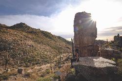
Ballantine Trail
Rio Verde, Arizona
12.8 miles SMica-embedded boulders, deep granite gorges, and a naturally sculpted mini-Stonehenge passage make Ballantine Trail a rewarding strenuous desert adventure near Rio Verde.
Hike 
Tortoise and Hilltop Trails
Fort McDowell, Arizona
23.8 miles SWA hike through desert terrain near Fort McDowell watching for jackrabbits and lizards on the Tortoise Trail before climbing to the hiker-only Hilltop Trail loop.
Hike 
Wagner Trail
Scottsdale, Arizona
23.9 miles SWA 2.2-mile beginner-to-intermediate loop trail in the McDowell Sonoran Preserve in Scottsdale, winding through a hoodoo canyon to a vantage point with views of Weaver's Needle at Fremont Saddle.
Hike, Horseback, Mountain Bike 
Wagner-Granite-Bluff Trails
Scottsdale, Arizona
23.9 miles SWHike and Mountain Bike near Scottsdale, Arizona
Hike, Mountain Bike 3.9 mi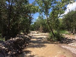
Cave Creek Swimming Hole
Cave Creek, Arizona
24.1 miles WA refreshing desert swimming hole at the end of nearly four miles of Cave Creek Trail — worth the cactus-country hike for the cool pool waiting in the shade.
Hike, Swim 
Brown Ranch Trail to Cone Mountain Trail
Scottsdale, Arizona
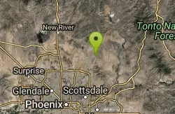
26.0 miles SWHike near Scottsdale, Arizona
Hike 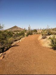
Jane Rau Brown's Canyon Trail
Scottsdale, Arizona
26.1 miles SWA wide, semi-paved half-mile loop honors a McDowell Sonoran Conservancy pioneer with interpretive plaques, desert views, and a shaded picnic area — perfect for all ages.
Hike, Horseback, Mountain Bike 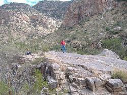
Pima and Dynamite Trail
Scottsdale, Arizona
26.1 miles SWA 100-plus-mile singletrack network in North Scottsdale rolls through fast Sonoran desert terrain with variety for beginners to advanced without serious gnarly descents.
Hike, Mountain Bike 2.2 mi
Marcus Landslide Trail
Scottsdale, Arizona
26.7 miles SWNamed for geographer Melvin Marcus, this trail winds through an ancient McDowell Mountain landslide with sweeping Superstition and Mazatzal mountain views and boulder-filled formations.
Hike, Horseback, Mountain Bike, Rock Climb 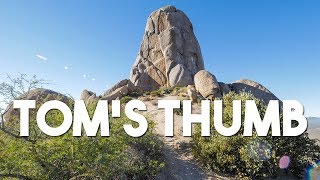
Tom's Thumb Trail
Scottsdale, Arizona
26.8 miles SWA 4.7-mile out-and-back hike in Scottsdale's McDowell Sonoran Preserve with 1,200 feet of elevation gain to a unique thumb-shaped granite rock formation — pet friendly, but no water on trail.
Hike, Mountain Bike, Rock Climb 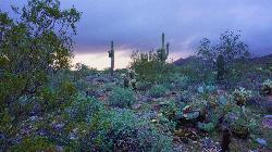
Tom's Thumb, Feldspar, and Marcus Landslide Loop
Scottsdale, Arizona
26.8 miles SWThis loop links three of the finest trails in the McDowell Sonoran Preserve, the enormous protected desert on the northeast edge of Scottsdale, and centers on Tom's Thumb, one of the most iconic rock...
Hike 
Hell's Gate
Payson, Arizona
27.5 miles NEHellsgate Wilderness hides deep canyon pools possibly separated by impassable falls in a remote 37,000-acre preserve — a true adventure for spring and fall explorers.
Backpack, Camp, Hike, Swim 
Fountain Park Trail
Fountain Hills, Arizona
28.0 miles SWA well-groomed ridge trail in Fountain Hills with Fountain Park views to the west and Four Peaks to the northeast — great for family hikes.
Hike, Mountain Bike 
Fountain Hills Park
Fountain Hills, Arizona
28.1 miles SWA 1.3-mile loop trail at Fountain Hills Park near Phoenix accessible year-round for all skill levels — a pleasant hike through a well-known community park.
Hike 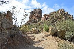
Pinnacle Peak Trail
Scottsdale, Arizona
28.2 miles SWA 3.5-mile out-and-back through Sonoran Desert switchbacks with 1,300 feet of elevation gain, panoramic mountain views, and abundant wildlife including quail, javelina, and mountain lions.
Hike, Horseback, Rock Climb 
Acacia Day Use Area Swim Beach, Canyon Lake
Apache Junction, Arizona
28.3 miles SGentle sand-and-gravel swim beach at the Forest Service's Acacia Day Use Area on Canyon Lake, 14 miles up the Apache Trail from Apache Junction in Tonto National Forest.
Canoe, Hike, Kayak, Swim 
Thompsons Peak
Fountain Hills, Arizona
28.3 miles SWHike near Fountain Hills, Arizona
Hike 
Dixie Mine
Fountain Hills, Arizona
28.3 miles SWA McDowell Mountain Regional Park trail near Fountain Hills accessible from multiple trailheads — reach the park at 16300 McDowell Mountain Park Dr, AZ 85255.
Hike 0.4-1.1 mi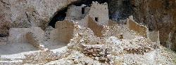
Tonto National Monument
Roosevelt, Arizona
28.3 miles SETonto National Monument preserves 700-year-old Salado cliff dwellings above Roosevelt Lake, reached by a short paved trail in the Arizona desert.
Hike


