


5 Hiking Trails near South Lost Creek Trail #86
first prev 1 next lastShowing Hiking Trails within 50 miles Distance miles of South Lost Creek Trail #86 near Bigfork, Montana City, Zip, or Address
Harry Harm Park
Bigfork, Montana
22.2 miles NWHike near Bigfork, Montana
Hike

Jewel Basin
Kalispell, Montana
24.1 miles NWThe Jewel Basin Hiking Area packs 35 miles of hiker-only trail, two dozen alpine lakes, and the Mount Aeneas lookout into the Swan Range near Kalispell.
Backpack, Camp, Hike
Morrell Falls National Recreation Trail
Condon, Montana
41.0 miles SThe Morrell Falls trail is an easy, popular ~5-mile Swan Valley hike to a spectacular 90-foot double waterfall near Seeley Lake, Montana.
Backpack, Camp, Hike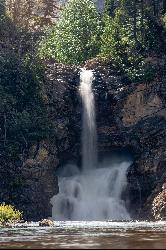
Running Eagle Falls
East Glacier Park
47.0 miles NRunning Eagle Falls, the waterfall older maps call Trick Falls, is a level 0.3 mile walk off the Two Medicine Road in Glacier National Park, wheelchair accessible to a viewing area. Two outlets run in spring, one over the cliff top and one straight out of
Hike, Swim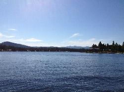
River Point Campground
Seeley Lake
47.0 miles SFree roped swim beach at a Lolo National Forest campground on the west shore of Seeley Lake, where the Clearwater River leaves the lake, about 2 miles from the town of Seeley Lake.
Camp, Canoe, Hike, Kayak, Swim


