


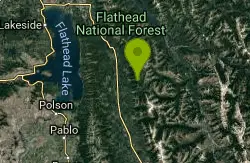
South Lost Creek Trail #86
Bigfork, Montana
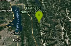
| Address: | ~21818 Lost Creek Rd, Bigfork, MT 59911, USA |
| GPS: |
47°51'25.5"N 113°41'47.2"W Maps | Directions |
| State: | Montana |
| Trail Length: | 6.00 miles |
| Trail Type: | Out & Back |
| MTB Trail Type: | Singletrack |
Mountain Bike
The South Lost Creek Trail starts at the of Lost Creek Rd and ends at the junction with Alpine Trail #7. This trail travels 5.8 miles and climbs 2,200 ft. The following uses are allowed: hiking, horseback riding, and mountain biking. Please be aware that the area around the Lost Creek Rd and the first mile of the trail were burned in a wildfire in 2010. Watch out for falling rocks, standing dead trees and partially burned limbs, and in general be cautious through this area. source: fs.usda.gov Courtesy of Singletracks.com
More Information
Add ResourceNever modify trail features. Ride trails when they're dry enough that you won't leave ruts. Speak up when you see others on the trail and always yield to hikers, horses, and others coming uphill. Always ride on the established trail.
Read More- Plan Ahead and Prepare
- Travel & camp on durable surfaces
- Dispose of waste properly
- Leave what you find
- Minimize campfire impacts
- Respect wildlife
- Be considerate of other visitors
Directions
From Bigfork, Montana
- Head north toward Monroe St (144 ft)
- Turn left at the 1st cross street onto Monroe St (338 ft)
- Monroe St turns right and becomes Chickadee Ln (348 ft)
- Turn left onto Commerce St (0.3 mi)
- Turn left onto Grand Ave (128 ft)
- Turn right onto Holt Dr (269 ft)
- Turn left onto MT-35 E (0.7 mi)
- Turn left onto MT-209 (4.8 mi)
- Turn right onto MT-83 S (13.0 mi)
- Turn left onto Lost Creek Rd/NF-680Continue to follow NF-680Destination will be on the right(8.5 mi)

Other Mountain Bike Trails Nearby
Alpine Trail #7
Bigfork, Montana
3.1 miles SThe Alpine 7 trail is 54.7 miles long. It begins at Jct. Columbia Mtn. Trail. #51 and ends at Inspiration Point. The trail is open for the following uses: Hiking, Biking, Motorcycle...
Mountain Bike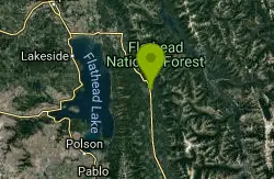
Bond Creek Trail #21
Bigfork, Montana
7.3 miles NWBond Creek Trail #21 begins flat and then steadily climbs alongside Bond Creek to Bond Lake. There is a small water cascade approximately 3.5 miles up the trail which is a popular...
Mountain Bike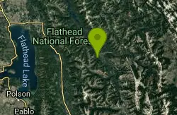
Stony Hill Trail #231
Hungry Horse, Montana
7.8 miles NEThe Stony Hill Trail is 6.4 miles long. It begins at Jct. Road #895 and Road #11437 and ends at Stony Hill Communication Site.. The trail is open for the following uses: Hiking,...
Mountain Bike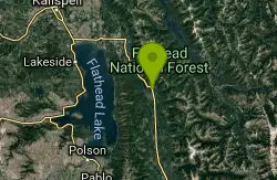
Hall Lake Trail #61
Bigfork, Montana
8.5 miles NWHall Lake trail #61 is 5.8 miles long and starts off on private property (please be respectful when parking) and ends at the junction with Alpine Trail #7. To get to Hall Lake climb...
Mountain Bike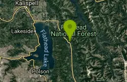
Sixmile Sidehill Trail #27
Bigfork, Montana
9.6 miles NWThe Sixmile Sidehill trail is 2.5 miles long after it's junction with Sixmile Lookout Trail #10. The trail is open for the following uses: hiking, horseback riding, mountain biking, and...
Mountain Bike
Sixmile Lookout Trail #10
Bigfork, Montana
9.6 miles NWThe Sixmile Lookout trail is 4.6 miles long and climbs 3,400 feet. It begins off of Forest Service Road #9508 and ends at Sixmile Peak after the junction with the Alpine Trail #7. The...
Mountain Bike
Beardance
Bigfork, Montana
15.7 miles WStart climbing right off the bat up beardance trail 314, and hang a right on trail 76 at the fork. climb until you hit forest road 498, and hang a left. ride along that road until you...
Mountain Bike
Crane Creek Trail #314
Bigfork, Montana
16.4 miles NWThe Crane Creek trail is 2.1 miles long (total of 3.5 miles from trailhead) and climbs about 330 feet. It begins at the junction with the Beardance Trail #76 and ends at the junction...
Mountain Bike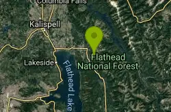
Peterson Creek Trail #293
Bigfork, Montana
17.3 miles NWThe Peterson Creek Trail #293 is 5.9 miles long and climbs about 1,700 feet. It starts from Forest Service Road # 5398 and ending at the junction with the Alpine Trail #7. The...
Mountain Bike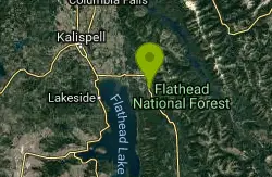
Swan Lake Ditch Ride
Bigfork, Montana
18.6 miles NWIn Montana, it is completely legal to run ATV's, dirtbikes, horses, and the like in the ditches along the highways. This has actually created a rather vast network of singletrack trails...
Mountain Bike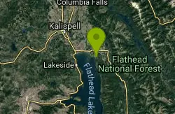
Old Bigfork Canyon Road
Bigfork, Montana
22.4 miles NWThis trail/ run down gravel road heads along the river for 2 miles, affording some excellent views and an easy ride. Especially useful for hooking up a loop on the ditch trails from...
Mountain Bike
Broken Leg Divide Trail #353
Bigfork, Montana
23.3 miles NWThe Broken Leg Divide trail is 2.8 miles long climbs about 520 feet. It begins at the junction with the Peterson Creek Trail #293 and ends at the junction with Echo-Brokenleg trail...
Mountain Bike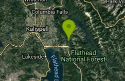
Wolf Creek Trail/Echo Broken Leg #544
Bigfork, Montana
23.3 miles NW**Now for one NOT in the Glacier Cyclery ride guide** Start climbing. Follow 544 till the split/junction with the supposed trail 354 (which in actual fact, doesn't exist) and then turn...
Mountain Bike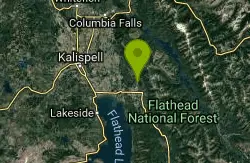
Jewel Basin Road
Kalispell, Montana
24.0 miles NWThis is a killer of a gravel road climb! It does offer some gorgeous views, though.
Mountain Bike
Echo Lake Logging Roads
Kalispell, Montana
24.0 miles NWHead out beyond the gate on the paved road, and start looking for old logging roads and ATV trails. There are a whole bunch lying around back in there that run next to the lake in...
Mountain Bike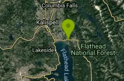
Bigfork Ditch Loop
Bigfork, Montana
24.4 miles NWIn Montana, it is completely legal to run ATV's, dirtbikes, horses, and the like in the ditches along the highways. This has actually created a rather vast network of singletrack...
Mountain Bike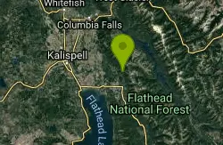
Switchback/trail# 725
Kalispell, Montana
24.4 miles NWFirst, I suggest you get the Swan Lake Ranger District map. **This is not in the Glacier Cyclery Ride Guide** Continue up the road, now on your bike, toward the Jewel Basin. Reach the...
Mountain Bike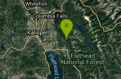
Horse Trails And Logging Roads Near Strawberry Lake
Kalispell, Montana
25.8 miles NWThe trail starts off on the right side of the road, and climbs steeply uphill and loops around, crossing back over the road. When you reach the other side of the road the trail joins a...
Mountain Bike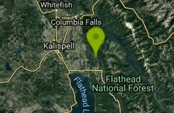
Strawberry Lake Road
Kalispell, Montana
26.4 miles NWFor a good hill climb, grind up this winding gravel road. If you want to brutalize yourself even more, tack on the Strawberry Lake trail, which starts from the top of the road, for an...
Mountain Bike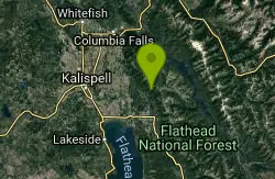
Strawberry Lake
Kalispell, Montana
26.6 miles NWClimb a brutal five miles of singletrack to Strawberry lake (which is a reportedly beautiful site) and then come busting back down those 5 miles.
Mountain BikeNearby Campsites

Jewel Basin
Kalispell, Montana
24.1 miles NWBeautiful hiking area in the Montana wilderness, Jewel Basin is home to lakes with plenty of fish, and many peaks to ascend.
Backpack, Camp, Hike
Morrell Falls National Recreation Trail
Condon, Montana
41.0 miles SSituated in the Swan Mountains, Morrell Trail leads visitors to a 90 ft double waterfall. The area is a popular spot and is best visited from late spring to fall.
Backpack, Camp, Hike
Two Medicine Campground
Glacier National Park
46.4 miles NCamp near Glacier National Park
Camp
Apgar Campground
Apgar Village, Glacier National Park
48.0 miles NApgar Campground is a beautiful campsite located in the heart of Glacier National Park in Montana. Situated on the shores of Lake McDonald, this campground offers stunning views of the surrounding...
Camp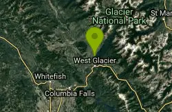
Fish Creek Campground
Glacier National Park
49.5 miles NFish Creek Campground is a popular campsite located within Glacier National Park in Montana. It offers a peaceful and picturesque setting for travelers looking to experience the beauty of the...
Camp


