


Jewel Basin
Kalispell, Montana

| Address: | Jewel Basin Rd, Kalispell, MT 59901, USA |
| GPS: |
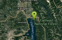
48°10'12.9"N 113°55'27.4"W Maps | Directions |
| State: | Montana |
Lakes Rivers Trails
Backpack, Camp, and Hike
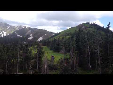
Tucked into the Swan Range east of Kalispell and Bigfork, the Jewel Basin Hiking Area is a hiker's paradise in the truest sense — a roughly 15,350-acre pocket of the Flathead National Forest set aside in the 1970s specifically and exclusively for foot travel. No bikes, no motorcycles, no horses or pack stock: just some 35 miles of well-built trail winding past more than two dozen sparkling alpine lakes and up to panoramic mountain summits. In a region full of shared-use backcountry, a whole high basin reserved purely for hikers is a rare and wonderful thing.
The classic hub is the Camp Misery trailhead, reached by a winding, washboarded gravel forest road (Road 5392) that climbs from the Echo Lake area — a rough enough drive that a higher-clearance vehicle helps, and the upper lot fills early on summer weekends. From there, a web of trails fans out to some 27 named lakes, many full of cutthroat and other trout, with names like Birch, Black, Crater, Twin, and the aptly named Picnic Lakes, a gentle first destination perfect for families. Longer or steeper routes climb to the fire lookout atop Mount Aeneas (about 7,528 feet), the high point of the basin, where the view is simply sensational: the jagged peaks of Glacier National Park to the north, the vast Bob Marshall Wilderness to the south and east, and the great shining sheet of Flathead Lake — the largest natural freshwater lake in the West — spread out below to the west.
Mountain goats are regularly spotted on the high ridges and near the summit, and the wildflower displays in the meadows peak gloriously in mid- to late summer. Because the basin sits high, it holds snow well into the season; the prime hiking window is generally mid-July through September, and even then afternoon thunderstorms can build fast over the exposed ridgelines.
This is serious grizzly country, and the rules matter: carry bear spray and know how to use it, make noise on blind corners and near running water, hike in a group when you can, and store all food and scented items properly — never leave a pack unattended. Come prepared for genuine mountain conditions, since sudden cold, wind, and rain are possible any month up here. Bring layers, more water than you think you'll need (or a way to filter it), sturdy footwear, and a map, because the network of lakes and trail junctions can quickly add up to far more mileage than you planned.
Whether you're after a mellow family stroll to the Picnic Lakes, a swim in a cold mountain tarn, a day of fishing, or a big push to the Mount Aeneas lookout and back, Jewel Basin delivers a concentrated dose of Montana's finest backcountry — jewel-like lakes, big peaks, abundant wildlife, and blessed quiet — all with none of the engine noise. It's an easy day trip from Kalispell, Bigfork, and the Flathead Lake resort towns, and a longtime local favorite for very good reason.
More Information
Jewel Basin (MT) : Climbing, Hiking & Mountaineering : SummitPost
Jewel Basin (MT) : SummitPost.org : Climbing, hiking, mountaineering
https://www.summitpost.org/jewel-basin-mt/448116Jewel Basin | Kalispell
Jewel Basin area offers 15,349 acres of wilderness that includes 27 lakes and 35 miles of trails. Trails are easy to access at the parking lot, Camp Misery.
https://discoverkalispell.com/activities/jewel-basin/Be courteous, informed, and prepared. Read trailhead guidelines, stay on the trail, and don't feed the wildlife.
Read More
- Plan Ahead and Prepare
- Travel & camp on durable surfaces
- Dispose of waste properly
- Leave what you find
- Minimize campfire impacts
- Respect wildlife
- Be considerate of other visitors
Directions
From Kalispell, Montana
- Head north on 4th Ave W toward 6th St W (23 ft)
- Turn right onto 6th St W (0.2 mi)
- Turn right onto S Main St/U.S. 93 SContinue to follow U.S. 93 S(7.7 mi)
- Turn left onto MT-82 E (6.8 mi)
- Turn right onto MT-35 E (0.3 mi)
- Turn left onto MT-83 S (2.8 mi)
- Turn left onto Echo Lake Rd (2.2 mi)
- Turn right onto Foothill Rd (1.1 mi)
- Continue straight onto Jewel Basin Rd (6.3 mi)

Other Hiking Trails and Backpacking Trails Nearby
Harry Harm Park
Bigfork, Montana
10.6 miles SWHike near Bigfork, Montana
Hike 4.5 mi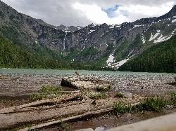
Avalanche Lake
Apgar Village, Glacier National Park
35.5 miles NHike near Apgar Village, Glacier National Park
Hike 0.9 mi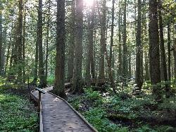
Trail of the Cedars
Apgar Village, Glacier National Park
35.6 miles NAn easy wheelchair-accessible loop through towering 500-year-old cedars up to 100 feet tall in Glacier National Park, with gorge views of glacial Avalanche Creek and a footbridge over the water.
Hike 5.0 mi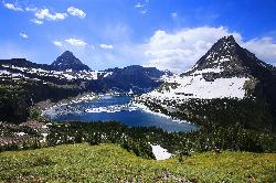
Hidden Lake
Glacier National Park
37.5 miles NA 6.6-mile round-trip hike from Logan Pass through alpine meadows, dense forest, and rocky terrain to the crystal-clear waters of Hidden Lake, with bighorn sheep and mountain goats along the way.
Hike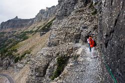
Highline Trail
Logan Pass, Glacier National Park
37.5 miles NOne of Glacier National Park's most celebrated hikes — the Highline Trail spans alpine meadows, the Continental Divide, and the Garden Wall with mountain goats, wildflowers, and views to rival anything in the park.
Backpack, Hike
Clements Mountain Trail
Logan Pass, Glacier National Park
37.6 miles NA four-mile round-trip climb of Clements Mountain in Glacier National Park, with several routes of varying difficulty and significant elevation gain — often confused with nearby Reynolds Mountain.
Backpack, Camp, Hike, Rock Climb 1.4-4.6 mi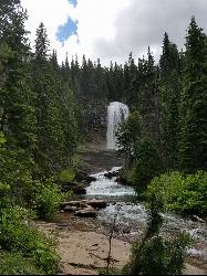
St Mary and Virginia Falls
Rising Sun, Glacier National Park
37.7 miles NA scenic 3.7-mile roundtrip hike past St. Mary Falls' 50-foot two-tiered drop to the upper and lower tiers of Virginia Falls, best in early season when snowmelt is rushing.
Hike 0.6 mi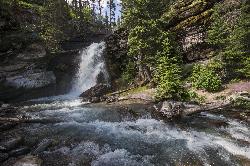
Baring Falls
Glacier National Park
38.2 miles NEA moderate trail hike in Glacier National Park to 30-foot Baring Falls dropping into crystal-clear water — with scenic mountain overlooks, wildlife, and an optional gorge viewpoint 1.5 miles beyond.
Hike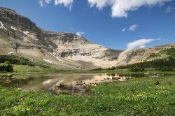
Siyeh Pass Trail
Logan Pass, Glacier National Park
38.5 miles NA top-of-the-world point-to-point hike through Glacier's Preston Park meadows to a high pass with glacier views, mountain goats, and bighorn sheep.
Backpack, Hike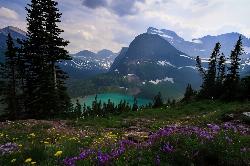
Grinnell Lake
Many Glacier, Glacier National Park
42.4 miles NA 7.5-mile round-trip hike along glacier-fed subalpine lakes to a turquoise glacial lake in Glacier National Park — with a waterfall along the way and an optional ferry across Lake Josephine.
Hike, Swim 10.5 mi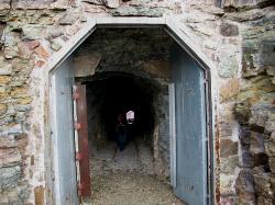
Ptarmigan Tunnel
Many Glacier, Glacier National Park
44.9 miles NA long hike to a hand-carved 240-foot tunnel through the Ptarmigan Wall at Glacier National Park, opening to views of Seaward Mountain and Elizabeth Lake — open mid-July through early October.
Backpack, Hike 9.7 mi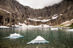
Iceberg Lake
Many Glacier, Glacier National Park
44.9 miles NNine miles of alpine trail deliver sweeping views of Ptarmigan Wall, Mount Grinnell, and Mount Wilbur before arriving at an iceberg-dotted cirque lake in Glacier NP.
Backpack, Camp, Hike 11.8 mi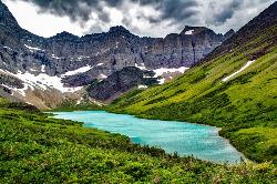
Cracker Lake Trail
Many Glacier, Glacier National Park
44.9 miles NA 12.5-mile hike through forests and meadows to a surreal turquoise lake in the Many Glacier area — plan for two days to fully enjoy this bear-country gem.
Backpack, Camp, HikeNearby Campsites
Apgar Campground
Apgar Village, Glacier National Park
24.7 miles NCampsites on the shores of Lake McDonald within Glacier National Park, with easy access to the Apgar Visitor Center, nature center, nearby hiking, and the western entrance to Going-to-the-Sun Road.
Camp
Fish Creek Campground
Glacier National Park
26.2 miles NA 193-site Glacier National Park campground along Fish Creek, surrounded by pine and cedar forest, with mountain views, fire rings, and access to the Trail of the Cedars nearby.
Camp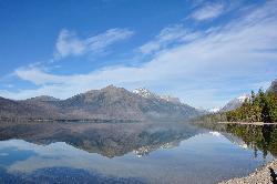
Sprague Campground
Glacier National Park
30.2 miles NAn 85-site campground on the west side of Glacier National Park near Lake McDonald, with swimming, boating, fishing, wildlife viewing, and the Trail of the Cedars nearby.
Camp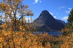
Two Medicine Campground
Glacier National Park
33.9 miles NETwo Medicine Campground lies in the quiet, dramatic southeast corner of Glacier National Park, on the shore of Two Medicine Lake beneath the sharp pyramid of Sinopah Mountain. About 13 miles up the...
Camp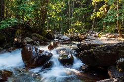
Avalanche Campground
Glacier National Park
35.4 miles NNestled on Glacier National Park's west side, Avalanche Campground puts 128 sites, flush toilets, and bear-proof storage right next to the Trail of the Cedars and the stunning Avalanche Lake hike.
Camp
Clements Mountain Trail
Logan Pass, Glacier National Park
37.6 miles NA four-mile round-trip climb of Clements Mountain in Glacier National Park, with several routes of varying difficulty and significant elevation gain — often confused with nearby Reynolds Mountain.
Backpack, Camp, Hike, Rock Climb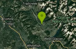
Logging Creek Campground
Glacier National Park
38.5 miles NA first-come, first-served campground nestled in the Many Glacier area of Glacier National Park, with 49 sites and close access to the Grinnell Glacier and Swiftcurrent trails.
Camp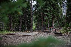
Cut Bank Campground
Glacier National Park
38.8 miles NEA peaceful forested campground along Cut Bank Creek in Glacier National Park with 48 first-come sites, nearby hiking trails, and access to fishing at St. Mary Lake.
Camp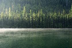
Quartz Creek Campground
Glacier National Park
40.5 miles NA peaceful 22-site campground in the heart of Glacier National Park, close to Going-to-the-Sun Road and a short hike from iconic Grinnell Glacier.
Camp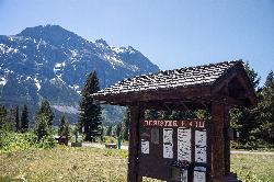
Rising Sun Campground
Glacier National Park
40.7 miles NEMore than 150 sites in eastern Glacier National Park close to Going-to-the-Sun Road, St. Mary's Falls and Red Rock Falls trails, and frequent bear, elk, and bighorn sightings.
Camp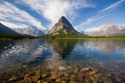
Many Glacier Campground
Many Glacier, Glacier National Park
44.7 miles NMany Glacier Campground sits in what many visitors consider the most spectacular corner of Glacier National Park: the Many Glacier valley on the park's northeast side, cradled among towering peaks...
Camp 9.7 mi
Iceberg Lake
Many Glacier, Glacier National Park
44.9 miles NNine miles of alpine trail deliver sweeping views of Ptarmigan Wall, Mount Grinnell, and Mount Wilbur before arriving at an iceberg-dotted cirque lake in Glacier NP.
Backpack, Camp, Hike 11.8 mi
Cracker Lake Trail
Many Glacier, Glacier National Park
44.9 miles NA 12.5-mile hike through forests and meadows to a surreal turquoise lake in the Many Glacier area — plan for two days to fully enjoy this bear-country gem.
Backpack, Camp, Hike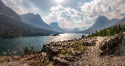
St. Mary Campground
Glacier National Park
45.7 miles NEOver 200 campsites on the edge of Glacier National Park with flush toilets, showers, and quick access to Going-to-the-Sun Road, the Highline Trail, and St. Mary Lake.
Camp
Bowman Lake Campground
Glacier National Park
47.2 miles NA stunning lakeside campground in the heart of Glacier National Park with 50+ campsites, bear-proof lockers, nearby hiking trails, and access to swimming, fishing, and paddling on Bowman Lake.
Camp


