


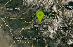
44 Hiking Trails near Upper Yosemite Falls
first prev 1 2 3 next lastShowing Hiking Trails within 50 miles Distance miles of 9001 Castle Cliffs Court, Yosemite Valley, CA 95389, USA City, Zip, or Address
Harden Lake
Big Oak Flat, Yosemite National Park
8.7 miles NWThe hike to Harden Lake at Yosemite is essentially a long walk. Much of the trail is walking down Tioga Road, an old gravel street that has been part of Yosemite since its foundation. The trail is...
Backpack, Hike 5.5 mi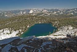
Ostrander Lake
Wawona, California
9.2 miles SOstrander Lake is a long, 11.4 mile hike just behind Sentinel Dome. Unlike most of Yosemite's summer hikes, the trail to Ostrander Lake is open during the winter for people to ski through....
Hike, Swim 5.7 mi
Ten Lakes
Tuolumne Meadows, Yosemite National Park
10.7 miles NA 6.4 mile hike will lead you to three of the Ten Lakes at Ten Lakes Basin. There are three possible trails to take to see this phenomenon. The shortest begins at Yosemite Creek. The other two...
Backpack, Camp, Hike 0.9-3.2 mi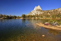
Cathedral Lakes
Wawona, California
10.7 miles NEOne of the busiest trails in the Tuloumne Meadows area, the hike to Cathedral Lakes is a gorgeous 7 mile walk to the perfect place to rest and recuperate. While there are several High Sierra...
Hike, Swim
Crane Flat
Big Oak Flat, Yosemite National Park
11.8 miles WCrane Flat Campground is a meadow and forest between Tuolumne and Merced Groves of Giant Sequoias. The campground is 30 minutes outside Yosemite Valley, has restrooms and picnic...
Backpack, Camp, Hike, Snowshoe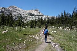
Elizabeth Lake
Wawona, California
13.2 miles NEElizabeth Lake is a gorgeous lake tucked underneath the High Sierras in Yosemite. It's about a 4.8 mile hike to reach it, with an elevation gain of 1000 feet. Even though it's not super long,...
Hike, Swim 6.0 mi
Glen Aulin
Wawona, California
13.9 miles NEThis is an 11 mile hike along the Tuolumne River to Glen Aulin. There is a view to take in at every turn on this hike, whether it's the Tuolumne River, Tuolumne Fall, Soda Springs,...
Backpack, Camp, Hike
Glen Aulin
Glen Aulin, California
13.9 miles NEThis trail is a popular route to take in the Yosemite High Country because it is a good introductory hike into the backcountry. At the end of the hike there are several waterfalls as well as a...
Backpack, Camp, Hike, Swim 2.5 mi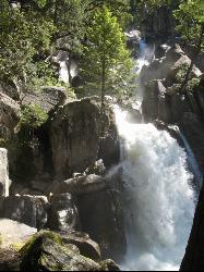
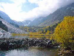
Chilnualna Falls
Wowana, Yosemite National Park
14.7 miles SLocated near the southern entrance of the valley, Chilnualna Falls is one of the lesser known waterfalls in Yosemite. The hike is about 8 miles round trip and takes you to the upper part of the...
Hike
Tuolumne Meadows
Tuolumne County, California
15.5 miles NEA beautiful alpine meadow found in the upper Sierra Nevada Mountains. Open during the summer, this meadow offers excellent views of nearby granite domes and mountains. There is a roadway through...
Camp, Hike 0.8-4.1 mi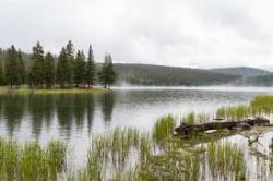
Dog Lake and Lembert Dome
Yosemite Valley, CA
16.3 miles NEThe hike to Dog Lake is often paired with the hike to Lembert Dome, because the two are so close in proximity. Each hike by itself is 2.8 miles round trip, but Lembert Dome has an elevation gain of...
Hike, Swim 3.6 mi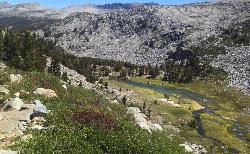
Lyell Canyon
Wawona, California
17.1 miles NELyell Canyon is a breezy, 8 mile hike through the Tuloumne Meadows of Yosemite. While it is a little bit of a longer hike, the total elevation gain is about 200 feet, making it pretty flat and...
Hike 4.7 mi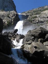
Wapama Falls
Groveland, California
17.2 miles NWA 5 mile hike along the shoreline of the Hetch Hetchy reservoir will take you to one of Yosemite's famous waterfalls. The hike to the fall is moderate, takes about 2.5-5 hours to...
Backpack, Hike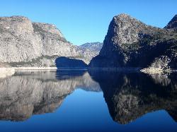
Hetch Hetchy Reservoir
Groveland, California
17.3 miles NWLocated thirty minutes outside Yosemite Valley, Hetch Hetchy has the longest hiking season in the park. It's home to the O'Shaughnessy Dam and Wapama Falls. Since...
Backpack, Hike
Hite Cove Trail
El Portal, California
18.0 miles SWThis hike is popular among wildflower enthusiasts. Located in Yosemite National Park, Hite Cove trail is one of the areas that blooms earliest for wildflowers. While areas in the high country...
Hike, Swim 4.0 mi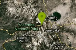
Mono Pass
Yosemite Valley, CA
19.9 miles NEAt an elevation of 10,600 feet, the hike through Mono Pass is an 8 mile journey that takes you across the High Sierras, through several meadows, and stops at a few different lakes along the...
Hike, Swim 1.8 mi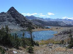
Gaylor Lakes
Yosemite Valley, CA
20.3 miles NEGaylor Lakes is one of Yosemite's most underrated hikes. It's a 2 mile trail with views the entire way. At various points along the trail, you can see Dana Meadows and the mountains...
Hike, Swim 4.0 mi
Saddlebag Lake
Lee Vining, California
22.4 miles NEA man-made lake found in the Inyo forest, resting at about 10,008 feet above sea level, Saddlebag Lake is located just outside the Tioga Pass entrance to Yosemite National Park. This lake has some of...
Camp, Canoe, Hike 1.1 mi
Lundy Canyon
Bridgeport, California
25.5 miles NEIn just one 3 mile hike, Lundy Canyon provides views of waterfalls, meadows, mountains, and if you're up for it, a trip to the Twenty Lakes Basin. There is much to take in even after going...
Hike
Gods Bath
Phoenix Lake-Cedar Ridge, CA, California
30.1 miles NWGod's Bath swimming hole in the Clavey River is a beautiful and popular location to take a dive in. However, the hike to get there is about one mile of rock climbing. The trailhead begins on...
Hike, Swim


