


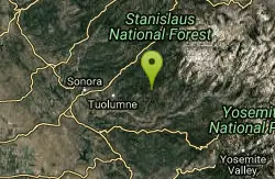
Gods Bath
Phoenix Lake-Cedar Ridge, CA, California
| GPS: |
37°59'8.9"N 120°3'10.8"W Maps | Directions |
| State: | California |
| Trail Length: | 0.90 miles |
| Trail Type: | Out & Back |
| Hike Difficulty: | Advanced |
Rivers Waterfalls Streams Rocks Ponds
Hike and Swim
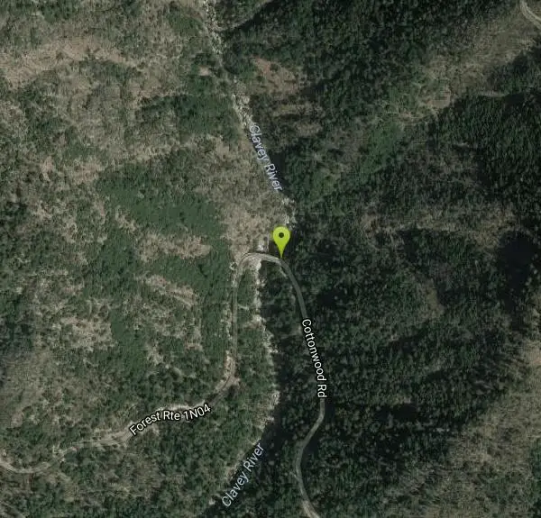
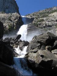
God's Bath swimming hole in the Clavey River is a beautiful and popular location to take a dive in. However, the hike to get there is about one mile of rock climbing. The trailhead begins on a bridge, where there are ropes to help you along the steep trail down into the canyon. The rest of the hike is a little less than a mile, but it does require you to wade in the stream as you hop and climb over the rocks. The water at God's Bath is crystal clear, but it tends to get cold, so be sure to visit in the summer. There are also smaller pools on the way down to God's Bath which visitors can use to take a quick break on their treacherous journey to the official pool. There are also a handful of popular cliff jumping spots surrounding the pool.
Because it is so well known, it tends to get a little crowded, so visitors are encouraged to take out any trash or belongings they may have brought in with them.
The hike can be dangerous if you're not careful, so watch out for slippery or mossy rocks, as well as poison oak, which has been known to gather near the bridge.
More Information
Be courteous, informed, and prepared. Read trailhead guidelines, stay on the trail, and don't feed the wildlife.
Read More- Plan Ahead and Prepare
- Travel & camp on durable surfaces
- Dispose of waste properly
- Leave what you find
- Minimize campfire impacts
- Respect wildlife
- Be considerate of other visitors
Directions
From Phoenix Lake-Cedar Ridge, CA, California
- Head south on Big Hill Rd/Hallermill RdContinue to follow Big Hill Rd(2.9 mi)
- Continue onto Longeway Rd (312 ft)
- Turn left to stay on Longeway Rd (0.4 mi)
- Turn right to stay on Longeway Rd (0.8 mi)
- Turn right to stay on Longeway Rd (2.5 mi)
- Turn left onto Soulsbyville Rd (2.1 mi)
- Turn left to stay on Soulsbyville Rd (0.7 mi)
- Turn left onto Tuolumne Rd (1.9 mi)
- Continue straight to stay on Tuolumne Rd (0.2 mi)
- Turn left onto Carter St (0.3 mi)
- Turn right onto Buchanan Rd (2.4 mi)
- Continue onto Fish Hatchery Rd (1.8 mi)
- Continue onto Forest Rte 1N04 (0.5 mi)
- Turn left onto Cottonwood Rd (0.7 mi)
- Turn right toward Cottonwood Rd (190 ft)
- Sharp left onto Cottonwood Rd (7.5 mi)
- Continue onto Forest Rte 1N04Destination will be on the left(4.0 mi)
From Sonora, take RT 17 (Tuolumne Rd.) east into Tuolumne. In Tuolumne, turn north to keep on RT 17 (Carter Rd.) then continue onto Buchanan Rd. then keep right onto Forest Road 1N04. Stay on that main road until you get to the bridge over the Clavey River. The coordinates will take you to a bridge over the Clavey River. (It takes about a total of 1 hour from Sonora to this bridge). Park near the bridge and climb down to river on west side of bridge. Walk upstream, clambering over boulders, for about 150 yards.Courtesy of swimmingholes.org
Other Swimming Holes and Hiking Trails Nearby
Wapama Falls
Groveland, California
14.7 miles EA 5 mile hike along the shoreline of the Hetch Hetchy reservoir will take you to one of Yosemite's famous waterfalls. The hike to the fall is moderate, takes about 2.5-5 hours to...
Backpack, Hike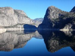
Hetch Hetchy Reservoir
Groveland, California
14.8 miles ELocated thirty minutes outside Yosemite Valley, Hetch Hetchy has the longest hiking season in the park. It's home to the O'Shaughnessy Dam and Wapama Falls. Since...
Backpack, Hike
Crane Flat
Big Oak Flat, Yosemite National Park
21.5 miles SECrane Flat Campground is a meadow and forest between Tuolumne and Merced Groves of Giant Sequoias. The campground is 30 minutes outside Yosemite Valley, has restrooms and picnic...
Backpack, Camp, Hike, Snowshoe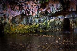
Natural Bridges
Sonora, California
23.2 miles WNatural Bridges is well known among the locals of Calaveras County. Calavers itself has many caverns throughout the mountains, but most are fee based. Natural Bridges however, is open to the...
Hike, Swim
Harden Lake
Big Oak Flat, Yosemite National Park
23.5 miles EThe hike to Harden Lake at Yosemite is essentially a long walk. Much of the trail is walking down Tioga Road, an old gravel street that has been part of Yosemite since its foundation. The trail is...
Backpack, Hike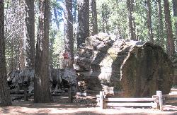
Calaveras Big Trees State Park
Arnold, California
24.5 miles NWCalaveras Big Trees State Park is a little known grove of Sequoias located in the beautiful Northern California gold country. The area became a State Park in 1931 in order to preserve the trees...
Hike
Hite Cove Trail
El Portal, California
25.0 miles SThis hike is popular among wildflower enthusiasts. Located in Yosemite National Park, Hite Cove trail is one of the areas that blooms earliest for wildflowers. While areas in the high country...
Hike, Swim 0.7 mi
Lukens Lake
Tuolumne Meadows, Yosemite National Park
25.7 miles ELukens Lake is a small lake in the White Wolf area of Yosemite National Park. The hike is a short, 1.6 mile walk through a forest to the secluded lake surrounded by trees and a small...
Hike, Swim
Briceburg Recreation Area
Midpines, California
27.2 miles SCamp, Kayak, and Swim near Midpines, California
Camp, Kayak, Swim 0.2 mi
Ribbon Falls
Yosemite Valley, Yosemite National Park
28.9 miles SEStanding at 1612 ft tall, Ribbon Falls is one of the tallest waterfalls in Yosemite Valley and the longest single-drop waterfall in North America. It's visible from El Capitan road as you...
Hike 0.2 mi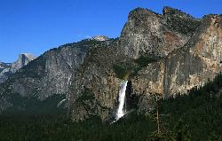
Bridalveil Falls
Yosemite Valley, Yosemite National Park
29.0 miles SEKnown for being the focal point for one of Ansel Adams' most famous photographs, Bridalveil Falls is one of the first waterfalls you see as you enter Yosemite. The path to get there...
Hike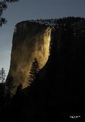
Horsetail Falls
Yosemite Valley, Yosemite National Park
29.2 miles SEHorsetail Falls is located near El Capitan Valley in Yosemite. Around mid to late February, the fall gains popularity due to the way the orange glow of the sunset radiates off of it. In order to...
Hike 5.7 mi
Ten Lakes
Tuolumne Meadows, Yosemite National Park
29.6 miles EA 6.4 mile hike will lead you to three of the Ten Lakes at Ten Lakes Basin. There are three possible trails to take to see this phenomenon. The shortest begins at Yosemite Creek. The other two...
Backpack, Camp, Hike 15.9 mi
Valley Loop Trail
Yosemite Valley, Yosemite National Park
29.8 miles SEThe Valley Loop trail at the heart of Yosemite is one of the best ways to discover the park. The entire loop is 11.5 miles long, and there are several places to enter and exit the trail...
Hike 0.8 mi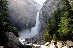
Lower Yosemite Falls
Yosemite Valley, Yosemite National Park
29.9 miles SEYosemite Falls is 3,967 feet high, making it twice as tall as the Empire State building, ten times as tall as Niagara Falls, and one of Yosemite Valley's biggest attractions. Lower...
Hike 0.7 mi
Cook's Meadow Loop
Yosemite Valley, Yosemite National Park
30.1 miles SECook's Meadow Loop is a shorter, smaller hike inside Sentinel Meadow. Cook's Meadow Loop is just under a mile and takes about 45 minutes to complete, depending on how long you stop at each...
Hike 2.9 mi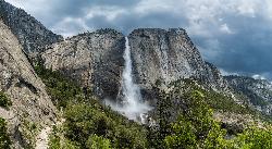
Upper Yosemite Falls
Yosemite Valley, Yosemite National Park
30.2 miles SEYosemite Falls is the tallest waterfall in North America, standing at 2,425 feet. It's made up of Upper Yosemite Falls, Lower Yosemite Falls, and the middle cascades. Lower Yosemite Falls...
Hike
Merced River
Yosemite Valley, Yosemite National Park
30.7 miles SEThe main fork of Merced River at Yosemite National Park is a perfect place to fish, swim, raft, and even pan for gold. The river circles around the center of Yosemite Valley, and almost every...
Camp, Swim, Whitewater 4.6 mi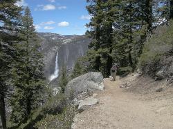
Four Mile Trail
Yosemite National Park
30.9 miles SEFour Mile Trail is a moderate hike that offers the best views of some of Yosemite's most famous landmarks, including Yosemite Falls, Half Dome, Clouds Rest, North Dome, El Capitan, and the Royal...
Hike 1.2 mi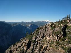
Taft Point
Yosemite Valley, Yosemite National Park
30.9 miles SEThe hike to Taft Point is often paired with the hike to Sentinel Dome. There is a 5 mile loop that connects the two and offers breathtaking views of the valley along the south rim. The trailhead...
HikeNearby Campsites
Crane Flat
Big Oak Flat, Yosemite National Park
21.5 miles SECrane Flat Campground is a meadow and forest between Tuolumne and Merced Groves of Giant Sequoias. The campground is 30 minutes outside Yosemite Valley, has restrooms and picnic...
Backpack, Camp, Hike, Snowshoe
Briceburg Recreation Area
Midpines, California
27.2 miles SCamp, Kayak, and Swim near Midpines, California
Camp, Kayak, Swim 5.7 mi
Ten Lakes
Tuolumne Meadows, Yosemite National Park
29.6 miles EA 6.4 mile hike will lead you to three of the Ten Lakes at Ten Lakes Basin. There are three possible trails to take to see this phenomenon. The shortest begins at Yosemite Creek. The other two...
Backpack, Camp, Hike
Merced River
Yosemite Valley, Yosemite National Park
30.7 miles SEThe main fork of Merced River at Yosemite National Park is a perfect place to fish, swim, raft, and even pan for gold. The river circles around the center of Yosemite Valley, and almost every...
Camp, Swim, Whitewater 6.0 mi
Glen Aulin
Wawona, California
35.0 miles EThis is an 11 mile hike along the Tuolumne River to Glen Aulin. There is a view to take in at every turn on this hike, whether it's the Tuolumne River, Tuolumne Fall, Soda Springs,...
Backpack, Camp, Hike
Glen Aulin
Glen Aulin, California
35.0 miles EThis trail is a popular route to take in the Yosemite High Country because it is a good introductory hike into the backcountry. At the end of the hike there are several waterfalls as well as a...
Backpack, Camp, Hike, Swim
Tuolumne Meadows
Tuolumne County, California
39.3 miles EA beautiful alpine meadow found in the upper Sierra Nevada Mountains. Open during the summer, this meadow offers excellent views of nearby granite domes and mountains. There is a roadway through...
Camp, Hike 4.0 mi
Saddlebag Lake
Lee Vining, California
42.6 miles EA man-made lake found in the Inyo forest, resting at about 10,008 feet above sea level, Saddlebag Lake is located just outside the Tioga Pass entrance to Yosemite National Park. This lake has some of...
Camp, Canoe, Hike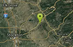
New Hogan Lake
Valley Springs, California
43.4 miles WBackpack, Camp, Hike, and Swim near Valley Springs, California
Backpack, Camp, Hike, Swim


