


6 Hiking Trails near Canton, GA
first prev 1 next lastShowing Hiking Trails within 50 miles Distance miles of Canton, GA, USA City, Zip, or Address
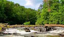
Edge Of The World
Dawsonville, Georgia
20.6 miles NEA scenic 3-mile hike along the Amicalola River to a family-friendly swimming hole and small waterfall near Atlanta.
Hike, Swim
Buford Dam Park Beach (Lake Lanier)
Buford, Georgia
25.1 miles ESmall sandy swim beach in a no-boat cove at the Corps of Engineers' Buford Dam Park on Lake Lanier, with shelters, a fishing pier and the Laurel Ridge Trail.
Hike, Kayak, Swim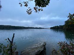
Lanier Park
Buford
25.6 miles EA Corps of Engineers day-use park just north of Buford Dam with a small swim beach in a sheltered cove of Lake Lanier. $8 per vehicle or $3 on foot, open 8 a.m. to 10 p.m., no lifeguards.
Hike, Kayak, Swim 5.6 mi

Emery Creek Trail
Chatsworth, Georgia
40.8 miles NTwo beautiful waterfalls and a small swimming hole shine on this 5.9-mile Northern Georgia trail, but plan for multiple creek crossings — water shoes are a must.
Hike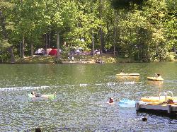
Lake Conasauga Picnic and Swim Site
Chatsworth
43.9 miles NThe highest lake in Georgia, a 19 acre CCC-built lake at 3,150 feet on Grassy Mountain, with a designated swim area and dock on the shore opposite the campground. The campground is closed until further notice after a September 2026 water main break.
Camp, Canoe, Hike, Kayak, Swim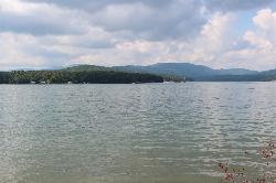
Morganton Point Recreation Area
Morganton, Georgia
45.7 miles NForest Service swim beach, campground and boat ramp on a wooded point jutting into Lake Blue Ridge, two miles from the town of Morganton.
Camp, Canoe, Hike, Kayak, Swim


