


5 Hiking Trails near Ooltewah, TN
first prev 1 next lastShowing Hiking Trails within 50 miles Distance miles of Ooltewah, TN, USA City, Zip, or Address
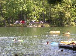
Lake Conasauga Picnic and Swim Site
Chatsworth
28.5 miles SEThe highest lake in Georgia, a 19 acre CCC-built lake at 3,150 feet on Grassy Mountain, with a designated swim area and dock on the shore opposite the campground. The campground is closed until further notice after a September 2026 water main break.
Camp, Canoe, Hike, Kayak, Swim 5.6 mi
Emery Creek Trail
Chatsworth, Georgia
30.3 miles SETwo beautiful waterfalls and a small swimming hole shine on this 5.9-mile Northern Georgia trail, but plan for multiple creek crossings — water shoes are a must.
Hike
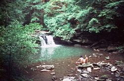
Blue Hole Falls
Tracy City
39.7 miles WA 9-foot waterfall pours into a clear, 7-foot-deep pool on Little Fiery Gizzard Creek, 0.6 mile from the Fiery Gizzard North Trailhead in Tracy City. Swimming is allowed, with no listed fee, but don't jump from the falls.
Hike, Swim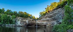
Desoto Falls
Mentone, Alabama
46.2 miles SWAlabama's tallest waterfall, a 104-foot cascade with its own small canyon inside Desoto State Park — rich in Native American history and Spanish explorer legends, with upper and lower viewing areas.
Hike, Swim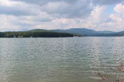
Morganton Point Recreation Area
Morganton, Georgia
49.0 miles EForest Service swim beach, campground and boat ramp on a wooded point jutting into Lake Blue Ridge, two miles from the town of Morganton.
Camp, Canoe, Hike, Kayak, Swim


