


Map of 144 Hiking Trails near Rio Verde, AZ
first prev 1 2 3 4 5 6 7 8 next lastShowing Hiking Trails within 50 miles Distance miles of Rio Verde, AZ, USA City, Zip, or Address

Gateway and Tom's Thumb Loop Trail
Scottsdale, Arizona
11.7 miles SWStarting at the 104th St trailhead, head toward the Gateway loop trail. Turn right at the Gateway loop. Next take the Bell pass trail and be prepared for a steep climb. Once you hit...
Hike, Horseback, Mountain Bike
Horseshoe Loop Hike
Scottsdale, Arizona
11.7 miles SWHike near Scottsdale, Arizona
Hike
Tom's Thumb to Bell Pass
Scottsdale, Arizona
11.7 miles SWHike and Mountain Bike near Scottsdale, Arizona
Hike, Mountain Bike
Tom's Thumb Trail South
Scottsdale, Arizona
11.7 miles SWHike near Scottsdale, Arizona
Hike
Saguaro Loop and Nature Trail
Scottsdale, Arizona
11.7 miles SWHike near Scottsdale, Arizona
Hike 2.1 mi
Lower Salt River Nature Trail
Fort McDowell, Arizona
12.3 miles SThe Lower Salt River Nature Trail is a scenic walk to take at the Tonto National Forest. This trail provides stunning views as you walk alongside the Salt River. This rustic trail is older and less...
Camp, Hike 1.5 mi

The Saddle
Mesa, Arizona
14.9 miles SSaddle trail is an intermediate mountain biking trail that connects to the greater Hawes trail network. The trail is 1.5-2mi long and it offers beautiful views of the neighboring Salt River and Red...
Hike, Mountain Bike 7.5 mi
Hawe's Loop
Mesa, Arizona
15.0 miles SMost of the trails in the Phoenix metropolitan area were originally built by mountain bikers, and the Hawe's loop trail system and trail are no exeptions. This trail features fantastic...
Hike, Mountain Bike
Indian Bend Bike Trail
Scottsdale, Arizona
15.2 miles SWIndian Bend Wash Greenbelt is a urban, concrete paved path, primarily used for biking and walking/jogging, in Scottsdale, Arizona. This point A to point B, 11 mile long trail takes you past parks,...
Hike, Mountain Bike
Buckhorn Campground Nature Trail
Apache Junction, Arizona
17.5 miles SCamp and Hike near Apache Junction, Arizona
Camp, Hike
Desert Trails Bike Park
Mesa, Arizona
17.6 miles SHike and Mountain Bike near Mesa, Arizona
Hike, Mountain Bike 1.5 mi
Moon Rock Loop
Apache Junction, Arizona
18.2 miles SLocated within the larger Usery Mountain Regional Park, the Moon Rock loop is a fast and smooth trail that adds 1.3 miles to the more famous Blevins Trail. Although the Moon Rock loop is not known as...
Hike, Horseback, Mountain Bike 1.7 mi
Levee Trail
Mesa, Arizona
18.6 miles SLocated within the Usery Mountain Regional Park, the Levee trail is named so because it mostly follows the top of levee, running parallel to a large section of the channel trail and a Phoenix...
Hike, Horseback, Mountain Bike
Crismon Wash Trail
Mesa, Arizona
19.0 miles SThe Crismon Wash Trail is 1.8 mile trail that is accessible from the south at the Crismon road trailhead. It is also accessible from the Blevins train to the north. There are several...
Hike, Horseback, Mountain Bike 5.8 mi
Go John Trail
Cave Creek, Arizona
20.2 miles WThe Go John Trail is a 5.8 mile loop trail outside of Cave Creek, Arizona, that is moderately trafficked, used by both hikers and mountain bikers. It is an excellent opportunity to view the desert...
Hike, Horseback, Mountain Bike
Reach 11 Trail
Phoenix, Arizona
20.3 miles WHike near Phoenix, Arizona
Hike 3.9 mi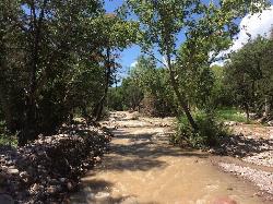
Cave Creek Swimming Hole
Cave Creek, Arizona
20.4 miles NWHidden along Cave Creek Trail #4 is a swimming hole deep enough to refresh from the summer heat. It takes almost four miles of hiking in Arizona desert to reach the swimming hole, but the water is...
Hike, Swim 3.6 mi
Charles M. Christiansen Memorial Trail
Phoenix, Arizona
20.5 miles SWPhoenix, Arizona is home to some of the best and largest city parks in the country and the Charles M. Christiansen Memorial Trail is a great introduction to this fantastic park system. Also known as...
Hike, Horseback, Mountain Bike 7.1 mi
Trail 100
Phoenix, Arizona
20.6 miles SWMountain Bikers and Hikers in Phoenix, Arizona can rejoice in the challenge that is Trail 100. Trail 100, or Charles M. Christensen Memorial Trail, is a little over 14 miles out and back in the...
Hike, Mountain Bike 5.4 mi
Denton Trail #69
Tonto Basin, Arizona
20.9 miles EFrom FR 421, the trail climbs steadily up the east face of the mountain. Some sections are quite steep. The trail eventually tops out at 5,760 feet elevation and then descends to Big Pine Flat for...
Hike, Mountain Bike


