


90 Mountain Bike Trails near Mesa Falls
first prev 1 2 3 4 5 next lastShowing Mountain Bike Trails within 50 miles Distance miles of Forest Rd 20295, Ashton, ID 83420, USA City, Zip, or Address

Yellowstone Branch Line Trail
Ashton, Idaho
4.7 miles SA 39-mile trail from Warm River to the Montana border — open to backpackers, hikers, mountain bikers, horseback riders, and ATVs through the Targhee National Forest.
Backpack, Cross-country Ski, Hike, Horseback, Mountain Bike
Flat Canyon Trail
Island Park, Idaho
6.4 miles NEA non-motorized trail in Island Park, Idaho — a peaceful ride through the forest with no engines to share the trail with.
Mountain Bike 29.6 mi
Ashton to Tetonia Trail
Ashton, Idaho
9.5 miles SWA 29.6-mile multi-use trail along a converted Union Pacific Railroad right-of-way from Ashton to Tetonia — open to bikes, ATVs, snowmobiles, runners, skiers, and horses with 787 ft of elevation gain southbound.
Mountain Bike
Big Bend Ridge Trail
Ashton, Idaho
9.9 miles WA smooth, swooping singletrack network near Driggs, Idaho with low elevation change, multiple route options, and a long riding season — one of the first trails to dry out each spring.
Mountain Bike 17.5 mi
Tear Drop Lake
Ashton, Idaho
10.2 miles EA small, lively lake in the Targhee forest for kayaking, swimming, and an easy loop trail — family fun with primitive lakeside camping.
Camp, Canoe, Hike, Kayak, Mountain Bike, Swim 0.6-4.7 mi
Harriman State Park
Island Park, Idaho
11.4 miles NWAn 11,000-acre wildlife refuge 38 miles from Yellowstone along Henry's Fork — world-class fly-fishing, hiking among wildflowers and wildlife, plus 24 miles of Nordic ski trails in winter.
Cross-country Ski, Hike, Horseback, Mountain Bike, Snowshoe 2.9 mi

Box Canyon Trail
Island Park, Idaho
15.9 miles NA scenic 3-mile riverside singletrack along Henry's Fork in Box Canyon — open to OHVs under 50 inches wide, with river views most of the trail and great trout fishing.
Hike, Mountain Bike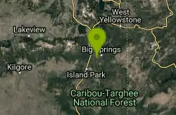
Boundary Trail
Island Park, Idaho
20.5 miles NA 37-mile loop in Idaho accessible from multiple trailheads, open to stock, mountain bikes, motorcycles, and ATVs — with steep, rocky sections not suited for beginners.
Mountain Bike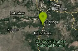
Coffee Pot Rapids Trail
Island Park, Idaho
21.0 miles NA 2.2-mile non-motorized trail following the Henry's Fork of the Snake River, where the water shifts from placid stream to raging rapids — lined with wildflowers and diverse shrubs.
Mountain Bike
Sawtell Peak Trail
Island Park, Idaho
26.0 miles NA trail at Island Park, Idaho offering great views of the valley floor, mountain peaks, and wildlife.
Mountain Bike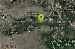
Howard Creek Trail
Island Park, Idaho
27.4 miles NWA very primitive trail following Howard Creek upstream through a low canyon near Island Park — remote, quiet, and best used as a connector to the Continental Divide Trail.
Mountain Bike
Wright Creek Trail
Tetonia, Idaho
27.9 miles SA multi-use trail near Tetonia, Idaho open for mountain biking, horseback riding, snowshoeing, and hiking in Targhee National Forest terrain.
Mountain Bike 0.6 mi
Packsaddle Lake
Tetonia, Idaho
28.6 miles SA secluded, steep-access Teton lake with a 300-foot descent from the trailhead, water that drops off quickly at the edge, and a small camp on the eastern shore.
Dive, Hike, Mountain Bike, Snowshoe, Swim 2.6 mi
Lone Star Geyser Trail
Old Faithful, Yellowstone National Park
30.2 miles NEA 4.8-mile round-trip trail through forest to a colorful geyser that erupts 30–45 feet into the air about every 3 hours — bikeable the entire way.
Hike, Mountain Bike
Probation And Burg Bumper
Tetonia, Idaho
30.8 miles SThe steepest downhill in the Tetonia area — a mile of bridges and log jumps on Probation, with the climbing Burg portion returning you to a 5-way junction with options to extend your ride.
Mountain Bike 1.2 mi
Old Faithful Lower General Store to Morning Glory Pool Bike Trail
Yellowstone National Park, Wyoming
30.9 miles NEAn easy 2-mile paved bike trail from Old Faithful to Morning Glory Pool through the Upper Geyser Basin — brilliant colors and stark geyser views await.
Mountain Bike
Sharks Belly
Driggs, Idaho
32.0 miles SA loop network connecting Channel Lock, Sodbusters, Cody's Loop, and Shark's Belly through pine-needle-carpeted singletrack in the Tetons — a smooth, secluded, tree-lined ride.
Mountain Bike
Southbound
Driggs, Idaho
32.0 miles SAn open sagebrush hillside MTB trail with sweeping Teton Range views, a small tree section, and a mostly XC up-and-down feel — one of the first trails to dry out in spring.
Mountain Bike
Channel Lock
Driggs, Idaho
32.0 miles SA short, smooth 1-mile access trail to the Horseshoe Canyon trail system near Driggs — fast and fun going down, with aspen stands, sagebrush, and 13 bermed turns.
Mountain Bike
Horseshoe Canyon
Tetonia, Idaho
32.2 miles SSmooth, swooping singletrack close to Driggs with varied route options, low elevation, and a dry climate that makes it one of the first trails to open each season.
Mountain Bike


