


99 Mountain Bike Trails near Packsaddle Lake
first prev 1 2 3 4 5 next lastShowing Mountain Bike Trails within 50 miles Distance miles of Packsaddle Lake Rd, Tetonia, ID 83452, USA City, Zip, or Address

Fish Creek Area
Ririe, Idaho
13.7 miles SWFish Creek is a network of mountain bike trails up in the Big Hole Mountains. The trails are easily accessed from either the Ririe or Rexburg side of the range. The trail system is set up much...
Hike, Mountain Bike 0.5-3.5 mi
Webster's Dam
Ririe, Idaho
14.0 miles WAlso known as Manmade Falls or the Woodmansee Dam, Webster Dam is an abandoned dam located deep in Moody Creek canyon, the dam was abandoned when sediment built up behind the dam which then...
Camp, Hike, Mountain Bike
Blacks Canyon Trail
Ririe, Idaho
14.1 miles SWThe Blacks Canyon trail begins at Black Can Road and ends at Junction Fleming Canyon Trail. The trail is open for the following uses: Motorcycle Trail Riding, Off Highway Vehicles (OHV)...
Mountain Bike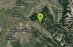
South Fork Rim Trail
Ririe, Idaho
14.1 miles SWMotorcycle trail. source: fs.usda.gov Courtesy of Singletracks.com
Mountain Bike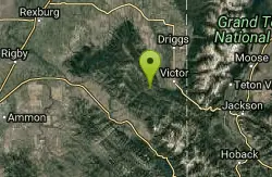
Red Creek Via Spooky Trail
Victor, Idaho
14.7 miles STrail starts on the Spooky trail segment. About 1.2 up you'll see a trail on your left. This is where you will be coming out at. Continue straight. At about 2.6 from the car you'll...
Mountain Bike 1.2 mi
Spooky
Victor, Idaho
14.7 miles STrail serves as the stem to Red Creek or access to Corral Creek as well as other possibilities in the big hole mountains. Nice fun singletrack to run as an out n back if your time is...
Mountain Bike
Kelly Canyon Loops
Ririe, Idaho
14.8 miles SWThis mountain bike trail near Kelly Canyon Ski Area has several options available. Highlights are the views in all directions from the top of the mountain. Trails: Waterfall...
Mountain Bike
Wolverine Creek Trail
Ririe, Idaho
14.9 miles SWThe Wolverine Creek Trail is a doubletrack trail in Ririe, Idaho. It begins at South Fork Road and ends at Wolverine trailhead. It is commonly used by dirt bikes and four wheelers. This trail is...
Mountain Bike
West Pine Creek Trail
Ririe, Idaho
15.0 miles SNon-motorized use. source: fs.usda.gov
Mountain Bike
Trail Canyon Trail
Ririe, Idaho
15.0 miles SThe Trail Canyon trail begins at Trail Canyon Parklot, T8s R43e Sec28 and ends at Intersect Trail 5251,t8s R43e Sec28. source: fs.usda.gov
Mountain Bike 11.9 mi

Waterfall Loop
Ririe, Idaho
15.2 miles SWTrail is a mixture of single track, forest road and double track. Provides a variety of scenery. About 1400 feet of elevation change throughout the trail.GPS is a must unless you are going with...
Mountain Bike
Cranky Cowboy
Herbert, Idaho
15.4 miles SWMountain Bike near Herbert, Idaho
Mountain Bike 13.3 mi
Cranky Buckskin Randy
Herbert, Idaho
15.4 miles SWThanks to the Snake River Trail Alliance, this route connects 3 great trails between the Buckskin Morgan parking area at the top and the Luthy's Corral parking at the bottom (new in...
Mountain Bike
Spring Creek Trail
Alta, Wyoming
15.5 miles EThis trail starts at the remains of the historic Rapid Creek Ranger Station. The trail heads east following an old road. After crossing Rapid Creek, the trail climbs up to a ridge...
Mountain Bike 4.5 mi
Aspen Trail
Alta, Wyoming
15.6 miles EAspen Trail (tr 034) is single track trail for 4.35 miles along 6,800 ft contour to Darby Canyon (tr 012). Spring Creek Trail (tr 032) is double track trail for 3.68 miles to end. The trail starts...
Hike, Mountain Bike 5.7-8.1 mi
Space Cruz
Ririe, Idaho
15.7 miles SWThe trail starts out with a really flowy singletrack then connects up to some ATV trails. On the single track, just stay on the main trail. There are several little splits several you can take...
Cross-country Ski, Mountain Bike 1.1 mi
Hidden Vista / Pine Loop
Ririe, Idaho
15.7 miles SWYou'll find the Hidden Vista trailhead on the South End of the Buckskin Morgan parking lot about a mile past Y Junction. This is a short trail with a little up and a little down for just under a...
Hike, Mountain Bike 1.7 mi
Buckskin Morgan Ridge
Ririe, Idaho
15.7 miles SWGoing up is a little tough because of the rocks, but once you clear the top it is a twisty down hill portion [until] you get to a fenced road. From there you can turn around or keep going strait...
Hike, Mountain Bike
Lower Hawley Gulch Trail
Ririe, Idaho
15.9 miles SWThis is a singletrack biking trail in Ririe, Idaho. The trail is mainly flat with a few gradual slopes. You may have to carry your bike over obstacles such as fallen trees, logs, and small ponds....
Mountain Bike
Kelly Canyon/Table Rock
Ririe, Idaho
16.1 miles SWThe initial climb is soft, so you might wash out a little. There are enough roots and rocks to add some challenge to the climb and some air to the descent. The trail forks at one point,...
Mountain Bike


