


50 Mountain Bike Trails near War Woman Dell Wildlife Management Area
first prev 1 2 3 next lastShowing Mountain Bike Trails within 50 miles Distance miles of 3742 Warwoman Rd, Clayton, GA 30525, USA City, Zip, or Address
High Point
Hayesville, North Carolina
24.7 miles WThis trail is named high point for a reason: it accesses the highest point in the trail system. The views of the top of the lake and the mountains in the background are phenomenal!...
Mountain Bike
Yotee's Run
Hayesville, North Carolina
24.7 miles WA part of the Jack Rabbit trail system, Yotee's run (named after their trail dog) is a wonderful fast, flowy trail that exemplifies what the singletrack here is all about....
Mountain Bike
Jack Rabbit Trails
Hayesville, North Carolina
24.7 miles WJackrabbit is a very beginner-friendly trail network and features gentle ups and downs, and is very twisty and very fast! There are very few obstacles, and essentially no technical...
Mountain Bike
Sneaking Creek
Hayesville, North Carolina
24.7 miles WWhile all of the trails at Jack Rabbit are flowy, Sneaking Creek is the king of flow! You'll find yourself pedaling as fast as possible and just reveling in the momentum you're able to...
Mountain Bike
Burnt Tree Peninsula
Hayesville, North Carolina
24.9 miles WOne of the easiest trails in the entire Jack Rabbit system, this is still an absolute blast to ride!
Mountain Bike
Blackrock #447
Glenville, North Carolina
26.3 miles NEBlackrock starts from the western most trailhead for Panthertown Valley off of Breedlove Road. From there it climbs steeply up and over a miniature mountain, with some options to access...
Mountain Bike
Panthertown Valley
Glenville, North Carolina
26.4 miles NEPantertown Valley is a network of trails ranging from old fire roads to double track to super tight singletrack. There's 35 miles of total trails in the valley, but bikes are limited...
Mountain Bike
Devils Elbow #448
Lake Toxaway, North Carolina
27.5 miles NEDevils Elbow trail #448 runs up to the knob of the same name and connects to trail #450 and trail #474, the main Panthertown Valley thoroughfare. Some sections are old forest road while...
Mountain Bike
WCU Trails
Cullowhee, North Carolina
30.4 miles NTrail is intermediate in difficulty with steep mountainside terrain. Although the elevation change from the trail's highest to lowest point is only a few hundred feet, there are lots of...
Mountain Bike
Snaggy Creek Trail
Cullowhee, North Carolina
31.9 miles NE5 mile climb starting at about 2300 feet and limbs steadily to 5500. Return halfway down previous route then break right and end up going down the atv trails and finally back to...
Mountain Bike
Swinging Bridge
Bryson City, North Carolina
32.0 miles NThis is a relatively flat ride with one huge hill near the end. From Brush Creek Church, ride Lower Needmore to the swinging bridge on the right (about one mile from the church)....
Mountain Bike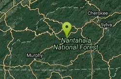
Winding Stairs
Topton, North Carolina
32.7 miles NWStart the trail by riding back down Wayah Rd. towards the power station. Turn right into the rafting put-in and find the bridge across the river (a cement bridge with steel framing)....
Mountain Bike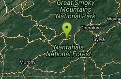
Flint Ridge
Bryson City, North Carolina
34.1 miles NWThe first mile or so of this trail is a series of nine switchbacks that take you up a pretty steep face of the ridge. The top of the ridge has some great views of the Nantahala river...
Mountain Bike
New Vista Rd
Brevard, North Carolina
36.0 miles NEGeneral Fire road with a nice view accross the valley
Mountain Bike
Buckhorn Gap / 103
Brevard, North Carolina
36.0 miles NEYou can access the bottom of this trail from FS 477, or the top of it from gated road 5058. Much of this trail is classic Pisgah singletrack, complete with gnar and creek crossings, but...
Mountain Bike
Buckwheat Knob / 122
Brevard, North Carolina
36.1 miles NEThe last of "Satan's Staircase," this is a crazy-steep push up to the top of Buckwheat Knob. Once to the top of the knob, the trail flattens out a little, climbs a little more...
Mountain Bike
Tsali Right Loop
Almond, North Carolina
38.5 miles NThe Right Loop is by far my favorite Tsali trail. Start at the trailhed parking lot and follow the signs for the LEFT LOOP (that's right). After about 0.3 miles, turn right onto the...
Mountain Bike
Tsali Thompson Loop
Almond, North Carolina
38.6 miles NThompson Loop, like Mouse Branch Loop, is more technical than the Right and Left loops at Tsali. Thompson has a lot of tight twisting singletrack and like all the trails at Tsali is...
Mountain Bike
Tsali Mouse Branch Loop
Almond, North Carolina
38.6 miles NFrom the main parking area, Mouse starts with doubletrack. Head out the main road and continue in a clockwise direction. Many riders consider Mouse the most technical of the Tsali trails, but...
Mountain Bike
Tsali Recreation Area
Almond, North Carolina
38.7 miles NTsali features four singletrack loops that hug the banks of Fontana Lake. The trails are super fast and flowy singletrack with mostly moderate climbs and amazing scenery.Daily usage...
Mountain Bike


