


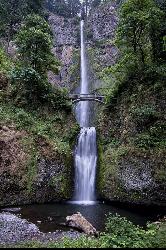
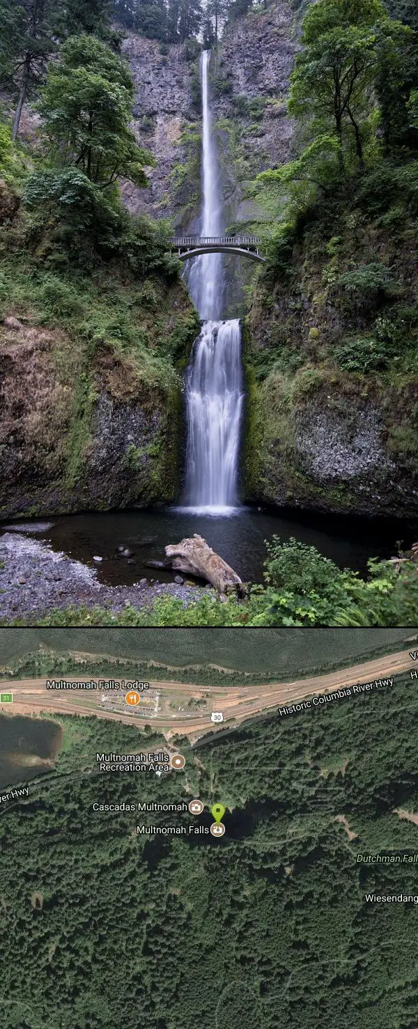
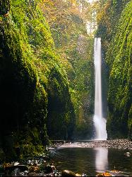
Multnomah Falls
Cascade Locks, Oregon
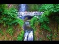
| Address: | Multnomah Falls, Multnomah County, OR, United States |
| GPS: |
45°34'34.2"N 122°6'56.8"W Maps | Directions |
| State: | Oregon |
Hike
Multnomah Falls is a 620-foot waterfall in Oregon located on the side of the Columbia River Gorge, located east of Troutdale, between Corbett and Dodson, along the Historic Columbia River Highway.
More Information
Be courteous, informed, and prepared. Read trailhead guidelines, stay on the trail, and don't feed the wildlife.
Read More- Plan Ahead and Prepare
- Travel & camp on durable surfaces
- Dispose of waste properly
- Leave what you find
- Minimize campfire impacts
- Respect wildlife
- Be considerate of other visitors
Directions
From Cascade Locks, Oregon
- Head northeast on US-30/Wa Na Pa St (374 ft)
- Turn right onto SW Cascade Ave (0.1 mi)
- Continue straight onto SW Watts Ave (276 ft)
- Turn right onto SW Benson Ave (203 ft)
- Turn left at the 1st cross street onto US-30/Wa Na Pa St (1.3 mi)
- Merge onto I-84 W/US-30 W (7.6 mi)
- Take exit 35 toward Historic Hwy/Ainsworth State Park (0.1 mi)
- Continue onto Historic Columbia River Hwy (4.1 mi)
Traveling West on Interstate 84, you may access Multnomah Falls via the Historic Columbia River Highway at Exit 35 or you may use the freeway parking lot by taking Exit 31.
If you are traveling East on Interstate 84, you may access Multnomah Falls via the Historic Columbia River Highway at Exit 28 or you may use the freeway parking lot by taking Exit 31
It is recommended that people with disabilities use Exit 28 (traveling East Bound) or Exit 35 (East and West Bound) for direct access to the lodge.
If you are traveling East and would like to see the key waterfall area in the gorge you may take Exit 17 or 18 and follow the Historic Columbia River Highway.


Other Hiking Trails Nearby
Oneonta Gorge
Cascade Locks, Oregon
2.2 miles EThis unique hike is one of the many incredible experiences you can have in Oregon! It is located near Horsetail Falls which is another great hike to add on to this one if you would prefer a more...
Hike, Swim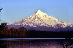
Lost Lake Loop Trail
Cascade Locks, Oregon
15.2 miles EA beautiful lake with an incredible view! Right along the lakeshore of Lost Lake, Mount Hood towers in the distance.
Canoe, Hike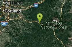
Wildwood Recreation Site
Mount Hood Village, Oregon
16.5 miles SWildwood Recreation Site is located along the Mount Hood Scenic Byway near the town of Welches, Oregon. Mount Hood, Oregon's tallest mountain, beckons travelers through a forested corridor to...
Hike, Mountain Bike, Swim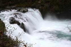
Sunset Falls Campground
Yacolt, Washington
18.0 miles NSunset falls is the place for you if you are looking for an easy hike followed by a refreshing swim. The hike is perfect for all skill levels, and is only 0.1 miles long. Minimal supplies will be...
Camp, Hike, Swim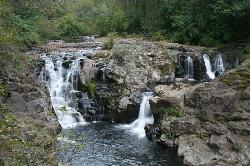
Moulton Falls County Park
Yacolt, Washington
22.0 miles NWMoulton Falls is 387 acres worth of beauty, and fun for you and your family to explore. The park runs through both sides of the river, with access to the Chelatchie Prairie Railroad excursion...
Hike, Swim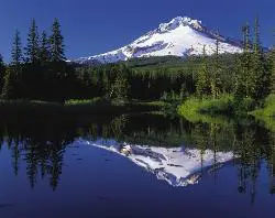
Mirror Lake Trail
Government Camp, Oregon
24.4 miles SEThis family-friendly hiking trail leads to the beautiful Mirror Lake. It gets the name because it reflects Mount Hood in the still, glacier cirque lake. You will walk through a dense forest and...
Hike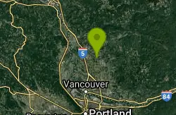
Daybreak Regional Park
Battle Ground, Washington
28.1 miles NWDaybreak Regional Park is a great place to spend the day with your family or friends. Open from 7 am to dusk, you can spend the entire day here. The park has a boat launch, picnic tables, and a...
Hike, Swim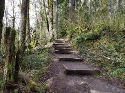
Tryon Park
Portland, Oregon
28.8 miles WImagine stepping into a lush forest, where woodpeckers forage, squirrels leap from limb to limb, owlets wait quietly for their next meal, beavers work busily by the creek, bats bury deep...
Backpack, Hike, Horseback
Willamette River Trail
Canby, Oregon
34.2 miles SWThe Willamette River trail is a mix of both paved and natural surface trails. It is a relatively flat trail that would be perfect if you want to take a leisurely bike ride and you're not up...
Hike, Mountain Bike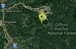
Ape Cave
Cougar, Washington
37.0 miles NApe Cave Lava Tube is a popular attraction in the Mount St. Helens National Monument and the longest lava tube in the continental United States at over two miles in length. The Ape Caves are located...
Cave, Hike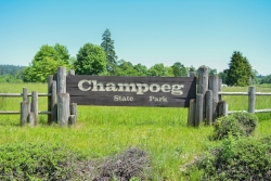
Champoeg State Park
Saint Paul, Oregon
44.0 miles SWChampoeg State Park (commonly pronounced SHAM-poo-EE) is a historic pioneer site as well as a beautiful outdoor recreational area. The Native Americans originally pronounced it CHAM-po-EGG, but it...
Camp, Disc Golf, Hike, Mountain Bike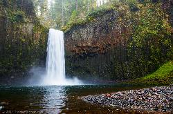
Abiqua Falls
Scotts Mills, Oregon
49.8 miles SWThis rough hiking trail will be well worth your effort and time. Although the trail is unmarked, there is a rope to steady yourself on the steep parts of the hike and guide you through the...
HikeNearby Campsites
Sunset Falls Campground
Yacolt, Washington
18.0 miles NSunset falls is the place for you if you are looking for an easy hike followed by a refreshing swim. The hike is perfect for all skill levels, and is only 0.1 miles long. Minimal supplies will be...
Camp, Hike, Swim
Champoeg State Park
Saint Paul, Oregon
44.0 miles SWChampoeg State Park (commonly pronounced SHAM-poo-EE) is a historic pioneer site as well as a beautiful outdoor recreational area. The Native Americans originally pronounced it CHAM-po-EGG, but it...
Camp, Disc Golf, Hike, Mountain Bike


