


Niter Ice Cave
Grace
Cave and Hike
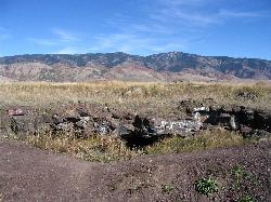
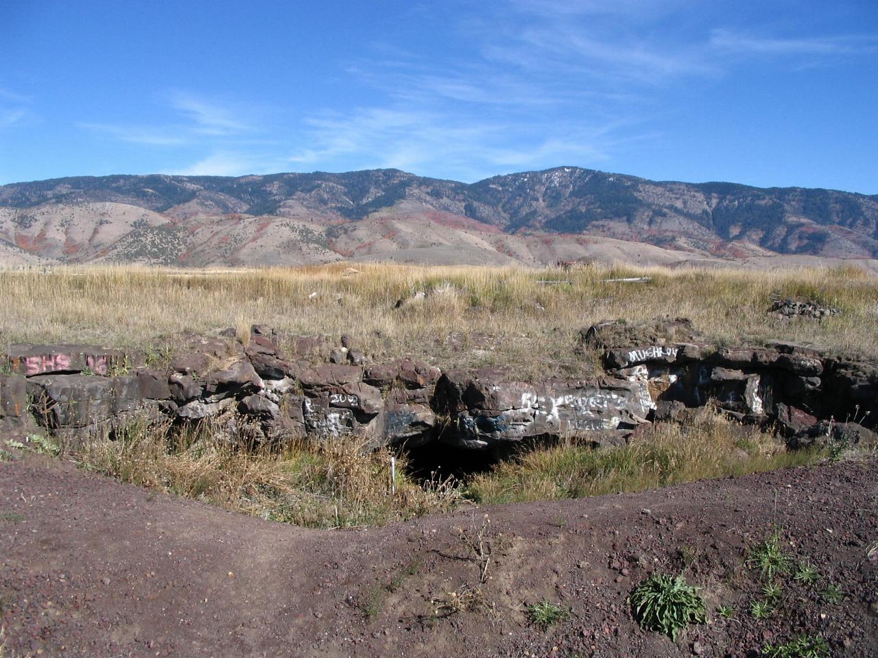
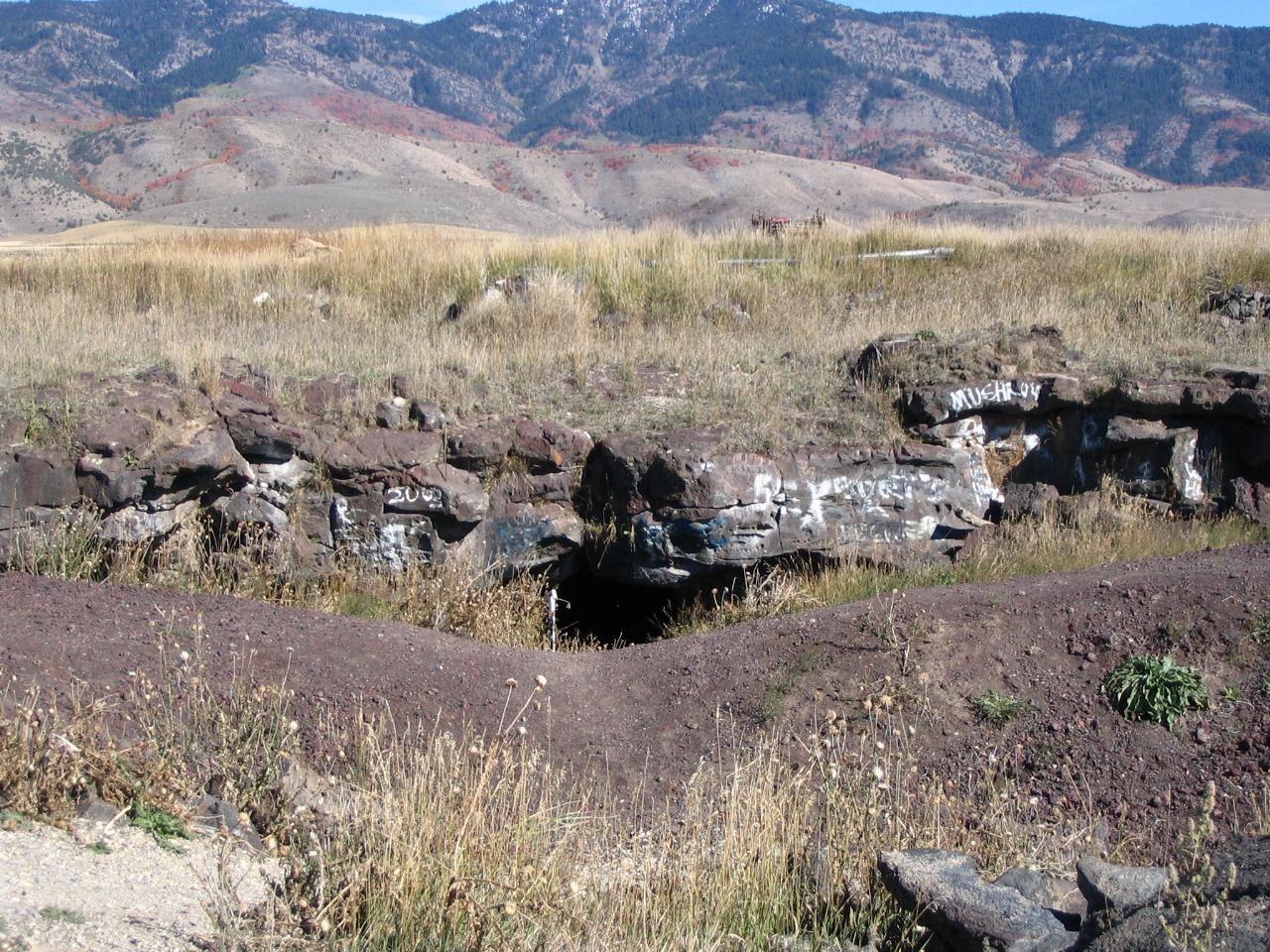
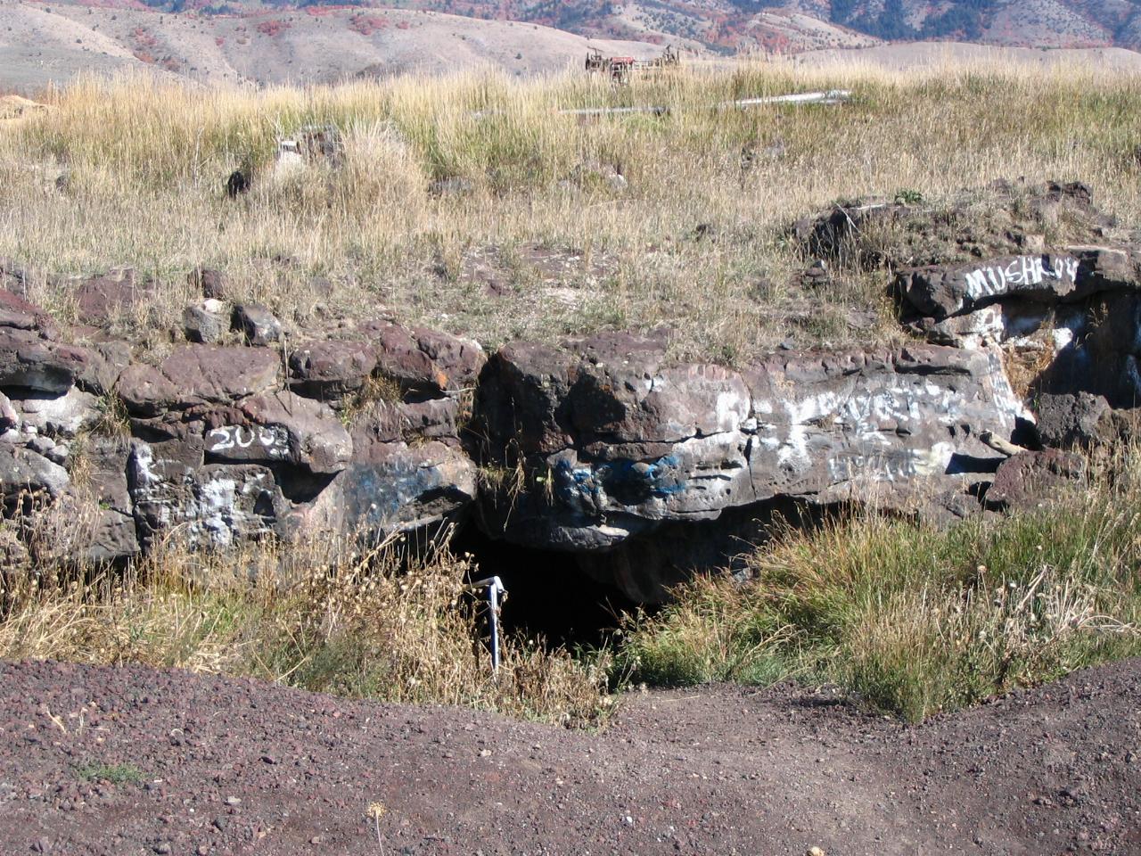
Niter Ice Cave is a lava tube in the farm country of the Gem Valley, about three miles south of Grace, Idaho, and a few hundred yards east of State Highway 34. From the road it looks like a low rim of dark basalt sitting in a hay field, but the opening drops into a long, cold tunnel where ice builds up on the floor for much of the year. It is one of the easiest lava tube caves in southeast Idaho to reach, and one of the few you can walk into straight from a gravel pullout.
The cave formed roughly 500,000 years ago, when basalt lava flowed across this part of the valley from the direction of Ice Cave Knoll, the small cinder cone on the west side of the highway. As the surface of a flow cooled and hardened into a crust, molten rock kept moving underneath it. When the supply stopped, the liquid drained out and left a hollow tube behind. That is an old age for a lava tube, since most collapse or fill in far sooner, and the stretch you can walk today is a surviving remnant of a longer system that is now mostly buried under wind-blown soil. Southeast Idaho High Country Tourism puts the open passage at about 1,800 feet long, roughly 24 feet wide and 14 feet high.
The entrance is a collapse in the roof of the tube. Cold air is heavier than warm air, so in winter frigid air sinks through that opening and settles in the passage, while summer heat has a hard time pushing in. Water dripping through the basalt freezes in that trapped cold, and the interpretive sign at the site says ice forms in the cave about seven months of the year. By late summer the ice is often gone and the floor turns to mud and standing water instead, so what you find depends heavily on the month.
People have used the cave for a long time. Native Americans and early settlers kept food in its natural cold, and pioneer families in the Gem Valley stored milk and butter there and made ice cream in July. John A. Dalton filed on a homestead next to the knoll in 1898, and local accounts say his family also used the cave as a refuge. Grace residents still repeat a story that community dances were once held in the big room near the entrance. The cave shares its name with Niter, a small farming community about two miles to the south; no reliable record we found ties the name to any saltpeter mining here.
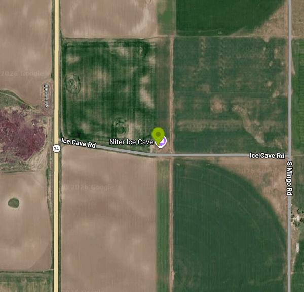
To get there from Grace, drive south on Main Street, which becomes State Highway 34, for about three miles. Turn left (east) onto Ice Cave Road and go roughly 0.15 to 0.2 miles to a small gravel pullout on the north side of the road, right above the entrance. A short dirt path with a handrail leads down into the opening, and a narrow wooden walkway runs a little way into the cave. Past the walkway you are on uneven rock, mud and ice, with piles of breakdown from the ceiling to climb over, and near the back the ceiling drops until the passage ends in a crawl. The tube does not branch, so it is easy to follow, and most visitors reach the end in 10 to 15 minutes.
Bring at least two reliable lights per person, since daylight fades within a few yards of the entrance and a phone light is a poor backup. Wear sturdy shoes with good grip and a warm layer, because the air inside stays near freezing even on hot summer days. The entrance steps are often wet or icy. Graffiti and old fire rings are unfortunately part of the scene; please do not add to them, and never build a fire inside, since the smoke has nowhere to go. In winter, bats may roost in the cave, so keep noise and lights down and leave any hibernating bats undisturbed.
There is no fee, no gate and no posted hours, and the site has no restrooms, water or trash service. The cave sits on land that is not federal; it is not part of the Caribou-Targhee National Forest or BLM ground, and the fields around it are private property, so park only in the pullout or along the road shoulder and stay on the path. The City of Grace and Southeast Idaho High Country Tourism both list it as a local attraction.
More Information
Caves of the United States of America: Niter Ice Cave
Niter Ice Cave America Caves of the United States showcaves.com
https://www.showcaves.com/english/usa/caves/NiterIce.htmlCool it: Niter Ice Cave, a geologic wonder in Grace, Idaho | News | hjnews.com
At first glance, the area around Grace, Idaho, seems like nothing more than miles of sleepy farmland.
https://www.hjnews.com/news/article_0380a6a2-d5c6-11e0-b5e2-001cc4c03286.htmlGrace Idaho | City Government | Grace
CIty government offices and services, attractions and activities
https://www.cityofgraceid.com/Niter Ice Cave - Grace Idaho - Road Trip Ryan
Niter Ice Cave, a short distance off of State Road 34 a few miles from Grace Id is a must stop for families or those with a penchant for spelunking. Here is information for visiting Niter Ice Cave.
https://www.roadtripryan.com/go/t/other/odds-and-ends-area/niter-ice-caveNiter Ice Cave in the Bear River Heritage Area
Just outside Grace, Idaho, is the Niter Ice Cave. The cave has some graffiti, but it is a great lava tube for exploring!
https://bearriverheritage.com/item/niter-ice-cave/Niter Ice Cave near Grace Idaho
Niter Ice Cave was formed when basalt lava flowed out of a vent 500 thousand years ago forming a lava tube
https://idahohighcountry.org/item/niter-ice-cave/Niter Ice Cave, Idaho - Gate to Adventures
Niter Ice Cave is easy to reach and easy to explore. Located a few miles south of Grace, Idaho and just a few hundred yards of the main road.
https://gatetoadventures.com/niter-ice-cave/Be courteous, informed, and prepared. Read trailhead guidelines, stay on the trail, and don't feed the wildlife.
Read More
- Plan Ahead and Prepare
- Travel & camp on durable surfaces
- Dispose of waste properly
- Leave what you find
- Minimize campfire impacts
- Respect wildlife
- Be considerate of other visitors
Directions
- Get directions on Google Maps




Other Hiking Trails and Caves Nearby
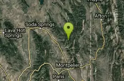
Summit View Campground
Montpelier, Idaho
21.9 miles ENestled in a forested setting high in the Bear River Range, this campground eight miles east of US-30 puts you near the Great Western Trail and wild huckleberry patches in season.
Camp, Hike, Horseback, Mountain Bike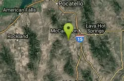
Garden Creek Gap
McCammon, Idaho
30.2 miles WA sandstone rock climbing area in a scenic mountain gap west of I-15, with great Class 3-4 scrambling and some of the best technical routes in the Pocatello area.
Cross-country Ski, Hike, Horseback, Rock Climb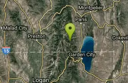
Minnetonka Cave
Saint Charles, Idaho
32.6 miles SIdaho's largest commercially developed cave features nine cavernous chambers, including a Ballroom 300 ft across and 90 ft high, all at a cool 7,700-foot elevation.
Cave
Scout Mountain Campground
Pocatello, Idaho
34.0 miles WA scenic campground at 6,900 feet on beautiful Scout Mountain, 13 miles south of Pocatello, with birding, wildlife viewing, and a variety of multi-use trails nearby.
Camp, Hike
Cherry Springs
Pocatello, Idaho
37.1 miles NWThick green vegetation, abundant birds, and wildlife viewing along a picnic-table-lined trail just a short distance from Pocatello, Idaho — a peaceful nature escape close to town.
Hike
South Fork Of Mink Creek Trail
Pocatello, Idaho
37.3 miles WThe South Fork of Mink Creek Trail is a quiet, four-season route in the Mink Creek drainage of the Caribou-Targhee National Forest, tucked into the Scout Mountain country roughly twelve miles south...
Cross-country Ski, Hike, Mountain Bike, Snowshoe
East Fork Mink Creek Trail
Pocatello, Idaho
37.3 miles WAn early-season cross-country skiing destination near Pocatello on the East Fork Road leading to Justise Park — access depends on seasonal gate closures and snowpack conditions.
Cross-country Ski, Hike, Horseback, Mountain Bike 3.2 mi
Kinney Creek Trail
Pocatello, Idaho
37.5 miles NWA 6.4-mile out-and-back to Indian Mountain Summit in Caribou-Targhee National Forest near Pocatello, with Idaho backcountry views and exceptional birdwatching — raptors, waterfowl, and songbirds.
Hike
Valve House Draw
Pocatello, Idaho
37.5 miles WA motorized doubletrack trail in Pocatello that climbs through forest to the top before a 2-mile stretch of very sweet downhill singletrack — short but worth the 10-mile loop.
Cross-country Ski, Hike, Horseback, Mountain Bike
West Fork Mink Creek Trail
Pocatello, Idaho
37.6 miles WA 3.5-mile shaded singletrack trail near Pocatello popular with hikers, horseback riders, and mountain bikers, climbing gradually to Elk Meadows Road with connections to further trails beyond.
Hike, Horseback, Mountain Bike
Slate Mountain/Gibson Jack Trail
Pocatello, Idaho
40.0 miles NWA beautiful Gibson Jack loop in Pocatello with aspen, pines, sage, and meadow views — clockwise is the preferred direction, but watch for a steep creek-bottom fork at mile 5 that can sink a tire.
Hike, Horseback, Mountain Bike 0.2-9.7 mi
City Creek
Pocatello, Idaho
42.8 miles NWPocatello's city-maintained trail network packs over six miles of singletrack into City Creek Canyon, with everything from casual loops to a downhill-only expert run.
Hike, Horseback, Mountain Bike
Intermittent Spring (Periodic Spring)
Afton, Wyoming
46.5 miles EThe largest intermittent spring in the world near Afton, Wyoming — cycling on and off every 15-to-18 minutes from late August to May, with up to 100 cubic feet per second of ice-cold clear water.
HikeNearby Campsites
Downata Hot Springs
Downey, Idaho
21.3 miles SWA full-service hot springs resort south of Pocatello with a large naturally heated pool, four water slides, a water playground, hot tub, volleyball, six cabins, yurts, and ATV trails nearby.
Camp, Hot Springs, Swim
Summit View Campground
Montpelier, Idaho
21.9 miles ENestled in a forested setting high in the Bear River Range, this campground eight miles east of US-30 puts you near the Great Western Trail and wild huckleberry patches in season.
Camp, Hike, Horseback, Mountain Bike
Bloomington Canyon Yurt
Bloomington, Idaho
28.2 miles SEThis backcountry yurt in Bear Lake Idaho opens up prime ski and snowmobile terrain for WSU students and the public — bring map and navigation skills for winter access.
Camp, Cross-country Ski, Snowshoe
Hawkins Reservoir Campground
Arimo, Idaho
30.9 miles WFourteen campsites on a small Idaho impoundment that punches above its weight — spring through fall, plovers, sandpipers, geese, sharp-tailed grouse, mule deer, coyote, and red fox all call it home.
Camp, Canoe
Scout Mountain Campground
Pocatello, Idaho
34.0 miles WA scenic campground at 6,900 feet on beautiful Scout Mountain, 13 miles south of Pocatello, with birding, wildlife viewing, and a variety of multi-use trails nearby.
Camp, Hike
Bear Lake / North Beach
Saint Charles, Idaho
36.3 miles SEA 20-mile-long, 8-mile-wide mountain lake at 5,900 feet with a two-mile sandy beach, gradual swimming slopes, and water skiing — plus native cutthroat and lake trout fishing and winter cisco runs.
Camp, Canoe, Kayak, Swim
Blackfoot River Crossing at Trail Creek Road
Firth, Idaho
42.5 miles NA remote Blackfoot River crossing accessed via a network of gravel roads near Firth, Idaho — multiple parking areas along a wildlife management area stretch of the river.
Camp


