


24 Free Swimming Holes near Tuolumne Meadows
first prev 1 2 next lastShowing Swimming Holes within 50 miles Distance miles of Tuolumne Meadows near Tuolumne County, California City, Zip, or Address
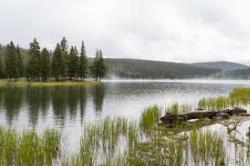
Dog Lake and Lembert Dome
Yosemite Valley, CA
1.0 miles NA 4-mile round-trip hike through Tuolumne Meadows wildflowers to a serene evergreen lake and a granite dome with sweeping views — doable in 1.5 to 3 hours.
Hike, Swim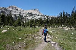
Elizabeth Lake
Wawona, California
2.6 miles SWA 4.8-mile hike with a 1,000-foot gain to a quiet alpine lake tucked between Cockscomb, Unicorn Peak, and Johnson's Peak in Yosemite's Tuolumne Meadows backcountry.
Hike, Swim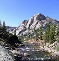
Glen Aulin
Glen Aulin, California
4.6 miles NWA popular introductory Yosemite High Country backcountry hike following the Tuolumne River to a High Sierra Camp beside the White Cascade waterfall, with further options to Waterwheel Falls.
Backpack, Camp, Hike, Swim 4.0 mi
Mono Pass
Yosemite Valley, CA
4.6 miles EAn 8-mile high-Sierra hike at 10,600 feet crossing meadows and several lakes, climbing through Bloody Canyon to sweeping views of Mono Valley and Mono Lake.
Hike, Swim 0.9-3.2 mi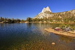
Cathedral Lakes
Wawona, California
4.8 miles SWA gorgeous 7-mile High Sierra hike along the John Muir Trail to twin lakes at 10,000 feet, framed by Cathedral, Echo, and Tressider Peaks with sweeping views of Tenaya Lake from a rock shelf.
Hike, Swim 1.8 mi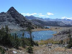
Gaylor Lakes
Yosemite Valley, CA
4.9 miles NEA 2-mile Yosemite hike with views the entire way — Dana Meadows, mountain peaks, and a high valley holding five separate lakes, with a mostly flat valley to wander once you top the pass.
Hike, Swim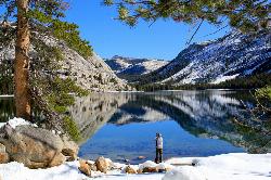
Tenaya Lake
Yosemite Valley, Yosemite National Park
7.1 miles SWTenaya Lake's glacier-carved granite shoreline offers a spacious east-beach for swimming, canoeing, and kayaking with stunning Yosemite dome views all around.
Canoe, Hike, Kayak, Swim 1.3-1.6 mi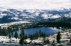
May Lake
Yosemite Valley, Yosemite National Park
8.3 miles WA 2.5-mile roundtrip hike to a scenic 9,270-foot lake at the base of Mt. Hoffmann — with views of Clouds Rest, Half Dome, and Teyana Lake, plus the option to summit the peak for even grander panoramas.
Hike, Swim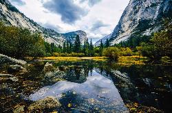
Mirror Lake
Yosemite Valley, Yosemite National Park
14.3 miles SWA paved, car-free trail winds to this seasonal lake at the base of Half Dome, offering a still mirror reflection and a popular summer swimming hole.
Backpack, Hike, Swim 0.7 mi
Lukens Lake
Tuolumne Meadows, Yosemite National Park
14.8 miles WA short 1.6-mile forest walk to a secluded lake famous for the luminescent shooting stars visible while you swim, plus a wildflower meadow that peaks in July.
Hike, Swim
Devil's Bathtub
Yosemite Valley, California
15.2 miles SWA warm, off-the-beaten-path pool fed by the Royal Arches Cascade just above Yosemite's Ahwanhee Hotel — great for families or a picnic near world-class climbing walls.
Swim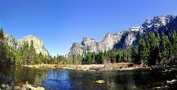
Merced River
Yosemite Valley, Yosemite National Park
16.0 miles SWThe Merced River circles Yosemite Valley with whitewater, swimming holes, gold-panning spots, and unbeatable views of Yosemite Falls and Glacier Point at every bend.
Camp, Swim, Whitewater 5.5 mi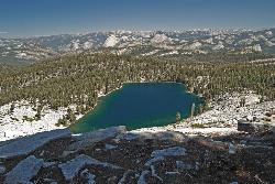
Ostrander Lake
Wawona, California
20.7 miles SWAn 11.4-mile Yosemite hike to a semi-secluded swim lake surrounded by granite mountains — wildflowers, streams, and meadows in summer; open for cross-country skiing in winter via Ostrander Lodge.
Hike, Swim
Hot Creek
Mammoth Lakes, California
30.5 miles SECLOSED. Entering the water is now prohibited at this location. A striking hot-spring creek where cold water meets hydrothermal vents — a geological spectacle worth photographing from shore, but fenced off for swimming due to dangerous temperature swings and past fatalities.
Swim
Hite Cove Trail
El Portal, California
33.4 miles SWOne of Yosemite's earliest wildflower blooms lights up the Hite Cove Trail in spring, with the added bonus of watching the South and Central Fork Merced rivers merge.
Hike, Swim

Crowley Lake
Mammoth Lakes, California
37.8 miles SEA reservoir famed for ancient volcanic columns rising from the lakebed, along with trout fishing, and stunning Eastern Sierra scenery near Mammoth Lakes.
Hike, Swim
Bass Lake Recreation Area
Oakhurst, California
39.0 miles SWarm Sierra reservoir at 3,400 feet with Forest Service beaches and campgrounds, a waterfall trail at the north end, and Yosemite's south gate twenty miles up the road.
Camp, Canoe, Hike, Kayak, Swim
Gods Bath
Phoenix Lake-Cedar Ridge, CA, California
39.2 miles WCrystal-clear but cold water at the bottom of a boulder-hop, rope-assisted descent into Clavey River canyon — cliff jumping, smaller pools on the way, about a mile one way.
Hike, Swim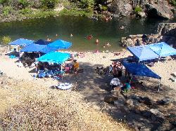
Briceburg Recreation Area
Midpines, California
39.9 miles SWBriceburg is where State Route 140 drops out of the Sierra foothills and meets the Wild and Scenic Merced River, twelve miles east of Mariposa on the road to Yosemite, and it's one of the best public...
Camp, Kayak, Swim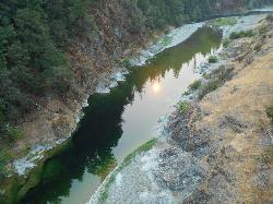
Standish Hickey Area
Lakeshore, California
42.1 miles SEA two-mile stretch of the south fork of the Eel River inside a redwood canyon 180 miles from San Francisco — swim, kayak, fish, or hike, then camp near the 1,200-year-old Captain Miles Standish Tree.
Backpack, Camp, Hike, Kayak, Swim


