


Crowley Lake
Mammoth Lakes, California

| Address: | Lake Crowley, California, USA |
| GPS: |
37°37'1.0"N 118°44'15.7"W Maps | Directions |
| State: | California |
Hike and Swim
Nestled in the picturesque landscape near Benton, California, Crowley Lake stands as a hidden gem, known not only for its breathtaking natural beauty but also for the intriguing geological formations that captivate visitors. This reservoir, created by the Long Valley Dam, offers a unique experience with its ancient columns rising from the lakebed, making it a must-visit destination for outdoor enthusiasts and nature lovers alike.
The Mystical Columns:
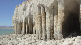
One of the most distinctive features of Crowley Lake is the presence of ancient columns, remnants of volcanic activity that occurred over 700,000 years ago. The columns, formed by the cooling and contracting of volcanic ash, create a surreal and mystical atmosphere. The most famous spot to witness these fascinating formations is the "Columns," an area accessible via the Crowley Lake Scenic Overlook. As you explore the site, take in the towering pillars that seem to reach towards the sky, creating a landscape reminiscent of an ancient and otherworldly realm.
Outdoor Activities:
Crowley Lake offers a variety of outdoor activities for visitors to enjoy. Fishing enthusiasts will find the lake well-stocked with trout, making it a popular destination for both novice and experienced anglers. The lake is regularly stocked by the California Department of Fish and Wildlife, ensuring a diverse and abundant fish population. Fishing from the shore or on a boat are both popular options, providing opportunities for a relaxing day on the water.
Camping is another highlight of the area, with several campgrounds around the lake offering a chance to immerse oneself in the serene surroundings. Crowley Lake Campground is a popular choice, providing facilities for both RV and tent camping. The campgrounds offer stunning views of the lake and easy access to outdoor activities, making it an ideal base for exploring the area.
Swimming is permitted in Crowley Lake, offering a refreshing way to cool off during the warmer months. However, it's important to note that the lake's elevation can lead to cooler water temperatures, so be prepared for a brisk swim.
Crowley Lake, with its mystical columns and diverse outdoor activities, beckons adventurers seeking a unique and enriching experience. Whether you're drawn to the ancient geological wonders or eager to cast a line into the crystal-clear waters, this destination in Benton, California, promises a memorable journey surrounded by nature's wonders. As you plan your visit, remember to adhere to regulations and guidelines to ensure the preservation of this natural marvel for future generations.
More Information
Crowley Lake | Fishing, Hiking and Camping | Visit Mono County
Crowley Lake, California is a quaint fishing village with a vast trout fishing lake approximately 12 miles south of Mammoth Lakes, Ca.
https://www.monocounty.org/places-to-go/lakes-rivers-creeks/crowley-lake/Be courteous, informed, and prepared. Read trailhead guidelines, stay on the trail, and don't feed the wildlife.
Read More
- Plan Ahead and Prepare
- Travel & camp on durable surfaces
- Dispose of waste properly
- Leave what you find
- Minimize campfire impacts
- Respect wildlife
- Be considerate of other visitors
Directions
From Mammoth Lakes, California
- Head west (276 ft)
- Turn left toward CA-203 E/
Main St (240 ft) - Turn left onto CA-203 E/
Main St Continue to follow CA-203 E(3.1 mi) - Turn right to merge onto US-395 S toward Bishop (5.4 mi)
- Turn left onto Benton Crossing Rd (0.4 mi)
- Continue onto Minnow Creek (0.1 mi)
- Continue onto Benton Crossing Rd (0.6 mi)
- Turn right onto N Landing Rd (0.7 mi)
- Slight right (2.7 mi)
- Turn leftDestination will be on the right(1.2 mi)


Other Swimming Holes and Hiking Trails Nearby
Crowley Lake Stone Columns
Mammoth Lakes, California
1.2 miles SEOtherworldly 20-foot tufa columns rising from the Eastern Sierra lakebed at Crowley Lake — a geological wonder formed over 600,000 years of calcium carbonate buildup.
Hike
Hot Creek
Mammoth Lakes, California
7.6 miles NWCLOSED. Entering the water is now prohibited at this location. A striking hot-spring creek where cold water meets hydrothermal vents — a geological spectacle worth photographing from shore, but fenced off for swimming due to dangerous temperature swings and past fatalities.
Swim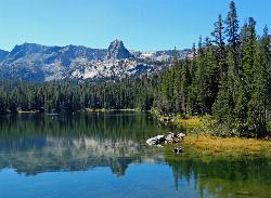
Crystal Lake
Mammoth Lakes, California
15.0 miles WA 3.2-mile roundtrip Sierra day hike past Lake George, Lake Marie, and Lake Mamie, ending at Crystal Lake beneath the monolith Crystal Crag — shaded trail with room to swim, fish, or picnic lakeside.
Camp, Hike
Santa Cruz Area
Lakeshore, California
25.3 miles SWSwim near Lakeshore, California
Swim
Mono Hot Springs
Lakeshore, California
25.3 miles SWMono Hot Springs is a magical high-Sierra retreat in California's Sierra National Forest, where natural hot springs bubble up along the South Fork of the San Joaquin River deep in the mountains...
Hot Springs, Swim
Salinas Area
Lakeshore, California
25.3 miles SWSwim near Lakeshore, California
Swim
Smith River Area
Lakeshore, California
25.3 miles SWSwim near Lakeshore, California
Swim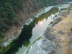
Standish Hickey Area
Lakeshore, California
25.3 miles SWA two-mile stretch of the south fork of the Eel River inside a redwood canyon 180 miles from San Francisco — swim, kayak, fish, or hike, then camp near the 1,200-year-old Captain Miles Standish Tree.
Backpack, Camp, Hike, Kayak, Swim 4.0 mi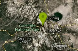
Mono Pass
Yosemite Valley, CA
34.3 miles NWAn 8-mile high-Sierra hike at 10,600 feet crossing meadows and several lakes, climbing through Bloody Canyon to sweeping views of Mono Valley and Mono Lake.
Hike, Swim 3.6 mi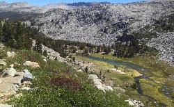
Lyell Canyon
Wawona, California
35.2 miles NWAn 8-mile, nearly flat hike through Yosemite's Tuolumne Meadows along the Lyell Fork river, with creek crossings, Kuna Creek cascades, and backcountry quiet far from the crowds.
Hike 1.8 mi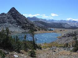
Gaylor Lakes
Yosemite Valley, CA
35.4 miles NWA 2-mile Yosemite hike with views the entire way — Dana Meadows, mountain peaks, and a high valley holding five separate lakes, with a mostly flat valley to wander once you top the pass.
Hike, Swim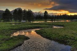
Tuolumne Meadows
Tuolumne County, California
37.7 miles NWA stunning alpine meadow in the high Sierra with granite domes and mountain views, the meandering Tuolumne River, and access to Yosemite backcountry — open summer only when the park road is clear.
Camp, Hike 4.0 mi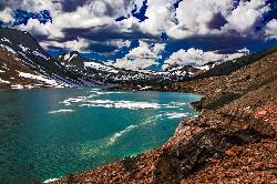
Saddlebag Lake
Lee Vining, California
37.8 miles NWAt 10,008 ft, this Eastern Sierra alpine lake offers exceptional trout fishing, a scenic four-mile loop, and a water taxi into the heart of the Twenty Lakes Basin.
Camp, Canoe, Hike 0.8-4.1 mi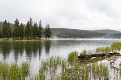
Dog Lake and Lembert Dome
Yosemite Valley, CA
37.9 miles NWA 4-mile round-trip hike through Tuolumne Meadows wildflowers to a serene evergreen lake and a granite dome with sweeping views — doable in 1.5 to 3 hours.
Hike, Swim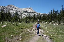
Elizabeth Lake
Wawona, California
38.0 miles NWA 4.8-mile hike with a 1,000-foot gain to a quiet alpine lake tucked between Cockscomb, Unicorn Peak, and Johnson's Peak in Yosemite's Tuolumne Meadows backcountry.
Hike, Swim 1.1 mi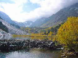
Lundy Canyon
Bridgeport, California
40.0 miles NWA 3-mile canyon hike past twin 70-foot waterfalls and beaver ponds into the Hoover Wilderness, with options to climb 2,000 feet to Burro Lake or explore wildflower meadows and multiple cascades.
Hike 0.9-3.2 mi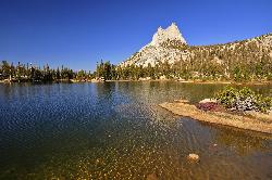
Cathedral Lakes
Wawona, California
40.7 miles NWA gorgeous 7-mile High Sierra hike along the John Muir Trail to twin lakes at 10,000 feet, framed by Cathedral, Echo, and Tressider Peaks with sweeping views of Tenaya Lake from a rock shelf.
Hike, Swim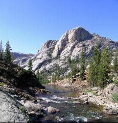
Glen Aulin
Glen Aulin, California
42.3 miles NWA popular introductory Yosemite High Country backcountry hike following the Tuolumne River to a High Sierra Camp beside the White Cascade waterfall, with further options to Waterwheel Falls.
Backpack, Camp, Hike, Swim 6.1 mi
Glen Aulin
Wawona, California
42.3 miles NWAn 11-mile hike along the Tuolumne River to Glen Aulin with 800 feet of gain, passing Tuolumne Falls, Soda Springs, wildflower meadows, and the stunning White Cascade.
Backpack, Camp, Hike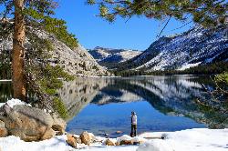
Tenaya Lake
Yosemite Valley, Yosemite National Park
42.4 miles WTenaya Lake's glacier-carved granite shoreline offers a spacious east-beach for swimming, canoeing, and kayaking with stunning Yosemite dome views all around.
Canoe, Hike, Kayak, SwimNearby Campsites

Wild Willy's Hot Spring
Mammoth Lakes, California
3.4 miles NWA soaking hot spring in Long Valley's open sagebrush plain — pools range from 95°F to 105°F, with a larger deeper pool and smaller, hotter pools, reached by a 0.2-mile wooden boardwalk from the parking area.
Camp, Hot Springs
Crowley Lake Campground
Crowley Lake, California
3.5 miles SWNestled in the stunning Eastern Sierra near Crowley Lake, this BLM campground offers first-come, first-served sites for tents, RVs, and trailers with breathtaking high-desert views.
Camp
Crystal Lake
Mammoth Lakes, California
15.0 miles WA 3.2-mile roundtrip Sierra day hike past Lake George, Lake Marie, and Lake Mamie, ending at Crystal Lake beneath the monolith Crystal Crag — shaded trail with room to swim, fish, or picnic lakeside.
Camp, Hike
Standish Hickey Area
Lakeshore, California
25.3 miles SWA two-mile stretch of the south fork of the Eel River inside a redwood canyon 180 miles from San Francisco — swim, kayak, fish, or hike, then camp near the 1,200-year-old Captain Miles Standish Tree.
Backpack, Camp, Hike, Kayak, Swim
Tuolumne Meadows
Tuolumne County, California
37.7 miles NWA stunning alpine meadow in the high Sierra with granite domes and mountain views, the meandering Tuolumne River, and access to Yosemite backcountry — open summer only when the park road is clear.
Camp, Hike 4.0 mi
Saddlebag Lake
Lee Vining, California
37.8 miles NWAt 10,008 ft, this Eastern Sierra alpine lake offers exceptional trout fishing, a scenic four-mile loop, and a water taxi into the heart of the Twenty Lakes Basin.
Camp, Canoe, Hike
Glen Aulin
Glen Aulin, California
42.3 miles NWA popular introductory Yosemite High Country backcountry hike following the Tuolumne River to a High Sierra Camp beside the White Cascade waterfall, with further options to Waterwheel Falls.
Backpack, Camp, Hike, Swim 6.1 mi
Glen Aulin
Wawona, California
42.3 miles NWAn 11-mile hike along the Tuolumne River to Glen Aulin with 800 feet of gain, passing Tuolumne Falls, Soda Springs, wildflower meadows, and the stunning White Cascade.
Backpack, Camp, Hike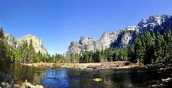
Merced River
Yosemite Valley, Yosemite National Park
47.0 miles WThe Merced River circles Yosemite Valley with whitewater, swimming holes, gold-panning spots, and unbeatable views of Yosemite Falls and Glacier Point at every bend.
Camp, Swim, Whitewater 5.7 mi
Ten Lakes
Tuolumne Meadows, Yosemite National Park
47.0 miles NWA 6.4-mile hike from Yosemite Creek to three of the Ten Lakes Basin's seven lakes, through wildflower meadows, forests, and past the Grand Canyon of the Tuolumne, gaining 2,200 feet.
Backpack, Camp, Hike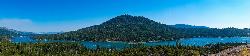
Bass Lake Recreation Area
Oakhurst, California
49.6 miles SWWarm Sierra reservoir at 3,400 feet with Forest Service beaches and campgrounds, a waterfall trail at the north end, and Yosemite's south gate twenty miles up the road.
Camp, Canoe, Hike, Kayak, Swim


