


8 Free Swimming Holes near Shingleton, MI 49884
first prev 1 next lastShowing Swimming Holes within 50 miles Distance miles of Shingleton, MI 49884, USA City, Zip, or Address
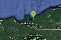
Pictured Rocks
Shingleton, Michigan
10.7 miles NA beautiful, little-used beach framed by the Pictured Rocks in Lake Superior's Pictured Rocks National Lakeshore — bathing suits may be optional.
Swim
Au Train Beach
Au Train
18.5 miles WFree MDOT roadside beach on Lake Superior in Au Train, where the warmer, shallow Au Train River spills into Au Train Bay. Sand beach, small lots and toilets off M-28, no lifeguards, open roughly May through late October.
Canoe, Kayak, Swim
Hurricane River Beach (Pictured Rocks)
Grand Marais, Michigan
26.3 miles NELake Superior beach where the Hurricane River comes out at Pictured Rocks, with a 22-site campground on the bluff, shipwreck timbers in the sand and the Au Sable Light a mile and a half east.
Camp, Hike, Swim

Sable Falls Beach
Grand Marais, Michigan
31.1 miles NELake Superior beach where Sable Creek reaches the lake below 75-foot Sable Falls, at the east end of Pictured Rocks National Lakeshore a mile from Grand Marais.
Hike, Swim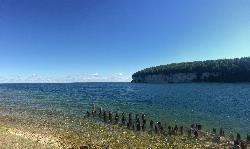
Fayette Historic State Park
Garden
45.3 miles SA buoyed Lake Michigan swim beach on Big Bay de Noc at the south end of Fayette Historic State Park, next to the picnic area, a short drive from the restored 1800s iron town. Recreation Passport required for vehicles.
Camp, Canoe, Hike, Kayak, Swim
South Beach Park
Marquette
45.5 miles WA free city beach at the south end of the Marquette waterfront, where a rock break wall and a long shallow sandy shelf make Lake Superior swimmable earlier in the summer than anywhere else in town.
Kayak, Swim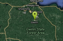
Farquar Metsa Park
Gwinn, Michigan
46.4 miles WSwim near Gwinn, Michigan
Swim
Clark Lambros Beach Park
Marquette
46.5 miles WA free, lifeguarded city beach on Lake Superior just north of downtown Marquette, with soft sand, restrooms and an accessible kayak launch on the Dead River.
Canoe, Kayak, Swim


