


252 Things to do near Badger Creek
first prev 3 4 5 6 7 8 9 10 11 12 next lastShowing results within 50 miles Distance miles of 2480 W 10000 N, Tetonia, ID 83452, USA City, Zip, or Address

Table Rock Campground
Ririe, Idaho
27.2 miles SWTable Rock / Poison Flat Campground is located at the Caribou-Targhee National Forest which occupies over 3 million acres and stretches across southeastern Idaho, from the Montana, Utah, and Wyoming...
Camp 4.3 mi
Leaning Fir #169
Ririe, Idaho
27.2 miles SWMountain Bike near Ririe, Idaho
Mountain Bike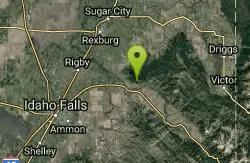
Kelly Canyon/Table Rock
Ririe, Idaho
27.3 miles SWThe initial climb is soft, so you might wash out a little. There are enough roots and rocks to add some challenge to the climb and some air to the descent. The trail forks at one point,...
Mountain Bike
St. Anthony Sandbar
Saint Anthony, Idaho
27.3 miles WCLOSED. //// Sand Bar Update //// ***As of 27 June 2019 *** The Sand Bar is still closed to ALL swimming, please do not cross the boundary line. We are closely monitoring the river flows...
Dive, Swim
Poison Flats
Ririe, Idaho
27.3 miles SWHike near Ririe, Idaho
Hike
North/South Rainey Creek Trails
Irwin, Idaho
27.3 miles SMotorcycle trail. source: fs.usda.gov
Mountain Bike
Flat Canyon Trail
Island Park, Idaho
27.4 miles NNon-motorized use. souce: fs.usda.gov
Mountain Bike
Fuzzy Bunny/Power Line Jumps/Parallel
Wilson, Wyoming
27.5 miles SThis is a steep, fast, rugged downhill trail with some freeride features that are also "ride-around-able." At the end of Fuzzy Bunny, look for Power Line Jumps off the Old Pass Road...
Mountain Bike
Herbert Idaho Ghost Town
Ririe, Idaho
27.6 miles SWCLOSED. Private property marked NO TRESPASSING. Herbert is a small ghost town that was operated until the 40s, but with the invention of the automobile, it was much more convenient to live in Rexburg...
Hike 3.8 mi
Kelly Mountain Trail
Ririe, Idaho
27.7 miles SWKelly Canyon Trail is a moderate, uphill trail that can be used by hikers, mountain bikers, and ATV riders. The trail features views of hills, mountains, trees, wildflowers, and some wildlife. Dogs...
Cross-country Ski, Hike, Mountain Bike, Snowshoe 2.1 mi
Batman
Ririe, Idaho
27.8 miles SWThis trail features rolling terrain, and multiple short, steep downhill sections followed by short steep uphill sections. This trail follows the fence line. Watch out for cows (and cow droppings)...
Mountain Bike 1.7 mi
Randy's Cow Trail / Ken's Corner
Ririe, Idaho
27.8 miles SWThis trail descends from the fence corner at the West end of Batman and continues down to Lyon's Creek Parking just off Lyon's road. The top of this trail is only a couple hundred yards from...
Mountain BikeHenry's Fork Green Way (St. Anthony Green Belt)
Saint Anthony, Idaho
27.8 miles WThis is a great walk along the river. While it is nestled right next to the highway, the closeness and beauty of the river flowing on the other side of the trail more than make up for it. Halfway...
Hike 1.8 mi
Crystal Cruise
Ririe, Idaho
28.2 miles SWThis trail uses the Crystal Cruise Nordic Trail along the Kelly Canyon ski resort boundary, taking you up to Kelly Canyon proper. It's a good climb, and a quick downhill back to the parking...
Mountain Bike
Black Canyon
Wilson, Wyoming
28.3 miles SETrail starts at the parking lot ontop of the pass. Take the service road on the west side of the parking lot. The road will turn into singletrack when you reach a service building...
Mountain Bike
Phillips Ridge
Wilson, Wyoming
28.3 miles SETrail is recommend to be done as a shuttle but can be done as an out and back from trailhead on Fish Creek Road. Shuttle is easiest by parking a vehicle and the Stagecoach bar or the...
Mountain Bike
Kelly Canyon
Ririe, Idaho
28.4 miles SWThe trail switchbacks up Kelly Mountain, hitting two brief red-line climbs before you get up on the top. The famed "Shale Chute" is back there somewhere (so this is part of the route for...
Mountain Bike 0.2-3.0 mi
Biting Goat Trail
Ririe, Idaho
29.4 miles SWPreviously known as The Cowboy Trail or the Old Cowboy Trail The Cowboy Trail is an older trail system that began revival in 2022 by Jared Klingonsmith. In 2024, it received approval to be...
Mountain Bike
Wolf Flats Recreation Area
Ririe, Idaho
29.4 miles SWWolf Flats is a completely free, dispersed, undeveloped camping area with 25 locations to camp. Some areas are large enough to accommodate groups of 50 people.
Camp
Paramount Wall / Blanche Rock
Ririe, Idaho
29.5 miles SWSitting high above the road, the routes at Paramount offer great exposure and relief from the afternoon summer sun. Chuck Oddette, Steve Reiser and Jed Miller established the routes from 1989...
Camp, Horseback, Rock Climb


