


Poison Flats
Ririe, Idaho

| Address: | Poison Flats, Jefferson County, MT, United States |
| GPS: |
43°38'2.2"N 111°35'43.8"W Maps | Directions |
| State: | Idaho |
Hike
More Information
Add ResourceBe courteous, informed, and prepared. Read trailhead guidelines, stay on the trail, and don't feed the wildlife.
Read More- Plan Ahead and Prepare
- Travel & camp on durable surfaces
- Dispose of waste properly
- Leave what you find
- Minimize campfire impacts
- Respect wildlife
- Be considerate of other visitors
Directions
From Ririe, Idaho
- Head east on Smith St toward 1st E St (0.3 mi)
- Continue onto Archer Rd (1.6 mi)
- Turn right onto E 200 N/Heise Rd/Poplar Loop (0.9 mi)
- Slight right onto Heise Rd/Poplar Loop (0.2 mi)
- Continue straight onto N 4800 E/Heise Rd/Poplar LoopContinue to follow Heise Rd/Poplar Loop(2.9 mi)
- Slight left onto E 100 N/Heise Rd/Poplar Loop (187 ft)
- Slight left onto N 5050 E (0.4 mi)
- Turn right onto E Heise Rd (2.3 mi)
- Continue straight onto Kelly Canyon Rd (3.5 mi)
- Slight right onto Forest Rd 217 (0.7 mi)


Other Hiking Trails Nearby

Hidden Vista / Pine Loop
Ririe, Idaho
0.7 miles NCLOSED. This land is owned and managed by the US Forest Service and is not designated for use. As of July 2024, being caught mountain biking on this trail could recieve up to a $5000 fine and a...
Hike, Mountain Bike 1.7 mi
Buckskin Morgan Ridge
Ririe, Idaho
0.7 miles NCLOSED. This land is owned and managed by the US Forest Service and is not designated for use. As of July 2024, being caught mountain biking on this trail could recieve up to a $5000 fine and a...
Hike, Mountain Bike 3.8 mi
Kelly Mountain Trail
Ririe, Idaho
0.8 miles WKelly Canyon Trail is a moderate, uphill trail that can be used by hikers, mountain bikers, and ATV riders. The trail features views of hills, mountains, trees, wildflowers, and some wildlife. Dogs...
Cross-country Ski, Hike, Mountain Bike, Snowshoe 0.6-2.2 mi
Fish Creek Area
Ririe, Idaho
2.4 miles NECLOSED. This land is owned and managed by the US Forest Service and is not designated for use. As of July 2024, being caught mountain biking on this trail could recieve up to a $5000 fine and a...
Hike, Mountain Bike 3.8 mi
Stinking Springs
Ririe, Idaho
3.1 miles SWStinking Springs is a great early to late season trail. Being at the edge of the Big Hole range, it gets spring earlier and winter later than other trails in the range. It's closed from December...
Hike, Mountain Bike 0.5-3.5 mi
Webster's Dam
Ririe, Idaho
4.4 miles NAlso known as Manmade Falls or the Woodmansee Dam, Webster Dam is an abandoned dam located deep in Moody Creek canyon, the dam was abandoned when sediment built up behind the dam which then...
Camp, Hike, Mountain Bike
Herbert Idaho Ghost Town
Ririe, Idaho
6.0 miles NWCLOSED. Private property marked NO TRESPASSING. Herbert is a small ghost town that was operated until the 40s, but with the invention of the automobile, it was much more convenient to live in Rexburg...
Hike 0.3-0.6 mi
Cress Creek Nature Trail
Rexburg, Idaho
6.4 miles WMeandering along the scenic South Fork of the Snake River, the beautiful 1¼ mile Cress Creek Nature Trail will lead you on a journey through sagebrush-grass communities, over juniper covered...
Hike
Burns Canyon
Ririe, Idaho
6.6 miles EHike and Mountain Bike near Ririe, Idaho
Hike, Mountain Bike 1.0-1.3 mi
Lorenzo Bridge
Rexburg, Idaho
15.2 miles NWThis is the old site of the Lorenzo Boat Launch, which has moved to the other side of the river a little further downstream. This spot sees very little traffic. There are beautiful, yet...
Airsoft, Hike, Paintball 0.1-1.3 mi
Hidden Valley Trails
Rexburg, Idaho
15.5 miles NWRight on the edges of town outside of the Hidden Valley subdivision, you'll find this fun little set of trails that's pretty good for mountain bikes. What was once just dirt roads and...
Hike, Mountain Bike
Lorenzo Boat Ramp
Rigby, Idaho
15.9 miles NWHike and Kayak near Rigby, Idaho
Hike, Kayak 0.6 mi
Packsaddle Lake
Tetonia, Idaho
16.0 miles NEPacksaddle is one of the less well known lakes/trails in the area. If you've got a good offroad vehicle, you can probably make it all the way to the end of the road, otherwise, it's just an...
Dive, Hike, Mountain Bike, Snowshoe, Swim 0.1-0.5 mi
Eagle Park
Rexburg, Idaho
17.2 miles NWEagle Park is a little urban oasis. Once you drive in to this cottonwood forest along the river, you may forget that you're still inside Rexburg city limits. You can camp, picnic, throw rocks in...
Camp, Hike, Mountain Bike, Sled
Fall Creek Falls
Swan Valley, Idaho
17.3 miles SEFalls Campground is located next to the Snake River near beautiful Swan Valley, only 45 miles east of Idaho Falls, Idaho. Mixed growth cottonwood trees provide partial shade, and grassy meadows with...
Camp, Cave, Hike, Kayak, Swim 0.6-2.0 mi
North Menan Butte ('R' Mountain)
Menan, Idaho
22.3 miles NWThe North Menan Butte is more commonly known to the locals and college students as R Mountain. Many kids know it better as Ou'R' Mountain. The butte is a rare and unique geological area and provides...
Camp, Cave, HikeHenry's Fork Green Way (St. Anthony Green Belt)
Saint Anthony, Idaho
23.1 miles NThis is a great walk along the river. While it is nestled right next to the highway, the closeness and beauty of the river flowing on the other side of the trail more than make up for it. Halfway...
Hike 1.0-7.5 mi
Idaho Falls Greenbelt
Idaho Falls, Idaho
24.3 miles SWThe Idaho Falls Greenbelt is one of Idaho Falls charms located in the heart of Idaho Falls, next to the historic Idaho Falls downtown. The paved foot-trail is approximately 6 miles around,...
Hike 5.6-8.3 mi
Palisades Creek Trail / Lakes and Waterfall Canyon
Irwin, Idaho
25.2 miles SEPalisades Creek Trail is located about 50 miles southeast of Idaho Falls and about 60 miles west of Jackson Hole WY in Swan Valley Idaho. The four mile hike up to lower Palisades Lake or the 6.2 mile...
Backpack, Camp, Hike, Horseback, Mountain Bike
Badger Creek
Tetonia, Idaho
27.2 miles NEBadger Creek is a stream located just 13.6 miles from Ashton, in Teton County, in the state of Idaho, United States, near France, ID. Whether you’re spinning, baitcasting or fly fishing your...
Camp, Cross-country Ski, Hike, Mountain Bike, Rock ClimbNearby Campsites

Table Rock Campground
Ririe, Idaho
0.4 miles SETable Rock / Poison Flat Campground is located at the Caribou-Targhee National Forest which occupies over 3 million acres and stretches across southeastern Idaho, from the Montana, Utah, and Wyoming...
Camp
Wolf Flats Recreation Area
Ririe, Idaho
2.5 miles SWolf Flats is a completely free, dispersed, undeveloped camping area with 25 locations to camp. Some areas are large enough to accommodate groups of 50 people.
Camp
Big Hole Dispersed Campsites
Ririe, Idaho
2.8 miles NA dispersed campsite is simply an unestablished and unmaintained area where people camp. Often, this means that there is a campfire or other basic campsite feature to identify the site and that's...
Camp
Paramount Wall / Blanche Rock
Ririe, Idaho
2.9 miles WSitting high above the road, the routes at Paramount offer great exposure and relief from the afternoon summer sun. Chuck Oddette, Steve Reiser and Jed Miller established the routes from 1989...
Camp, Horseback, Rock Climb
Kelly Island Campground
Ririe, Idaho
3.4 miles WThis is a BLM campground with 14 campsites for RVs or tents and 1 group campsite. Daily Rates $5-20 Showers No Bathrooms Vault...
Camp 0.5-3.5 mi
Webster's Dam
Ririe, Idaho
4.4 miles NAlso known as Manmade Falls or the Woodmansee Dam, Webster Dam is an abandoned dam located deep in Moody Creek canyon, the dam was abandoned when sediment built up behind the dam which then...
Camp, Hike, Mountain Bike
Moody Meadows
Driggs, Idaho
7.3 miles NEGood place for kids, they can ride bikes in the meadow, play in the stream, and camping is off of the road. Hiking, motorbiking, and horseback riding trails are abundant in the area.
Camp
Twin Bridges Park
Rexburg, Idaho
8.9 miles WTwin Bridges is a campground 12 miles South East of Rexburg on S. 600 E. It is maintained by Madison County Parks Department. It is a 27 acre park of pristine land rich with wildlife on the Snake...
Camp, Canoe
Jefferson County Lake (AKA Rigby Lake)
Rigby, Idaho
16.0 miles WRigby Lake has long been a favorite swimming hole for those in the area. The county has taken it well under its wing and made it a buzzing spot on any warm summer day. Along with the long standing...
Camp, Canoe, Dive, Kayak, Sled, Swim 0.1-0.5 mi
Eagle Park
Rexburg, Idaho
17.2 miles NWEagle Park is a little urban oasis. Once you drive in to this cottonwood forest along the river, you may forget that you're still inside Rexburg city limits. You can camp, picnic, throw rocks in...
Camp, Hike, Mountain Bike, Sled
Fall Creek Falls
Swan Valley, Idaho
17.3 miles SEFalls Campground is located next to the Snake River near beautiful Swan Valley, only 45 miles east of Idaho Falls, Idaho. Mixed growth cottonwood trees provide partial shade, and grassy meadows with...
Camp, Cave, Hike, Kayak, Swim
Falls Campground
Victor, Idaho
18.2 miles SEFalls Campground is located next to the Snake River near beautiful Swan Valley, only 45 miles east of Idaho Falls, Idaho. Mixed growth cottonwood trees provide partial shade, and grassy meadows...
Camp
Pine Creek Campground
Victor, Idaho
19.9 miles EThe Pine Creek Campground has 10 single units and has restrooms.
Camp
Beaver Dick Park
Rexburg, Idaho
20.3 miles NWBeaver Dick is a park 4.5 miles west of Rexburg, Idaho on Hwy 33. It's a 9.5 acre park that passes next to the west bank of the Henry Fork of the Snake River; it's a popular...
Camp, Canoe, Disc Golf, Swim 0.8-1.3 mi
Warm Slough Campground
Rexburg, Idaho
21.2 miles NWThis is a pretty popular campsite that fills up pretty quick on busy weekends. Campsites are fairly spread out and there is no official donation box (as of July 2015). A couple of the campsites...
Airsoft, Camp, Canoe 0.6-2.0 mi
North Menan Butte ('R' Mountain)
Menan, Idaho
22.3 miles NWThe North Menan Butte is more commonly known to the locals and college students as R Mountain. Many kids know it better as Ou'R' Mountain. The butte is a rare and unique geological area and provides...
Camp, Cave, Hike 5.6-8.3 mi
Palisades Creek Trail / Lakes and Waterfall Canyon
Irwin, Idaho
25.2 miles SEPalisades Creek Trail is located about 50 miles southeast of Idaho Falls and about 60 miles west of Jackson Hole WY in Swan Valley Idaho. The four mile hike up to lower Palisades Lake or the 6.2 mile...
Backpack, Camp, Hike, Horseback, Mountain Bike
Mike Harris Campground
Victor, Idaho
26.9 miles EMike Harris Campground is located along scenic Teton Pass, just 5 miles from Victor, Idaho at an elevation of 6,200 feet. Visitors enjoy fishing, exploring local trails and sightseeing in this...
Camp
Badger Creek
Tetonia, Idaho
27.2 miles NEBadger Creek is a stream located just 13.6 miles from Ashton, in Teton County, in the state of Idaho, United States, near France, ID. Whether you’re spinning, baitcasting or fly fishing your...
Camp, Cross-country Ski, Hike, Mountain Bike, Rock Climb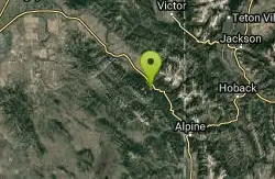
Bear Creek Campground at Palisades
Irwin, Idaho
28.5 miles SEPalisades Reservoir is ideal for water skiing in the summer and features many picnic spots and boat docks. The area forest service hosts nine campgrounds containing 181 family units. Boat launch...
Camp, Hike, Horseback, Mountain Bike


