


224 Things to do near Buckhorn Campground Nature Trail
first prev 3 4 5 6 7 8 9 10 11 12 next lastShowing results within 50 miles Distance miles of Buckhorn Campground Nature Trail near Apache Junction, Arizona City, Zip, or Address
Maxine Lakin Nature Trail
Phoenix, Arizona
27.6 miles WHike near Phoenix, Arizona
Hike
Buffalo Ridge Park
Phoenix, Arizona
27.7 miles NWA rugged disc golf course with elevation, blind holes, and great views — the long hole 27 runs alongside the mountain back to the parking lot; bring plenty of water.
Disc Golf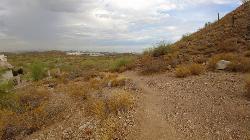
Scarlett Canyon
Phoenix, Arizona
27.9 miles NWAn unmarked 3-mile loop around a desert mountain with ever-changing views, an old fenced mine on the north side, and optional summit scrambling on rocky, loose gravel.
Hike, Horseback, Mountain Bike, Rock Climb 0.8-1.1 mi
Kiwanis Trail to Telegraph Pass Lookout
Phoenix, Arizona
27.9 miles WA short, beginner-friendly hike in South Mountain near Phoenix winding through a small canyon to Telegraph Pass — best enjoyed at sunrise or just before sunset for near-constant shade.
Hike, Mountain Bike 3.1 mi
Goat Hill via Telegraph Pass Trail
Phoenix, Arizona
27.9 miles SWGoat Hill via the Telegraph Pass Trail is a rocky South Mountain Park climb to a sweeping 360-degree view over Phoenix.
Hike
Telegraph Pass Trail
Phoenix, Arizona
27.9 miles SWA 2.3-mile beginner-friendly trail in South Mountain Park with petroglyphs, saguaro views of metropolitan Phoenix, and a paved first section that's wheelchair accessible.
Hike 5.4 mi
Denton Trail #69
Tonto Basin, Arizona
28.0 miles NEA strenuous trail climbing to 5,760 feet through Ponderosa pine with nice Tonto Basin vistas — rough, steep sections require caution and make this one for experienced riders.
Hike, Mountain Bike
Sycamore Trail #68
Tonto Basin, Arizona
28.1 miles NEA rugged desert-to-forest hike near Tonto Basin climbing from Sonoran Desert through chaparral and juniper woodland to Ponderosa pine forest and El Oso Divide views.
Mountain Bike 23.0 mi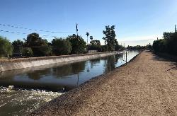
Grand Canal Trail
Phoenix, Arizona
28.4 miles WA 23-mile paved and unpaved trail system following the Grand Canal through Glendale, Phoenix, and Tempe — open for biking, walking, and running with multiple landmark stops.
Hike 1.2 mi
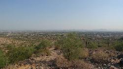
Ma-Ha-Tauk Trail
Phoenix, Arizona
29.0 miles WA mostly easy 2.5-mile out-and-back trail in South Mountain Park connecting to many other trails, with views of downtown Phoenix and the Estrella Mountains — dogs welcome on leash.
Hike, Horseback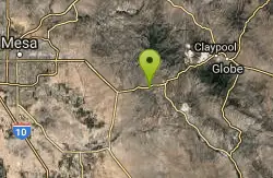
Picket Post
Superior, Arizona
29.2 miles SEA relentlessly climbing mountain bike and trail experience near Superior, Arizona — going around Picket Post Mountain's western side with high-elevation views and a connection to the Arizona Trail.
Mountain Bike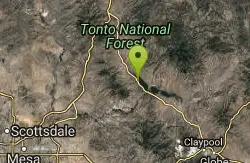
Three Bar Route
Tonto Basin, Arizona
29.4 miles NEA scenic loop around the Three Bar Wildlife Enclosure near Roosevelt Lake in Tonto Basin, with riparian habitat, chaparral, and the option to cool off at the lake after your ride.
Mountain Bike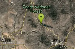
Vineyard Trail #131
Tonto Basin, Arizona
29.5 miles NEA scenic desert trail in Tonto Basin passing through historic Camp O'Rourke with panoramic views of Roosevelt Lake, Roosevelt Dam, and Four Peaks.
Mountain Bike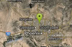
Sweetwater
Phoenix, Arizona
29.7 miles WA hilly, moderately challenging disc golf course set in a dry lake bed — concrete tees on the front nine and a map strongly recommended since signage is limited.
Disc Golf
Pyramid Trail
Phoenix, Arizona
30.1 miles SWHike near Phoenix, Arizona
Hike
South Mountain Pyramid Trail
Phoenix, Arizona
30.1 miles SWThe Pyramid Trail is one of the classic hikes in South Mountain Park and Preserve, the enormous Phoenix municipal park that sprawls across the mountains on the southern edge of the city. Climbing...
Hike
Conocido Park
Phoenix, Arizona
31.1 miles WMostly flat, grassy disc golf holes with trees in play, dual tees, and alternate pin locations — play it backwards for a completely different 18-hole experience.
Disc Golf 21.4 mi
Spur Cross to Lake Pleasant
Cave Creek, Arizona
31.2 miles NWHead north from Flat Tire Bike Shop to Spur Cross Conservation Ranch at 3.2 miles, then enter the Maricopa Trail system and follow signs to Lake Pleasant from Cave Creek.
Mountain Bike
Cave Creek Park
Cave Creek, Arizona
31.2 miles NWMultiple singletrack loops to explore at Cave Creek Park — watch out for hikers and horses sharing the trail.
Mountain Bike 0.4-1.1 mi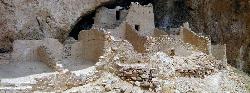
Tonto National Monument
Roosevelt, Arizona
31.5 miles ETonto National Monument preserves 700-year-old Salado cliff dwellings above Roosevelt Lake, reached by a short paved trail in the Arizona desert.
Hike


