


132 Things to do near Catamount Links
first prev 1 2 3 4 5 6 7 next lastShowing results within 50 miles Distance miles of 77 Pointe Ln, Cullowhee, NC 28723, USA City, Zip, or Address
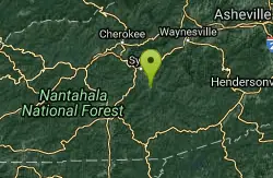
Jackson County Rec Center Disc Golf Course
Cullowhee, North Carolina
0.5 miles SVery short course through some flat fields. There are soccer fields, basketball courts and a bunch of walking trails. A few holes have trees and one throws over a small pond, but otherwise it is...
Disc Golf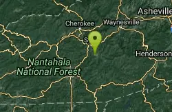
WCU Trails
Cullowhee, North Carolina
1.5 miles WTrail is intermediate in difficulty with steep mountainside terrain. Although the elevation change from the trail's highest to lowest point is only a few hundred feet, there are lots of...
Mountain Bike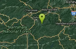
Snaggy Creek Trail
Cullowhee, North Carolina
3.0 miles E5 mile climb starting at about 2300 feet and limbs steadily to 5500. Return halfway down previous route then break right and end up going down the atv trails and finally back to...
Mountain Bike
Big Creek
Tuckasegee, North Carolina
3.6 miles SESwim near Tuckasegee, North Carolina
Swim
Midnight Hole
Tuckasegee, North Carolina
3.6 miles SESwim near Tuckasegee, North Carolina
Swim

Mt. LeConte Lodge
Sylva, North Carolina
8.0 miles NWHigh atop Mt. LeConte in the Great Smoky Mountains National Park, LeConte Lodge® is the highest guest lodge in the eastern United States. It is situated on an open glade just below the summit of...
Camp, Hike, Horseback, Rock Climb
Big Creek Area
Tuckasegee, North Carolina
9.9 miles ESeveral swimming holes near the NE border of the Great Smoky Mtns N. P. in the Big Creek Recreation Area on the TN-NC border. NOTE: The National Park Service will not allow you to...
Swim
Bear Creek Area
Tuckasegee, North Carolina
9.9 miles ESeveral swimming holes in lakes along RT 281 southeast of Sylva and Cullowhee. For details... Bathing suits: Optional at most places, very remote
Swim
Blackrock #447
Glenville, North Carolina
11.7 miles SEBlackrock starts from the western most trailhead for Panthertown Valley off of Breedlove Road. From there it climbs steeply up and over a miniature mountain, with some options to access...
Mountain Bike
Panthertown Valley
Glenville, North Carolina
11.8 miles SEPantertown Valley is a network of trails ranging from old fire roads to double track to super tight singletrack. There's 35 miles of total trails in the valley, but bikes are limited...
Mountain Bike
Devils Elbow #448
Lake Toxaway, North Carolina
14.0 miles SEDevils Elbow trail #448 runs up to the knob of the same name and connects to trail #450 and trail #474, the main Panthertown Valley thoroughfare. Some sections are old forest road while...
Mountain Bike
Sunburst
Canton, North Carolina
14.3 miles ESwim near Canton, North Carolina
Swim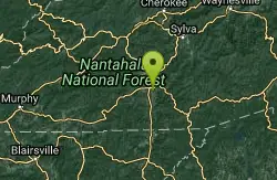
Macon Early College Disc Golf Course
Franklin, North Carolina
14.9 miles SWSmall 9 hole course with dual tees on 7 holes. Good for beginners - a variety of uphill, downhill, short, and long holes. Bring the map to aid navigation. Public (No Fee)
Disc Golf 1.7 mi
Flat Laurel Creek
15.3 miles E
Flat Laurel Creek is a 3.18 mile multi-use trail that is perfect for exploring on foot, horse and bike. This trail can be accessed from a parking lot on either end, making it easy to begin...
Hike, Horseback, Mountain Bike, Swim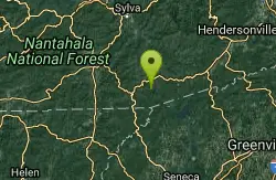
Cashiers Area
Woodleaf, North Carolina
15.8 miles SSwim near Woodleaf, North Carolina
Swim
Courthouse Falls
16.1 miles E
Courthouse Falls is a beautiful 45 foot waterfall that is popular to visit. This waterfall is an easy 3/4 mile hike from the parking lot on Courthouse Creek Road (FSR 140) or can be accessed from the...
Hike, Swim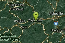
Waynesville Disc Golf Course
Waynesville, North Carolina
18.3 miles NEAround Waynesville Rec Center. Awesome views of the Southern Appalachians. Long shots and ace runs. Maps at Rec. Center and kiosk. Public (No Fee)
Disc Golf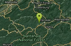
Deep Creek Area
Wallace, North Carolina
18.5 miles NWSwim near Wallace, North Carolina
Swim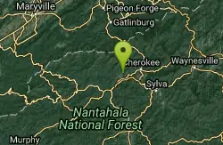
Deep Creek Trail
Bryson City, North Carolina
18.5 miles NWThe trail appears to be an old forest service road or an old logging road. There are two out and back trails. Deep Creek and Indian Creek Falls. Deep Creek is about 2 miles one way....
Mountain Bike 1.4 mi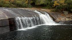
Turtleback Falls
Lake Toxaway, North Carolina
18.5 miles SETurtleback Falls was named for its domed shape, similar to the back of a turtle. It's also called "umbrella falls" for the same reason. Visitors slide down Turtleback as the...
Backpack, Hike, Swim


