


Deep Creek Area
Wallace, North Carolina
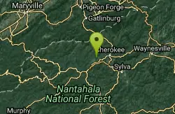
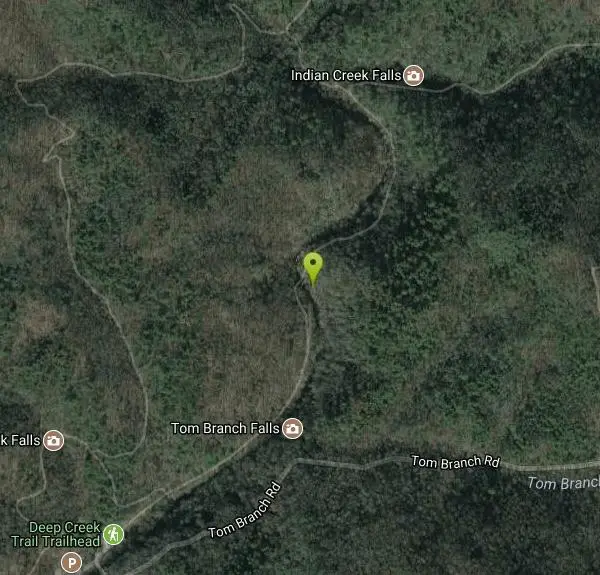
| GPS: |
35°28'8.8"N 83°25'46.0"W Maps | Directions |
| State: | North Carolina |
Swim

- Plan Ahead and Prepare
- Travel & camp on durable surfaces
- Dispose of waste properly
- Leave what you find
- Minimize campfire impacts
- Respect wildlife
- Be considerate of other visitors
Directions
From Wallace, North Carolina
- Head north on N College St toward E Southerland St (253 ft)
- Turn right at the 1st cross street onto E Southerland St (1.0 mi)
- Turn left onto NC-11 S N (2.3 mi)
- Turn left to merge onto I-40 W toward Benson (157 mi)
- Take exit 131 for I-40 W/Interstate 85 BUSINESS S toward U.S 70/Greensboro/Winston-Salem (0.4 mi)
- Keep left to continue on I-40 W/I-85BL S (7.3 mi)
- Keep right at the fork to continue on I-40 W, follow signs for Interstate 40 W/US 220 S/Winston - Salem (12.6 mi)
- Keep left to stay on I-40 W, follow signs for Winston-Salem Statesville (178 mi)
- Take exit 27 for US-74 toward US-19/US-23/Clyde/Waynesville/Maggie Valley/Franklin/Murphy/Atlanta (0.3 mi)
- Continue onto US-74 W/Great Smoky Mountains Expy (33.3 mi)
- Keep left to continue on US-74 W (4.0 mi)
- Take exit 69 for Hyatt Creek Rd toward E Bryson City/National Park/Cherokee/Piration Park/Ela/Great Smoky Mountains (0.3 mi)
- Turn right onto Hyatt Creek Rd (1.7 mi)
- Turn left onto US-19 S (0.4 mi)
- Turn right onto Shuler Rd (0.6 mi)
- Turn right onto Galbraith Creek Rd (1.1 mi)
- Continue onto Tom Branch Rd (0.8 mi)
Other Swimming Holes Nearby

Fingerlake
Almond, North Carolina
10.1 miles SWAn offshoot of Fontana Lake open April through October, Fingerlake offers gravel-edged swimming, kayaking, canoeing, and fishing surrounded by lush forest — with restrooms and picnic tables on site.
Canoe, Kayak, Swim 3.8 mi
Ramsey Cascades
Gatlinburg, Tennessee
16.6 miles NRamsey Cascades is the tallest waterfall in Great Smoky Mountains National Park — a thundering 100-foot, multi-tiered cascade hidden deep in the old-growth forest of the Greenbrier area near...
Hike, Kayak, Swim, Whitewater 
Queens Creek Lake
Nantahala, North Carolina
18.3 miles SWA secluded reservoir in the Nantahala mountains with mountain reflections on still water, quality trout fishing, swimming on warm days, and a scenic drive up Winding Stairs Road.
Swim 
Little Pigeon River
Gatlinburg, Tennessee
18.6 miles NSeven accessible swimming holes and tubing spots on the Little Pigeon River, surrounded by beautiful Smoky Mountain scenery near Gatlinburg's attractions.
Swim 
Big Creek
Waynesville, North Carolina
22.1 miles SEBig Creek is a crystalline mountain stream tumbling through the quiet northeastern corner of Great Smoky Mountains National Park, and it may be the single best swimming creek in the Smokies. Cold,...
Swim 
Midnight Hole
Waynesville, North Carolina
22.1 miles SEMidnight Hole is the most beloved swimming hole in Great Smoky Mountains National Park, an emerald-green pool of startling clarity sitting at the base of a six-foot waterfall, ringed by house-sized...
Swim 
Cosby Campground
Cosby, Tennessee
23.4 miles NECamp and Swim near Cosby, Tennessee
Camp, Swim 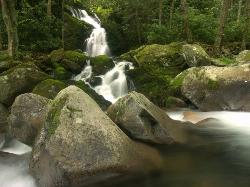
Mouse Creek Falls
Waynesville, North Carolina
24.7 miles NEMouse Creek Falls is one of the finest waterfall hikes in Great Smoky Mountains National Park, a two-tiered 45-foot cascade where Mouse Creek spills down a mossy rock face and empties straight into...
Swim 
Big Creek Area
Tuckasegee, North Carolina
28.1 miles SESeveral remote swimming holes near the TN-NC border in the Big Creek Recreation Area of the Great Smoky Mountains — very secluded, and dogs are not allowed on the trail.
Swim 
Bear Creek Area
Tuckasegee, North Carolina
28.1 miles SESeveral remote swimming holes in lakes along Route 281 southeast of Sylva and Cullowhee — bathing suits optional at most spots, given how far off the beaten path they are.
Swim 
Sunburst
Canton, North Carolina
28.4 miles ESunburst is a refreshing mountain getaway along the West Fork of the Pigeon River in North Carolina's Pisgah National Forest, tucked into the high, forested country south of Canton and...
Swim 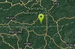
Big Laurel Falls
Otto, North Carolina
30.7 miles SSwim near Otto, North Carolina
Swim 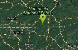
Boone Area
Otto, North Carolina
30.7 miles SSwim near Otto, North Carolina
Swim 1.8 mi
Flat Laurel Creek
30.9 miles E
A 3.18-mile multi-use trail following Flat Laurel Creek through colorful rock formations and forest, with distant views of Sam Knob and a small waterfall — open year round.
Hike, Horseback, Mountain Bike, Swim 
Cashiers Area
Woodleaf, North Carolina
32.7 miles SESwim near Woodleaf, North Carolina
Swim 
Courthouse Falls
33.1 miles SE
A gorgeous 45-foot waterfall streams into a stunning blue-green pool in a greenery-covered cliff cove — just a 3/4-mile easy hike from the parking lot, open year-round.
Hike, Swim 0.2-2.8 mi
Graveyard Fields
Brevard, North Carolina
34.4 miles ETwo cascading waterfalls — a swimmable Lower Falls just 1/3 mile from the road, and a more challenging Upper Falls on a 3.5-mile wildflower loop — make this a must-see hike.
Hike, Swim 
Skinny Dip Falls
Brevard, North Carolina
35.1 miles EA cascading waterfall with multiple clear pools for wading and swimming, a 6-foot jumping spot, and an easy 3/4-mile forested walk from the Blue Ridge Parkway — swimmers should mind fast water and slippery rocks.
Hike, Swim 
Big East Fork
Canton, North Carolina
35.2 miles EHeavy forest, multiple waterfalls, and a river that shifts from white rapids to calm swimming holes along Big East Fork in Pisgah National Forest — great for kayaking, camping, and swimming year-round.
Backpack, Hike, Kayak, Swim 
Fires Creek Area
Wake Forest, North Carolina
35.4 miles SWSwim near Wake Forest, North Carolina
SwimNearby Campsites
Mt. LeConte Lodge
Sylva, North Carolina
10.9 miles SEThe highest guest lodge in the eastern United States at 6,400 feet, with spectacular Smokies views from an open glade just below the Mt. LeConte summit in Great Smoky Mountains NP.
Camp, Hike, Horseback, Rock Climb 
Cades Cove Campground
Townsend, Tennessee
21.6 miles NWOver 2 million visitors a year come to bike, hike, tour the 11-mile loop road, and watch wildlife amid wildflowers in spring and vivid fall colors in this iconic Smoky Mountain valley.
Camp
Cosby Campground
Cosby, Tennessee
23.4 miles NECamp and Swim near Cosby, Tennessee
Camp, Swim 
Davis Branch
Tellico Plains, Tennessee
39.9 miles WA riverside campground on the Tellico River with six campsites, each with a picnic table — a peaceful Tennessee base camp for hiking, fishing, and campfire nights.
Camp, Hike, Swim 
War Woman Dell Wildlife Management Area
Clayton, Georgia
40.8 miles SA short 0.8-mile out-and-back hike near Clayton, Georgia through a nature trail to a waterfall — good for all skill levels and accessible year-round.
Camp, Hike, Horseback 
Davidson River Campground
Pisgah Forest, North Carolina
41.9 miles EA year-round campground in Pisgah National Forest just four miles from Brevard and less than an hour from Asheville, with shaded loops, hiking trails, waterfalls, and fishing spots nearby.
Camp, Hike, Swim 
Rocky Bluff
Hot Springs, North Carolina
42.5 miles NERocky Bluff is a tranquil mountain getaway in the Pisgah National Forest near Hot Springs, North Carolina, where a wooded campground sits beside the lovely Spring Creek just a few miles south of...
Camp, Hike, Swim


