


257 Things to do near Empire Link
first prev 1 2 3 4 5 6 7 8 9 10 next lastShowing results within 50 miles Distance miles of JFFH+JH Park City, UT, USA City, Zip, or Address

Spruces Campground
Salt Lake City, Utah
6.3 miles WCamping isn't free. See USDA.gov for details. If you know the coordinates of the sledding hill here, please comment.
Camp, Sled
Trailside Park
Park City, Utah
6.4 miles NA 9 hole course that stretches across the sagebrush covered hillside. It is either a work in progress or significantly underfunded. Well marked dirt tees are bordered by rocks. Public (No Fee)
Disc Golf
Historic Union Pacific Rail Trail
Park City, Utah
6.4 miles NThe Historic Union Pacific Rail Trail is a 28-mile non-motorized trail. One end of the trail begins in Park City and follows Interstate 80 through Wanship and Coalville to Echo...
Mountain Bike
Cecret (Secret) Lake
Alta, Utah
6.4 miles SWCecret (pronounced "Secret") Lake is a beautiful lake located among alpine meadows in Little Cottonwood Canyons Albion Basin. Some folks spell Secret Lake as Cecret Lake, but the USGS...
Hike
Sugarloaf Peak
Alta, Utah
6.8 miles SWSugarloaf Peak is an easily reached 11,000 ft. summit which overlooks Albion Basin, Secret Lake, and much of Utah's Alta ski resort. The easy terrain and relatively high trailhead elevation...
Hike
Silver Springs
Park City, Utah
6.8 miles NPartially paved, double track. Very easy. Excellent for beginners or casual riders.
Mountain Bike
Donut Falls
Salt Lake City, Utah
6.9 miles WVery popular beginning hike in the Salt Lake City area. Many take this as a good intro hike into the outdoors, while others go for a trip out with friends to escape the rush of daily life. The...
Hike, Swim
Flying Dog Trail
Park City, Utah
7.2 miles NThis hot, dusty, and sun-exposed route is a great test for riders looking to gain some fitness and get used to the loose dirt Park City has on offer. If you're feeling bold and want to expand...
Mountain Bike
Chopped Coyote Loop
Heber City, Utah
7.8 miles SEThe Coyote Canyon Loop lies northeast of Heber. It's a big ride that's best reserved for conditioned riders. Much of the trail is easier-intermediate technical, but there are many tight...
Mountain Bike
American Fork Twin Peaks
Provo, Utah
8.7 miles SWAmerican Fork Twin Peaks is the highest mountain on the Little Cottonwood Canyon ridge. The summit is the prominent peak overlooking the Snowbird ski resort. A short approach hike...
Hike
Stealth
Park City, Utah
8.8 miles NThe best rout is to go clockwise. Take the Stealth trail and follow it to the top of the ridge. Cross the road at the top of the ridge and look for a single track near the cell towers....
Mountain Bike
Pfeiferhorn Peak
Provo, Utah
9.0 miles WThe Pfeifferhorn is a majestic peak, which is located east of Salt Lake City, Utah in the Wasatch mountain range. It's easy access, proximity to alpine lakes and short trail make it a popular...
Backpack, Hike
Lake Blanche
Salt Lake City, Utah
9.1 miles WLake Blanche is a fun and popular hike. Lake Blanche, Lake Florence and Lake Lillian are all located next to each other in the upper reaches of the South Fork of Mill B. The trail to Lake Blanche...
Hike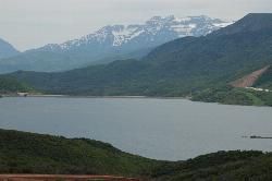
Jordanelle Perimeter Trail
Heber City, Utah
9.4 miles EThe Jordanelle Perimeter Trail is an expert trail found along the edges of the Jordanelle Reservoir. Several portions of the trail run along dirt roads as well as mountain bike only trails. The park...
Mountain Bike
White Pine Lake
Sandy, Utah
10.1 miles SWWhite Pine Canyon has long been the subject of intense controversy between advocates of wilderness and ski resort owners. The original boundaries of Lone Peak Wilderness Area, created in 1977, were...
Hike, Mountain Bike
Glenwild
Park City, Utah
10.5 miles NThis easy to follow 8.4 mile loop is located just across from I-80 in Park City. Starting at 6350 feet, the loop has 800 feet of elevation change, with a total of 1200 feet of climbing....
Mountain Bike

Hidden Falls
Salt Lake City, Utah
10.7 miles WHidden Falls is a popular road side attraction for anyone cruising Big Cottonwood Canyon on a sunny afternoon. The falls are within strolling distance of the parking lot and only require about 15...
Hike
Lisa Falls
Sandy, Utah
11.3 miles WLisa Falls is a great place to climb Spring through Fall, any time of day. The base is well shaded by trees and offers many flat places to belay, or just hang out and relax. The roaring waterfall...
Hike, Rock Climb
Mill Creek Pipeline
Salt Lake City, Utah
11.4 miles NWthere are quite a few hiking trails that connect into this trail coming up the mountain from your left you will go about 6.5 miles and then a sign post will mark the Rattlesnake down...
Mountain Bike
Mill Creek Canyon
Salt Lake City, Utah
11.4 miles NWMill Creek is an out and back with over 1000 ft of elevation gain. The lower section of the ski trail gets a lot of foot traffic, but the upper section (above Elbow Fork) is generally very quiet....
Camp, Cross-country Ski, Snowshoe


