


Chopped Coyote Loop
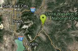
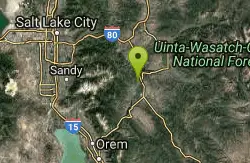
Heber City, Utah
| Address: | ~3111 College Way, Heber City, UT 84032, USA |
| GPS: |
40°32'48.9"N 111°24'41.1"W Maps | Directions |
| State: | Utah |
| Trail Length: | 17.00 miles |
| Trail Type: | Out & Back |
Mountain Bike
The Coyote Canyon Loop lies northeast of Heber. It's a big ride that's best reserved for conditioned riders. Much of the trail is easier-intermediate technical, but there are many tight turns and a few rock gardens that will challenge skilled riders.Courtesy of utahmountainbiking.com
The Chopped Coyote Trail is accessed through multuple trailheads. Behind the UVU Wasatch campus, riders can find the trail, following it for about 1.5 miles until it reaches the Riverview Trail. The main trail is the Riverview Trail, though it can be joined from various other points. When the trail begins it is a bit of climb, but this makes the trail all the more fun. In the beginning there will be climbing up until the high point which is about 7550 ft in elevation. Along the way, riders will pass through several aspen tree groves. The views all across the trail are beautiful and showcase the Wasatch mountains, fromt the Big and Little Cottonwood, the Unitah's, and Mount Timpanogos. After this view, the trail will descend from the mount and will graudally become more steep. This portion of the trail is full of switchbacks because the mountain is becoming steeper, though the trail is not. This trail forms a loop and will take riders back to the Riverview Trailhead, past the UVU Wasatch Campus trail. It is a great ride with some good technical portions.
More Information
Chopped Coyote Loop
Chopped Coyote Loop is a singletrack mountain bike trail in Heber, Utah. View maps, videos, photos, and reviews of Chopped Coyote Loop bike trail in Heber.
http://www.singletracks.com/bike-trails/chopped-coyote-loop/Coyote Canyon trail near Heber Utah - Ultimate Guide to Mountain Biking in Utah
Coyote Canyon Loop. Epic loop with 20 and 24-mile options. Substantial climbing. Terrific views. Top elevation 7550. For conditioned riders. Completed in 2013, this ride is destined to be a classic. Season June through September.
https://utahmountainbiking.com/trails/coyote/Never modify trail features. Ride trails when they're dry enough that you won't leave ruts. Speak up when you see others on the trail and always yield to hikers, horses, and others coming uphill. Always ride on the established trail.
Read More- Plan Ahead and Prepare
- Travel & camp on durable surfaces
- Dispose of waste properly
- Leave what you find
- Minimize campfire impacts
- Respect wildlife
- Be considerate of other visitors
Directions
From Heber City, Utah
- Head north on US-189/US-40 W/S Main St toward W Center StContinue to follow US-189/US-40 W(2.9 mi)
- Turn right (0.4 mi)

Other Mountain Bike Trails Nearby
Wasatch Mountain State Park
Park City, Utah
2.2 miles WUtah's most developed state park in beautiful Heber Valley, offering hiking, biking, golfing, camping, horseback riding, snowmobiling, and cross-country skiing in the Wasatch Mountains.
Mountain Bike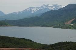
Jordanelle Perimeter Trail
Heber City, Utah
5.3 miles NEA 29-mile expert mountain bike trail circling Jordanelle Reservoir with beautiful lake views, rough singletrack, loose rock climbs, and a fee to enter the park.
Mountain Bike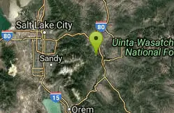
Deer Valley Resort Bike Park
Park City, Utah
6.5 miles NWAn extensive mountain bike zone at Deer Valley Resort spanning from PCMR to Jordanelle, with lift-accessed downhill trails and multi-use two-way routes for all levels.
Mountain Bike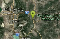
Spin Cycle
Park City, Utah
6.5 miles NA famous Park City singletrack featuring a natural half-pipe known as Spin Cycle — mostly a one-way downhill blast, with a washing machine at the end of the half-pipe as your reward.
Mountain Bike
TG
Park City, Utah
6.5 miles NWA high-altitude advanced singletrack with one doubletrack section featuring rocks, drops, and sharp switchbacks on the side of the mountain above Park City.
Mountain Bike
Payroll
Park City, Utah
6.7 miles NWA rowdy .67-mile mountain bike descent in Park City with massive berms, swoops, rocks, kickers, doubles, and sizeable drops — bring your skills and a full-suspension rig.
Mountain Bike
Corvair
Park City, Utah
6.8 miles NWA narrow, steep, and rocky high-alpine trail near Park City that crosses and intersects with TG Trail multiple times.
Mountain Bike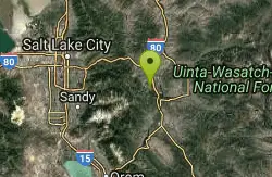
Snow Park Loop
Park City, Utah
7.2 miles NWOne of the best mountain bike loops in the country at Deer Valley — well-marked blue ribbon singletrack mixing smooth buffed sections with hair-raising, endo-inducing descents.
Mountain Bike
Daly Grind
Park City, Utah
7.3 miles NWA doubletrack connector that drops down the mountain, linking Empire Link, Prospect Ridge, and a multitude of other Park City trails.
Mountain Bike
Gravedigger
Park City, Utah
7.3 miles NWAn advanced 20.6-mile singletrack through roots, rocks, and tight aspens in Park City, connecting Moosehouse to Speedbag with fast cruising sections and a flying dirt-road finish.
Mountain Bike
Gina's Daly Bypass
Park City, Utah
7.5 miles NWA half-singletrack, half-gravel connector trail in Park City linking Gravedigger and Daly Grind down to Sweeney's and town.
Mountain Bike
Moosehouse
Park City, Utah
7.5 miles NWA .6-mile oldschool freeride descent in Park City with steep loamy terrain, sharp berms, and drops — connecting John's 99 to Gravedigger.
Mountain Bike
Link
Park City, Utah
7.8 miles NWA crucial 1-mile singletrack connector linking Mid Mountain, John's 99, Ore Cart, Speed Bag, and more — the glue of the Park City trail network.
Mountain Bike
Empire Link
Park City, Utah
7.8 miles NWA bermed, root-strewn, loamy 1.5-mile mountain bike connector in Park City that links Sweeney's, John's 99, and Sam's with switchbacks, roots, and lips to pop off of.
Mountain Bike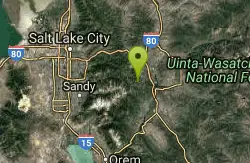
Webster
Park City, Utah
7.9 miles NWAbout 1.5 miles of alternating singletrack and doubletrack connecting Keystone, Meadow Road, Pioneer, McConkey's, Flat Iron, Minor's Mile, Link, and more.
Mountain Bike
John's 99
Park City, Utah
7.9 miles NWA 1.8-mile mostly downhill singletrack in Park City connecting to the 'Little Chief' trail at the bottom — easy-to-intermediate with a few sharp turns that catch newer riders off guard.
Mountain Bike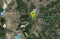
Prospector Area
Park City, Utah
8.0 miles NWA 0.75-mile uphill connector to the top of Masonic Hill, where multiple downhill options including Solamere and Masonic await, all within the Prospector trail network.
Mountain Bike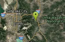
John's Trail
Park City, Utah
8.0 miles NWA twisting aspen trail at Park City Mountain Resort accessible by lift on PayDay — full of roots and tight squeezes for a fun, lively mountain bike challenge.
Mountain Bike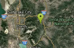
Trestle Trail
Park City, Utah
8.1 miles NWAn advanced 0.66-mile descent straight down below the Town Lift chairlift at Park City Mountain Resort — fast and steep for confident riders only.
Mountain Bike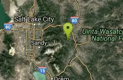
Steps
Park City, Utah
8.1 miles NWA quick 1-mile advanced descent through aspen groves and small meadows on Park City's ski runs, connecting Viking Yurt to the Home Run dirt road at the bottom.
Mountain BikeNearby Campsites

Spruces Campground
Salt Lake City, Utah
13.6 miles NWA fee campground in Big Cottonwood Canyon near Salt Lake City — check USDA.gov for current rates and seasonal availability.
Camp, Sled 1.6-14.1 mi
Mount Timpanogas
Provo, Utah
14.4 miles SWUtah's most-climbed mountain towers 7,000 feet above the Provo valley, stretching seven miles north to south with multiple peaks over 11,000 feet — a Wasatch landmark.
Camp, Hike, Horseback, Swim
Mill Creek Canyon
Salt Lake City, Utah
19.0 miles NWAn out-and-back canyon trail with over 1,000 feet of elevation gain — the lower ski trail sees heavy traffic while the upper section above Elbow Fork stays quiet, with a reservable Yurt at the top December through April.
Camp, Cross-country Ski, Snowshoe
Y-Mountain Summit Trail
Provo, Utah
23.2 miles SWA 1.2-mile climb east of BYU leads to a massive block Y on the hillside and sweeping panoramas over Provo, Orem, Utah Valley, and Utah Lake below.
Camp, Hike 4.7 mi
Fifth Water Hot Springs
Provo, Utah
32.1 miles SA scenic 2.5-mile riverside hike to the famous Diamond Fork rock pools and waterfall, with soaks up to 108°.
Backpack, Camp, Hike, Hot Springs, Mountain Bike, Swim
Holbrook Trailhead
Bountiful, Utah
32.3 miles NWThe Holbrook Trailhead is a popular access point for the Bonneville Shoreline Trail and Holbrook Canyon above Bountiful, Utah, on the western face of the Wasatch. Perched on the bench right at the...
Airsoft, Backpack, Camp, Paintball, Snowshoe
Hell Hole Lake
Evanston, Utah
34.0 miles NEA challenging wash hike in Evanston's Dry Wash, navigating sand and boulders for 1.8 miles to Hellhole Canyon at the edge of the Red Mountain Wilderness.
Camp, Hike, Horseback


