


152 Things to do near Biscuit Basin to Fairy Falls and Firehole Meadows
first prev 1 2 3 4 5 6 7 8 next lastShowing results within 50 miles Distance miles of 85PFF3MC+XH City, Zip, or Address

Warm River Campground
Ashton, Idaho
31.4 miles SWWarm River Campground is located nine miles northeast of Ashton, Idaho, along the slow-moving Warm River at an elevation of 5,200 feet. Willows line the riverbanks and pine trees offer partial...
Camp 3.2-47.0 mi
Yellowstone Branch Line Trail
Ashton, Idaho
31.5 miles SWYellowstone branch line trail runs from Warm River to the Montana border totaling 39 miles. There are a few places to jump on and off the trail as well as a few smaller trails that branch off of this...
Backpack, Cross-country Ski, Hike, Horseback, Mountain Bike
Mile Creek Trail
31.9 miles NW
It is important to note that Mile Creek Trail is part of the Continental Divide Trail system, so it connects to other trails of various difficulties. Mile Creek Trail itself is a great...
Mountain Bike 8.4 mi
Bunsen Peak Loop Bike Trail
Yellowstone National Park, Wyoming
32.4 miles NBunsen Peak Loop Bike Trail is a challenging trail that follows several service roads around Bunsen Peak. This 10 mile loop has a total elevation change of 1,120 feet, with several miles of the trail...
Mountain Bike 7.8 mi
Osprey Falls Trail
Mammoth Hot Springs, Yellowstone National Park
32.4 miles NOsprey Falls Trail is an 8 mile out and back trail near Mammoth Hot Springs that provides hikers with a variety of stunning views, including ravines and a waterfall. Hikers begin this hike...
Hike 4.0 mi
Bunsen Peak Trail
Mammoth Hot Springs, Yellowstone National Park
32.4 miles NBunsen Peak Trail is a 4.6 mile hike to the peak of Mount Bunsen. This is an out and back trail and is considered moderately difficult because of the 1,300 foot climb in elevation. ...
Hike 16.3 mi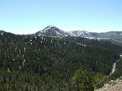
Mount Washburn Spur Trail
Canyon Village, Yellowstone National Park
32.5 miles NEWashburn Spur Trail is an exciting 8-mile trail connecting the peak of Mount Washburn to Seven Mile Hole Trail near Canyon Village. Hikers typically hike the trail starting at Mount Washburn and...
Hike 4.4 mi
Chittenden Road - Mount Washburn Trail
Canyon Village, Yellowstone National Park
32.5 miles NEHiking Mount Washburn via Chittenden Road is the shortest and easiest route to the top. The trail was once a service road and is now a clear well packed trail with a steady, gradual incline. The...
Hike
Falls River, Lower Run
Ashton, Idaho
32.9 miles SWFall River rises on the Madison and Pitchstone plateaus in the southwest corner of Yellowstone National Park, Wyoming and flows approximately 64 miles (103 km) to its confluence with the Henrys Fork...
Whitewater 2.8 mi
Mount Washburn Bike Trail
Devils Den, Wyoming
33.3 miles NEMount Washburn Bike Trail follows Chittenden Service Road for 2.5 miles to the top of Mount Washburn. This steep climb up the mountain provides a challenging elevation gain of 1500 feet. Mount...
Mountain Bike
Cabin Creek
West Yellowstone, Montana
33.6 miles NWStarts out as a nice, buff trail. After a mile or two, there are a lot of tough creek crossings and when I rode it in 2010 there were a lot of trees down. This was from a recent...
Mountain Bike
Sheep Creek Trail
33.6 miles NW
The trail has a few interesting spots (rocks, roots, etc.), but mostly it's pretty simple and straightforward. A pretty good climb, especially the last few hundred yards to the lake....
Mountain Bike
Ashton Hill
Ashton, Idaho
34.2 miles SWFairly thick forest. Considerable underbrush. Lots of places in the area to play.
Airsoft, Paintball
Big Bend Ridge Trail
Ashton, Idaho
34.3 miles SWTrail is open to OHVs. source: fs.usda.gov
Mountain Bike 2.0 mi
Snow Pass Trail
Yellowstone National Park Wyoming
34.4 miles NSnow Pass Trail is a beautiful day hike for visitors to Yellowstone looking to escape the crowds. Located a half mile south of the Mammoth Hot Springs Upper Terraces. Parking is available at a...
Backpack, Hike 0.8 mi
Wraith Falls Trail
Mammoth Hot Springs, Yellowstone National Park
34.9 miles NEWraith Falls Trail is a less than 1 mile there and back hike that can be taken in under an hour. This is a wonderful family friendly hike that is easy for hikers of all levels. The hike leads...
Hike 8.1 mi
Sepulcher Mountain Trail
Mammoth Hot Springs, Yellowstone National Park
35.5 miles NSepulcher Mountain Trail is an 11 mile loop trail from Mammoth Hot Springs to the peak of Sepulcher Mountain. This is a challenging hike with a 3,500 foot ascent to the 9,652 foot peak. The...
Hike 5.3 mi
Beaver Ponds Trail
Mammoth, Yellowstone National Park
35.5 miles NBeaver Ponds Trail is a wonderful short hike accessible from Mammoth Hot Springs. The trail forms a loop between the two trailheads available at Mammoth Hot Springs. The loop is just over 5 miles...
Hike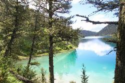
Cliff Lake
Cameron, Montana
35.5 miles NWCanoe and Kayak near Cameron, Montana
Canoe, Kayak 0.1-5.2 mi
Mammoth Hot Springs
Mammoth, Yellowstone National Park
35.5 miles NMammoth Hot Springs is a unique sight in Yellowstone National Park. The soft limestone in this area allowed the water to form colorful terraces. The extremely hot running water is clear and smooth,...
Camp, Hike


